Grote Hollandse Waard, River island in County of Holland, Netherlands
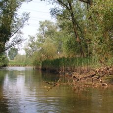
Grote Hollandse Waard is a low-lying river region in the Netherlands, situated between the Afgedamde Maas and the Boven Merwede. It now consists mostly of open water and wetland, covering an area that was once a continuous stretch of farmed and settled land.
The region was farmed and densely settled for centuries until a major flood in 1421 transformed it almost overnight. Most of the villages and agricultural land were submerged, leaving behind a scattered pattern of water bodies where a continuous landscape had existed before.
The name refers to a former polder region that was once densely settled, and the memory of its lost villages still lives on in old place names and local stories. Visitors today find open water where fields and church villages once stood for centuries.
Most of the area is hard to access today because it is made up of water and wetland that cannot easily be crossed on foot. Anyone wanting to explore should be ready for soft, wet ground and bring sturdy waterproof footwear.
Some of the flooded villages were never officially dissolved and their boundaries still appear in old maps and archives. Researchers use digital terrain models to rebuild what the land looked like before 1421, revealing details of a world that had been hidden for centuries.
The community of curious travelers
AroundUs brings together thousands of curated places, local tips, and hidden gems, enriched daily by 60,000 contributors worldwide.