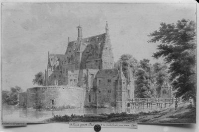
Groot Poelgeest, Medieval castle ruins in Koudekerk aan den Rijn, Netherlands.
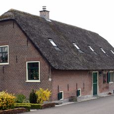
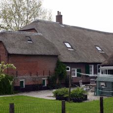
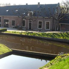
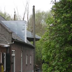
Groot Poelgeest is a medieval castle site in Alphen aan den Rijn featuring a polygonal tower from the former gatehouse and surrounded by a wide defensive moat. A coach house dating from 1648 stands along the Oude Rijn road and shows how the property was used in later centuries.
The castle was first mentioned in 1326 when the Lords of Poelgeest pledged it to the Count of Holland as a feudal estate. Over the following centuries it underwent various rebuildings and modifications before gradually falling into decline.
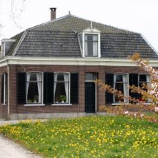
The castle served as a residence for a noble family whose presence shaped the local community for generations. The layout and design reflect building traditions common among regional estates of that era.
The ruins are visible year-round and easily accessible along the Oude Rijn road. Wear appropriate footwear since the site is outdoors and can be muddy or wet depending on weather conditions.
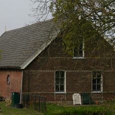
The round base layout of this castle was already unusual for the 14th century, suggesting the structure may have originated in the 13th century. This older design style set it apart from later castle-building traditions in the region.
Location: Alphen aan den Rijn
Address: Dorpsstraat, ongenummerd
GPS coordinates: 52.13299,4.59426
Latest update: December 9, 2025 20:26
Watertoren
846 m
De Tol
856 m
Hondsdijkse Molen
1 km
Brugkerk
234 m
De Rijnenburger
863 m
Gereformeerde kerk
507 m
Lagewaard 20, Koudekerk aan den Rijn
313 m
Lagewaard 53, Koudekerk aan den Rijn
1.2 km
Rijndijk 123, Hazerswoude
913 m
Lagewaard 47, Koudekerk aan den Rijn
1.1 km
Oorlogsmonument
205 m
Dorpsstraat 50, Koudekerk aan den Rijn
249 m
Lagewaard 24-25, Koudekerk aan den Rijn
489 m
Dorpsstraat 1, Koudekerk aan den Rijn
675 m
Rijndijk 199, Hazerswoude
849 m
Oorlogsmonument
552 m
Koetshuis Groot Poelgeest
103 m
Dorpsstraat 17, Koudekerk aan den Rijn
479 m
Hoeve "Westdorp"
871 m
Schuur bij hoeve "Westdorp"
871 m
Boerderijcomplex
282 m
Zomerhuis
296 m
Rijndijk 203, Hazerswoude-Rijndijk
883 m
Terrein waarin sporen van een begraving
123 m
Hondsdijk 59, Koudekerk aan den Rijn
1 km
Dorpsstraat 70, Koudekerk aan den Rijn
142 m
Dorpsstraat 59, Koudekerk aan den Rijn
190 m
Hooiberg
282 mVisited this place? Tap the stars to rate it and share your experience / photos with the community! Try now! You can cancel it anytime.
Discover hidden gems everywhere you go!
From secret cafés to breathtaking viewpoints, skip the crowded tourist spots and find places that match your style. Our app makes it easy with voice search, smart filtering, route optimization, and insider tips from travelers worldwide. Download now for the complete mobile experience.
A unique approach to discovering new places❞
— Le Figaro
All the places worth exploring❞
— France Info
A tailor-made excursion in just a few clicks❞
— 20 Minutes