Woeste Hoeve, Historic memorial site near Apeldoorn, Netherlands.
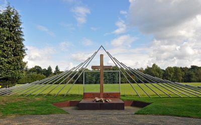
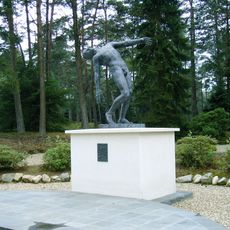
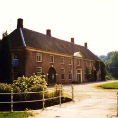
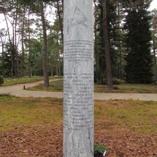
Woeste Hoeve is a memorial site situated in open countryside between Apeldoorn and Arnhem, marking the location of a tragic wartime event. The monument stands in a rural setting near a main road, with accessible grounds that allow visitors to walk around the commemorative structures.
In March 1945, Dutch resistance fighters engaged SS General Hanns Rauter during an operation targeting German supply convoys. German occupation forces responded with mass killings of civilians in the surrounding area as collective punishment.
The memorial represents a defining moment of collective loss in the Dutch resistance story that still shapes how locals view this rural stretch. Walking through the grounds, visitors encounter the names and stories of those whose lives were cut short, making the past feel immediate and personal.
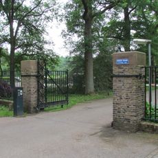
The memorial is open throughout the year and can be reached by car with parking near the N304 road. The site sits in open countryside, so visitors should be prepared for weather exposure while walking the grounds.
A German soldier refused to participate in the killings and was buried with the Dutch victims in an act of solidarity. This rare moment of conscience across enemy lines is physically marked at the memorial, making it tangible for those who visit.
GPS coordinates: 52.10373,5.95239
Latest update: December 14, 2025 11:03
Woeste Hoeve
166 m
Memorial cemetery Loenen
3.5 km
Waterfalls of the Vrijenberger Spreng
5 km
Huis Ter Horst
5.7 km
Ijkbasis
4.2 kmLandgoed Groenouwe
5.2 km
Imbosch
5.4 km
Twee halve bollen
452 m
Heldringkerk
5.3 km
Stadsmuseum Hof van Hessen
2 km
Harmanahof
4.4 km
Ter Horst: toegangsbrug
5.7 km
Nederlands hervormde kerk
4.7 km
Heldringput
5.6 km
Lebretshoeve: boerderij, waarvan het woonhuis dwars voor de stal gebouwd is
1.2 km
Nederlands Hervormde Kerk
4.7 km
The Falling Man
3.5 km
Dalenk 22, Loenen
4.8 km
Tolhuis, Loenen
1.1 km
Roman Catholic Church
5.2 km
De Arcke : houten huis, prefab, vervaardigd in Noorwegen
5.4 km
Ter Horst: oostelijk bouwhuis
5.7 km
Terrein waarin grafheuvel #45193
3.4 km
Kleine boerderij op T-vormige plattegrond. Woongedeelte onder pannen schilddak; dubbele deur met eenvoudige bovenlichten; vensters met luiken en zesruitsramen
5.3 km
Houten huis, jachthuis, gebouwd als prefab, sinds 1945 bewoond
5.1 km
Monument slachtoffers Tarakan
3.4 km
Deelerwoud : poortgebouw met twee dienstwoningen
5 km
Toegangshek naar het landgoed De Hoge Veluwe. Het hek vormt een noordoostelijke toegang tot het park
5.7 kmVisited this place? Tap the stars to rate it and share your experience / photos with the community! Try now! You can cancel it anytime.
Discover hidden gems everywhere you go!
From secret cafés to breathtaking viewpoints, skip the crowded tourist spots and find places that match your style. Our app makes it easy with voice search, smart filtering, route optimization, and insider tips from travelers worldwide. Download now for the complete mobile experience.
A unique approach to discovering new places❞
— Le Figaro
All the places worth exploring❞
— France Info
A tailor-made excursion in just a few clicks❞
— 20 Minutes