
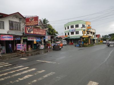
Padre Garcia, municipality of the Philippines in the province of Batangas
Location: Batangas
Inception: December 1, 1949
Elevation above the sea: 158 m
Shares border with: San Antonio, Rosario
Website: https://padregarcia.gov.ph/home
GPS coordinates: 13.88333,121.21667
Latest update: March 7, 2025 20:05

Taal Volcano
27.6 km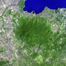
Mount Makiling
27.5 km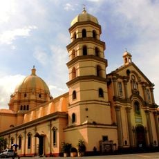
Lipa Cathedral
8.7 km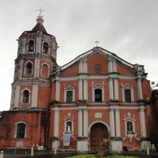
San Pablo Cathedral
23.9 km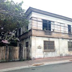
Casa de Segunda
8.6 km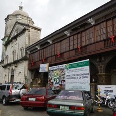
Bauan Church
24.9 km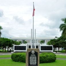
Apolinario Mabini Shrine
27.4 km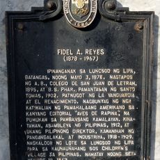
Fidel A. Reyes historical marker
8.6 km
Villa Escudero Museum
18.5 km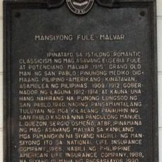
Fule–Malvar Mansion historical marker
23.9 km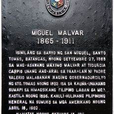
Miguel Malvar historical marker
26.5 km
Apolinario Mabini historical marker
27.3 km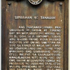
Church of Tanauan historical marker
23.6 km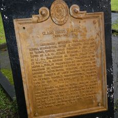
Claro Recto y Mayo historical marker
14.4 km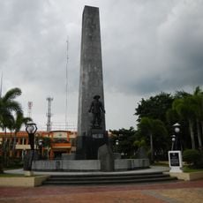
Malvar Shrine
26.5 km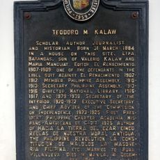
Teodoro M. Kalaw historical marker
8.8 km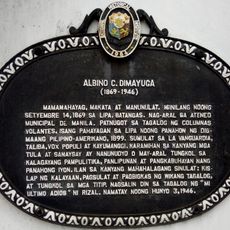
Albino C. Dimayuga historical marker
8.5 km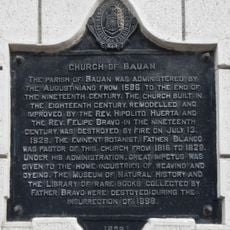
Church of Bauan historical marker
24.9 km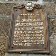
Church of San Juan historical marker
20.2 km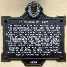
Cathedral of Lipa historical marker
8.6 km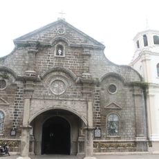
Saint John Nepomucene Parish Church
20.2 km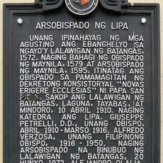
Archbishopric of Lipa historical marker
8.6 km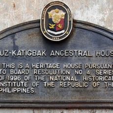
Luz–Katigbak Ancestral House historical marker
8.6 km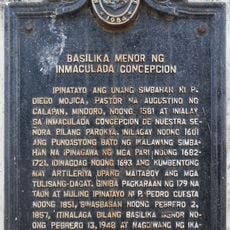
Minor Basilica of the Immaculate Conception historical marker
22.3 km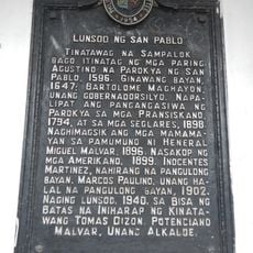
City of San Pablo historical marker
23.9 km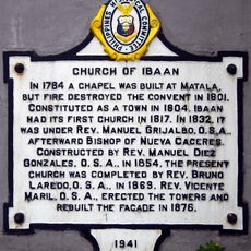
Church of Ibaan historical marker
11.6 km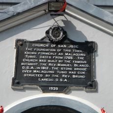
Church of San Jose historical marker
12.2 km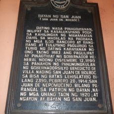
Town of San Juan historical marker
20.5 kmVisited this place? Tap the stars to rate it and share your experience / photos with the community! Try now! You can cancel it anytime.
Discover hidden gems everywhere you go!
From secret cafés to breathtaking viewpoints, skip the crowded tourist spots and find places that match your style. Our app makes it easy with voice search, smart filtering, route optimization, and insider tips from travelers worldwide. Download now for the complete mobile experience.

A unique approach to discovering new places❞
— Le Figaro
All the places worth exploring❞
— France Info
A tailor-made excursion in just a few clicks❞
— 20 Minutes