Taal Volcano

Log in to your account

AroundUs is a community-driven map of interesting places, built by curious explorers like you. It grows with every review, story, and photo you share.
Connect to save your favorite spots, contribute locations, and create personalized routes.
Continue with Google
Continue with Apple
Continue with X
Continue with Facebook
Continue with email
By continuing, you accept our Terms and Conditions and our Privacy Policy
Create an account

Taal Volcano

Add to collection
Map
Suggest a change
Share

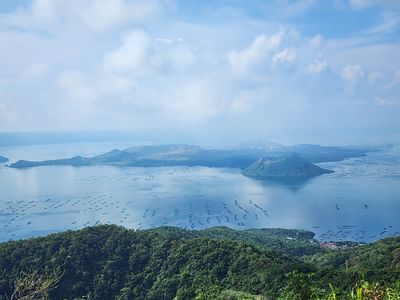
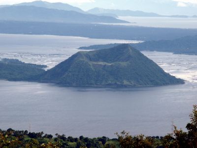
Taal Volcano, Caldera in Batangas, Philippines

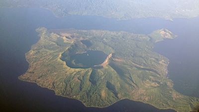
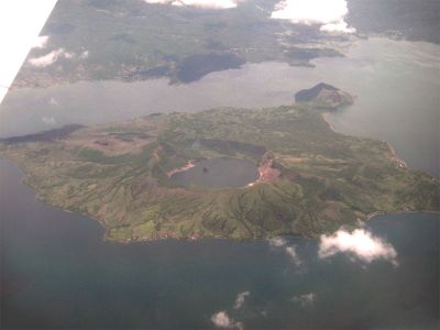
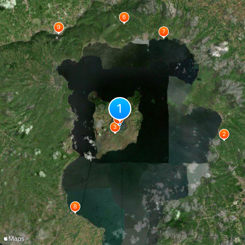
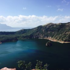
The caldera measures 25 kilometers across and holds a lake from which a populated volcanic island rises, containing a crater that shelters a smaller crater lake. This entire system forms a nested sequence of water and land within an older volcanic structure in the province of Batangas.

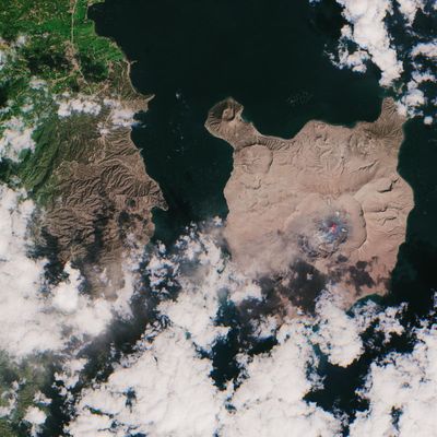
Four large eruptions between 500,000 and 100,000 years ago shaped the caldera, while later events created the central island. Since the 16th century, chroniclers have documented dozens more eruptions that altered the landscape and settlement patterns.

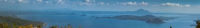
Fishing villages and farming communities surround the lake, selling fresh catch and produce at markets shaped by generations of local knowledge. Visitors notice boats departing at dawn and fields planted with pineapple and coffee, maintained despite the constant threat from below.

The Philippine Institute of Volcanology provides daily reports on seismic activity that visitors should check before planning a trip. Access to the island is by boat only, and conditions change quickly depending on alert levels and weather.

The site ranks among the most dangerous volcanoes worldwide due to its proximity to densely populated areas and the unpredictability of its eruptions. Despite this risk, the central island remains inhabited, with villages, schools, and even a small post office within the crater area.

Location: Batangas

Location: Calabarzon

Elevation above the sea: 129 m

Part of: Taal Caldera

GPS coordinates: 14.01000,120.99750

Latest update: December 12, 2025 16:39

Photos
Active volcanoes worldwide: online map

This collection brings together active volcanoes located on multiple continents, from Cotopaxi in the Ecuadorian Andes to Mount Fuji in Japan, including Vesuvius in Italy and Mauna Loa in Hawaii. Each site demonstrates different geological processes: stratovolcanoes like Mount Saint Helens and Etna...

Natural landmarks of the Philippines for photography

The Philippines display rice terraces in Ifugao mountains, coral reefs in Tubbataha National Park, and cave systems in Samar. Mayon Volcano shows its geometric shape, while Chocolate Hills of Bohol extend across the landscape. White sand beaches line the coasts of Boracay and Palawan.

Reviews

Visited this place? Tap the stars to rate it and share your experience / photos with the community! Try now! You can cancel it anytime.

« Taal Volcano - Caldera in Batangas, Philippines » is provided by Around Us (aroundus.com). Images and texts are derived from Wikimedia project under a Creative Commons license. You are allowed to copy, distribute, and modify copies of this page, under the conditions set by the license, as long as this note is clearly visible.

Discover hidden gems everywhere you go!

From secret cafés to breathtaking viewpoints, skip the crowded tourist spots and find places that match your style. Our app makes it easy with voice search, smart filtering, route optimization, and insider tips from travelers worldwide. Download now for the complete mobile experience.

Around Us App Screenshot

A unique approach to discovering new places

Le Figaro

All the places worth exploring

France Info

A tailor-made excursion in just a few clicks

20 Minutes