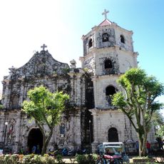
Jomalig, Municipal island in Quezon Province, Philippines.
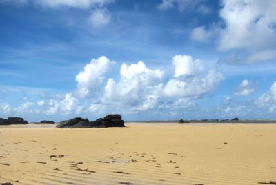
Jomalig is a municipal island in Quezon Province, Philippines, surrounded by sandy shores fringed with palm trees and bounded by the Pacific Ocean. The terrain is mostly low and flat, with several bays and small beaches breaking the coastline, shaped by a tropical climate.
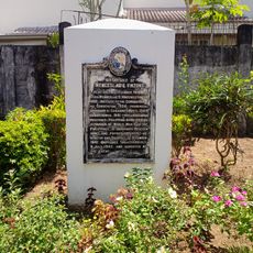
The island formed like many Pacific islands through geological processes over long periods and was later inhabited by fishing communities. The name evolved over time from older terms and connects to narratives that early settlers shared about their origins.
The name comes from an old story about a leader's daughter and a marriage request from across the sea, a tale that residents still share today. Life here revolves around fishing traditions and the daily rhythms that have shaped the community for generations.
The island is best reached by boat from the mainland, with the journey taking several hours and best planned during calm weather conditions. Visitors should expect longer travel times and remain flexible, as ferry connections depend on sea conditions.
The island has several named beaches with different characters, some featuring steep cliffs similar to island formations found further north. These geological features make it an interesting destination for visitors wanting to see different landscape types in one place.
GPS coordinates: 14.69588,122.33067
Latest update: December 7, 2025 20:41
Jose Rizal Monument
93.4 km
Paete Church
98.6 km
Quezon Protected Landscape
96.8 km
Bicol Natural Park
108.2 km
Gumaca Cathedral
89.7 km
Three Crosses of Paete
97.6 km
Guillermo Peñamante Nakar historical marker
76.7 km
Rizal Hill Park historical marker
85.8 km
Atimonan Church
89 km
Mauban Church
85.7 km
The Church of Gumaca historical marker
89.7 km
Jose Ma. Panganiban y Enverga historical marker
59.6 km
Martyr of Camarines Norte historical marker
93.4 km
Church of Atimonan historical marker
89 km
Monument for Peace historical marker
97.4 km
Manuel S. Enverga historical marker
85.7 km
Parroquia de San Juan Bautista
93.7 km
Fort San Diego historical marker
89.6 km
First Rizal Monument historical marker
93.4 km
Rizal Park
93.4 km
Infanta Cathedral
73.6 km
Church of Mauban historical marker
85.7 km
400th Anniversary of the Christianization of the Town of Gumaca historical marker
88.7 km
General Nakar Municipal Hall
76.7 km
The Town of Pakil historical marker
98.3 km
The Church of Pakil historical marker
98.3 km
Pakil Municipal Hall
98.3 km
Birthplace of Wenceslao Q. Vinzons historical marker
84.8 kmVisited this place? Tap the stars to rate it and share your experience / photos with the community! Try now! You can cancel it anytime.
Discover hidden gems everywhere you go!
From secret cafés to breathtaking viewpoints, skip the crowded tourist spots and find places that match your style. Our app makes it easy with voice search, smart filtering, route optimization, and insider tips from travelers worldwide. Download now for the complete mobile experience.
A unique approach to discovering new places❞
— Le Figaro
All the places worth exploring❞
— France Info
A tailor-made excursion in just a few clicks❞
— 20 Minutes