Quezon Protected Landscape, Protected landscape in Quezon Province, Philippines.
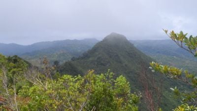
Quezon Protected Landscape covers around 900 hectares across three municipalities and features lowland rainforest, distinctive karst rock formations, waterfalls, and an extensive system of caves. The terrain varies from dense forest to open karst areas with water features throughout.
The area was first protected as a national park in 1934 and underwent boundary changes before being reclassified as a protected landscape in 2003. These transitions reflect shifting approaches to conservation in the Philippines over several decades.
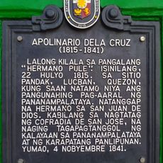
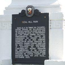
The area holds meaning for local communities and visitors as a place tied to Philippine national identity through its role in historical moments. Today, people recognize it as an important natural and historical landmark that connects them to their country's past.
The Pan-Philippine Highway passes through the park with a distinctive zigzag road section designed for light vehicles due to sharp turns. Visitors traveling by car should be aware of this challenging road stretch and drive carefully through it.
Scientists formally described a rare monitor lizard species in this park in 2010, though local people had long known about the animal. The discovery highlights that hidden wildlife continues to exist in these forests beyond what science had documented.
The community of curious travelers
AroundUs brings together thousands of curated places, local tips, and hidden gems, enriched daily by 60,000 contributors worldwide.