Enable Location

We need your location to show you interesting places around you

Discover nearby places

Find interesting locations and hidden gems around you

Precise directions

Get accurate directions and distances to places

Your location is never shared with other users. It's only used when you tap the location button.

Cainta

Log in to your account

Start exploring — it's free

Trusted by 62,098 travelers worldwide

Continue with Google
Continue with Apple
or

We will send you a code to connect

By continuing, you accept our Terms and Conditions and our Privacy Policy

Check your inbox

We've sent a pincode in your inbox. Please enter the code below.

Cainta, Municipality in Rizal, Philippines.

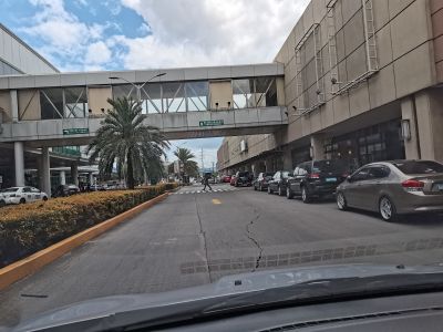
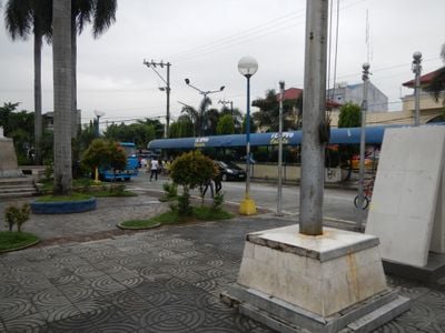
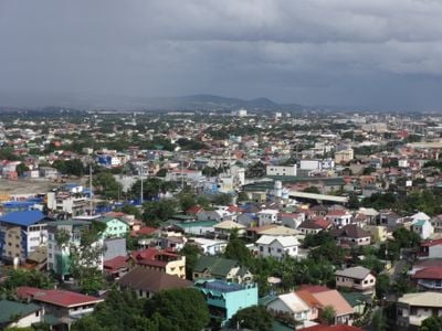
Cainta is a municipality in Rizal province, Philippines, bordering Metro Manila at several points and using major roads that lead inland. The area includes residential neighborhoods next to commercial zones and some green spaces that run along the waterways.

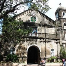
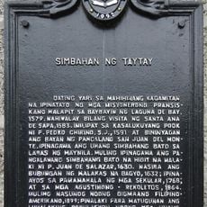
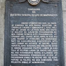
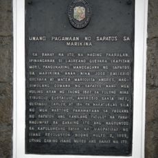
The settlement began during Spanish colonial times as a church territory and later became an administrative district of Rizal province. During the Japanese occupation in World War II, the area experienced fighting and reconstruction before growing into its present form over the following decades.

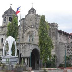
The name comes from the Tagalog word for bamboo, which once covered the riverbanks and still grows in some barangays. Many residents shop for fresh produce at the morning market beside the old church, while others work in the industrial parks that fill the streets during the day.

Many visitors pass through on the Ortigas Avenue Extension or Marcos Highway, both linking Metro Manila to eastern provinces. The area is busy during the day, especially during morning and evening rush hours when commuters travel.

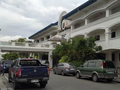
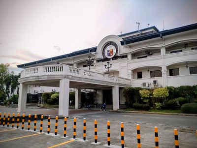
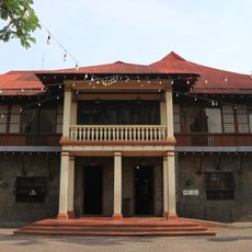
The area is considered one of the wealthiest local governments in the country and runs its own digital portal for citizen applications. Visitors often notice the mix of older houses and new commercial buildings that reflect the rapid growth of recent decades.

The community of curious travelers

AroundUs brings together thousands of curated places, local tips, and hidden gems, enriched daily by 60,000 contributors worldwide.

Start exploring
Location
Inception
1571
Elevation above the sea
41 m
Reference
0405805000
Shares border with
Taytay, Marikina, Pasig, Antipolo
Address
Cainta, 1900 Rizal, Philippines
GPS coordinates
14.56667,121.11667
Latest update
December 13, 2025 18:36
« Cainta - Municipality in Rizal, Philippines » is provided by Around Us (aroundus.com). Images and texts are derived from Wikimedia project under a Creative Commons license. You are allowed to copy, distribute, and modify copies of this page, under the conditions set by the license, as long as this note is clearly visible.

Discover hidden gems everywhere you go!

From secret cafés to breathtaking viewpoints, skip the crowded tourist spots and find places that match your style. Our app makes it easy with voice search, smart filtering, route optimization, and insider tips from travelers worldwide. Download now for the complete mobile experience.

Around Us App Screenshot

A unique approach to discovering new places

Le Figaro

All the places worth exploring

France Info

A tailor-made excursion in just a few clicks

20 Minutes

Around Us
Travel Guide & Maps
Download

Send to your phone

QR Code
1

Open the camera app on your mobile.

2

Point at the QR code with your camera. A notification will appear.

3

Tap the notification to open the link.