Enable Location

We need your location to show you interesting places around you

Discover nearby places

Find interesting locations and hidden gems around you

Precise directions

Get accurate directions and distances to places

Your location is never shared with other users. It's only used when you tap the location button.

Pili

Log in to your account

Join the adventure

Create your free account and start exploring (like 60k+ others)

We will send you a code to connect

or
Continue with Google
Continue with Apple
By continuing, you accept our Terms and Conditions and our Privacy Policy

Check your inbox

We've sent a pincode in your inbox. Please enter the code below.

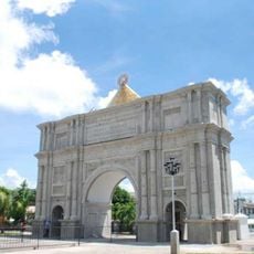
Pili, Administrative center in Camarines Sur, Philippines.

Description

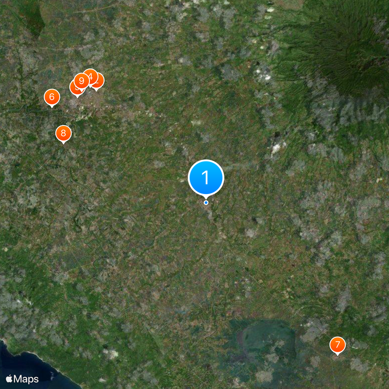
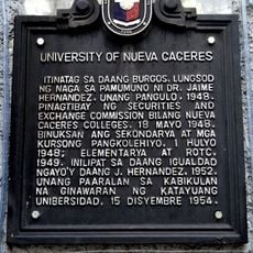
Pili is a municipality in Camarines Sur province that spans a large area divided into 26 barangays. The town functions as the provincial administrative center and is home to Central Bicol State University of Agriculture alongside various government offices.

History

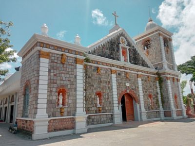
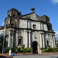
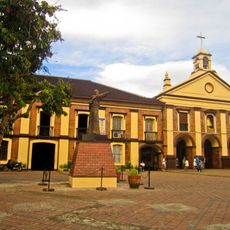
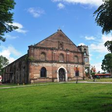
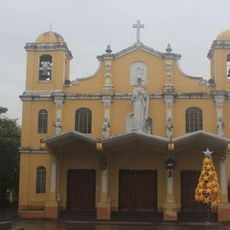
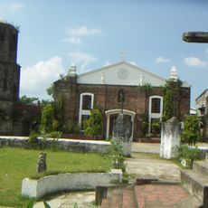
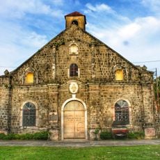
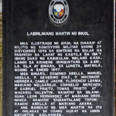
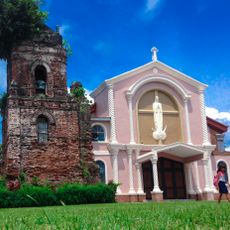
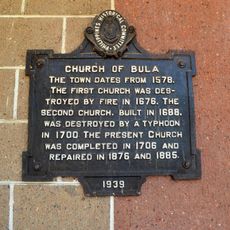
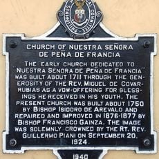
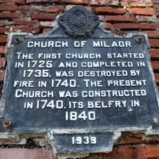
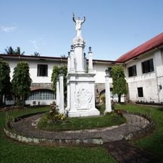
Spanish missionaries established the first settlement in the late 1700s and began organizing the community under colonial rule. The area gradually developed as a regional center over the following centuries as the local population engaged in farming and trade.

Culture

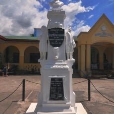
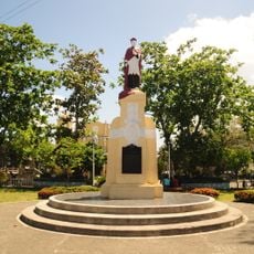
The Cimarrones Festival each October brings together local traditions through competitions and performances that reflect the region's heritage. Residents and visitors participate in celebrations that keep historical memories alive in the community.

Practical

Getting around is straightforward with regular jeepney and bus services connecting all barangays throughout the municipality. The town has basic services and facilities you would expect in a regional administrative center.

Did you know?

The town was chosen as provincial capital in 1955 instead of the larger and more accessible Naga City due to serious flood risks there. Geography rather than size or convenience shaped this important administrative decision for the region.

i
Location
i
Inception
1789
i
Elevation above the sea
33 m
i
Shares border with
Milaor, Ocampo
i
i
GPS coordinates
13.55611,123.27556
i
Latest update
December 20, 2025 16:08

AroundUs brings together thousands of curated places, local tips, and hidden gems, enriched daily by 60,000 contributors worldwide. Discover all places nearby (Camarines Sur).

Around this place
Minor Basilica and National Shrine of Our Lady of Peñafrancia
Philippines

Minor Basilica and National Shrine of Our Lady of Peñafrancia

11.8 km
Metropolitan Cathedral and Parish of Saint John the Evangelist
Philippines

Metropolitan Cathedral and Parish of Saint John the Evangelist

12.5 km
Peñafrancia Church
Philippines

Peñafrancia Church

12.3 km
Porta Mariae
Philippines

Porta Mariae

12.5 km
Saint Anthony of Padua Parish Church
Philippines

Saint Anthony of Padua Parish Church

13.6 km
Baao Church
Philippines

Baao Church

15 km
Saint Joseph the Worker Parish Church
Philippines

Saint Joseph the Worker Parish Church

11.5 km
Jose Maria Panganiban Monument
Philippines

Jose Maria Panganiban Monument

12.5 km
Panicuason Hot Springs Resort
Philippines

Panicuason Hot Springs Resort

13.8 km
Magarao Church
Philippines

Magarao Church

14.9 km
Jorge Barlin é Imperial historical marker
Philippines

Jorge Barlin é Imperial historical marker

15 km
Fifteen Martyrs of Bicol historical marker
Philippines

Fifteen Martyrs of Bicol historical marker

12.3 km
University of Nueva Caceres historical marker
Philippines

University of Nueva Caceres historical marker

12.5 km
Canaman Church
Philippines

Canaman Church

15.3 km
Jose Ma. Panganiban y Enverga historical marker
Philippines

Jose Ma. Panganiban y Enverga historical marker

12.5 km
Jorge Barlin Monument
Philippines

Jorge Barlin Monument

15 km
Jesse Robredo Museum
Philippines

Jesse Robredo Museum

11.7 km
Colegio de Santa Isabel historical marker
Philippines

Colegio de Santa Isabel historical marker

12.4 km
Jesse M. Robredo historical marker
Philippines

Jesse M. Robredo historical marker

11.7 km
Universidad de Santa Isabel historical marker
Philippines

Universidad de Santa Isabel historical marker

12.4 km
Holy Rosary Seminary historical marker
Philippines

Holy Rosary Seminary historical marker

12.5 km
Church of San Francisco historical marker
Philippines

Church of San Francisco historical marker

12.3 km
Cathedral of Naga historical marker
Philippines

Cathedral of Naga historical marker

12.5 km
Church of Bula historical marker
Philippines

Church of Bula historical marker

9.7 km
Church of Nuestra Señora de Peña de Francia historical marker
Philippines

Church of Nuestra Señora de Peña de Francia historical marker

12.3 km
Church of Milaor historical marker
Philippines

Church of Milaor historical marker

11.5 km
Church of Baao historical marker
Philippines

Church of Baao historical marker

15 km
Seminary of Nueva Caceres historical marker
Philippines

Seminary of Nueva Caceres historical marker

12.6 km
Show the full map
« Pili - Administrative center in Camarines Sur, Philippines » is provided by Around Us (aroundus.com). Images and texts are derived from Wikimedia project under a Creative Commons license. You are allowed to copy, distribute, and modify copies of this page, under the conditions set by the license, as long as this note is clearly visible.

Discover hidden gems everywhere you go!

From secret cafés to breathtaking viewpoints, skip the crowded tourist spots and find places that match your style. Our app makes it easy with voice search, smart filtering, route optimization, and insider tips from travelers worldwide. Download now for the complete mobile experience.

Around Us App Screenshot

A unique approach to discovering new places

Le Figaro

All the places worth exploring

France Info

A tailor-made excursion in just a few clicks

20 Minutes

Around Us
Travel Guide & Maps
Download

Send to your phone

QR Code
1

Open the camera app on your mobile.

2

Point at the QR code with your camera. A notification will appear.

3

Tap the notification to open the link.