Enable Location

We need your location to show you interesting places around you

Discover nearby places

Find interesting locations and hidden gems around you

Precise directions

Get accurate directions and distances to places

Your location is never shared with other users. It's only used when you tap the location button.

Śląsko-Dąbrowski Bridge

Log in to your account

Start exploring — it's free

Trusted by 62,894 travelers worldwide

Continue with Google
Continue with Apple
or

We will send you a code to connect

By continuing, you accept our Terms and Conditions and our Privacy Policy

Check your inbox

We've sent a pincode in your inbox. Please enter the code below.

Śląsko-Dąbrowski Bridge
Discussion Reviews 1 Photos
14.5k Popularity

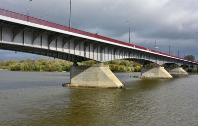
Śląsko-Dąbrowski Bridge, Road bridge in Warsaw, Poland.

The Śląsko-Dąbrowski Bridge is a road bridge in Warsaw that spans approximately 527 meters across the Vistula River and connects the city's eastern and western districts. It carries two vehicle lanes and separate tram tracks running in both directions.

The bridge was built between 1947 and 1949, replacing the earlier Kierbedzia Bridge that German forces destroyed during their retreat in World War II. Its construction was part of Warsaw's major reconstruction efforts in the postwar period.

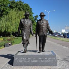
The bridge takes its name from two regions that supported Warsaw's reconstruction after World War II. Local residents and visitors recognize this connection through the bridge's designation in the city's daily life.

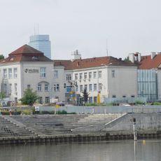
The bridge serves as a major traffic junction in Warsaw, connecting different neighborhoods across the river. Pedestrians and cyclists can also use it and gain good views of the Vistula and surrounding areas.

Memorial plaques on the bridge mark locations where resistance fighters conducted operations against Nazi officials during the Warsaw Uprising. These markers show the dangerous role the location played during wartime.

The community of curious travelers

AroundUs brings together thousands of curated places, local tips, and hidden gems, enriched daily by 60,000 contributors worldwide.

Start exploring
Location
Inception
July 21, 1949
Architects
Józef Sigalin, Jan Knothe, Stanisław Jankowski, Zygmunt Stępiński
Official opening
July 21, 1949
Length
527 m
Part of
Warsaw W-Z Route
GPS coordinates
52.24926,21.02200
Latest update
December 7, 2025 20:21
« Śląsko-Dąbrowski Bridge - Road bridge in Warsaw, Poland » is provided by Around Us (aroundus.com). Images and texts are derived from Wikimedia project under a Creative Commons license. You are allowed to copy, distribute, and modify copies of this page, under the conditions set by the license, as long as this note is clearly visible.

Discover hidden gems everywhere you go!

From secret cafés to breathtaking viewpoints, skip the crowded tourist spots and find places that match your style. Our app makes it easy with voice search, smart filtering, route optimization, and insider tips from travelers worldwide. Download now for the complete mobile experience.

Around Us App Screenshot

A unique approach to discovering new places

Le Figaro

All the places worth exploring

France Info

A tailor-made excursion in just a few clicks

20 Minutes

Around Us
Travel Guide & Maps
Download

Send to your phone

QR Code
1

Open the camera app on your mobile.

2

Point at the QR code with your camera. A notification will appear.

3

Tap the notification to open the link.