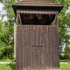
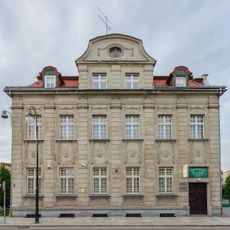
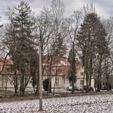
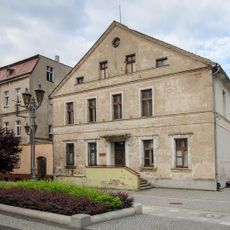
Bralin, Greater Poland Voivodeship, Administrative village in Kępno County, Poland
Bralin is an administrative village in Greater Poland Voivodeship that spreads across rural landscape in west-central Poland. The village serves as the administrative center for several surrounding communities and sits about 140 kilometers southeast of Poznań.
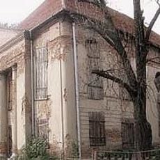
The village was occupied by German forces during World War II, leading to severe persecution and deportations of residents. This difficult period left lasting marks on the community's history.
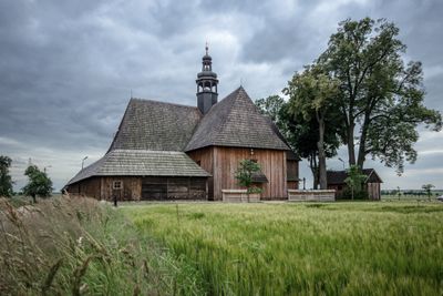
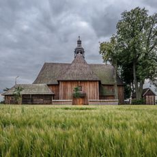
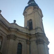
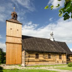
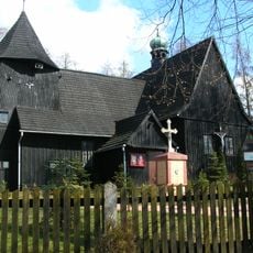
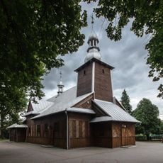
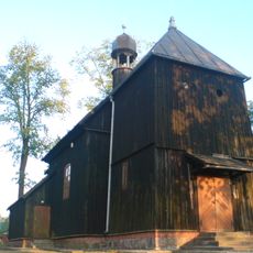
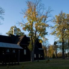
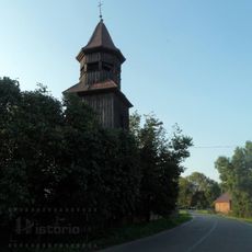
The Church of the Nativity of the Virgin Mary shapes the village center and shows how important Catholic faith is to daily life here. You will see it play a central role in local celebrations and community gatherings.
The village is connected to neighboring towns by regional roads and can be reached from Wrocław in about an hour by car. Visitors should plan to arrive by personal vehicle since public transport options are limited.
The village sits at 172 meters above sea level, standing out in the relatively flat landscape of Greater Poland. This slight elevation gives it an interesting vantage point across the surrounding rural countryside.
Location: Gmina Bralin
Elevation above the sea: 172 m
Website: http://bralin.iap.pl
GPS coordinates: 51.28333,17.90000
Latest update: December 11, 2025 11:01
Kobyla Góra, Greater Poland Voivodeship
7.9 km
Evangelical-Augsburg church in Pisarzowice
9.7 km
Church of the Nativity of the Virgin Mary Na Pólku
1.4 km
Synagogue in Kępno
6.2 km
Saint Martin church in Kępno
5.9 km
Saint Lawrence and Saint Andrew church
7.5 km
Kępno town hall
6.1 km
Water tower in Kępno
5.1 km
Immaculate Conception church in Grębanin
6.7 km
Saints Philip and James church in Koza Wielka
10.3 km
Saint John of Nepomuk church in Dróżki
9.9 km
Saint Andrew church in Słupia pod Bralinem
7.5 km
Saint Hedwig church in Olszowa
10.5 km
Kościół Św. Trójcy w Nowej Wsi Książęcej
5.7 km
Holy Trinity church in Marcinki
8.4 km
Saint Nicholas church in Parzynów
9.6 km
Fire station in Kępno
5.9 km
7 Kręta Street in Kępno
6.2 km
21 Sienkiewicza Street in Kepno
6.1 km
6 Szkolna Street in Kępno
6 km
Dzwonnica kościoła św. Jana Nepomucena w Drożkach
9.9 km
20 Wawrzyniaka Street in Kępno
6 km
Brama I
6.1 km
Palace in Mroczeń
8.7 km
Manor in Kochłowy
10.2 km
Magistrat, ob. biblioteka
6.1 km
Dzwonnica w Domasłowie
8.1 km
Ogrodzenie z bramą
11.3 kmVisited this place? Tap the stars to rate it and share your experience / photos with the community! Try now! You can cancel it anytime.
Discover hidden gems everywhere you go!
From secret cafés to breathtaking viewpoints, skip the crowded tourist spots and find places that match your style. Our app makes it easy with voice search, smart filtering, route optimization, and insider tips from travelers worldwide. Download now for the complete mobile experience.
A unique approach to discovering new places❞
— Le Figaro
All the places worth exploring❞
— France Info
A tailor-made excursion in just a few clicks❞
— 20 Minutes