Gać, Podkarpackie Voivodeship, Rural settlement in Przeworsk County, Poland
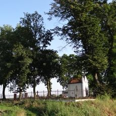
Gać is a village in Podkarpackie Voivodeship situated on gentle terrain amid agricultural fields and forested areas. The settlement spreads across rolling slopes with farmland as the dominant feature of the surrounding landscape.
The village formed as an agricultural center in the post-World War II era when rural communities were reorganized. Over the following decades it adapted to shifts in farming methods and changes in local administrative structures.
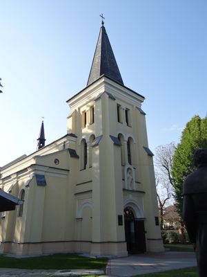
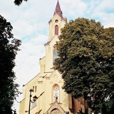
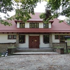
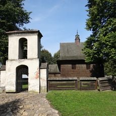
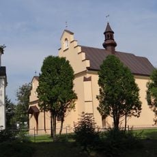
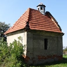
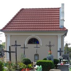
The Church of the Assumption of Mary serves as a gathering place where residents mark important moments in the calendar. Religious practices shape how the community comes together and celebrates seasons and transitions throughout the year.
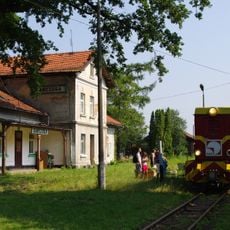
The village is positioned near Przeworsk and provides basic services for visitors and residents. It is best explored on foot or with your own transport, as public transportation options are limited in this rural area.
The community holds harvest celebrations where families gather in the fields to mark the end of growing seasons together. These gatherings show how farming traditions remain central to how neighbors share life and mark the passage of time.
Location: Gmina Gać
Elevation above the sea: 207 m
GPS coordinates: 50.02611,22.35944
Latest update: December 11, 2025 11:03
The Ulma Family Museum of Poles Saving Jews in World War II
3 km
Skansen w Markowej
3 km
Mary Magdalene church in Nowosielce
4.8 km
Saint Michael Archangel church in Kańczuga
6 km
Church of St Dorota in Markowa
3.3 km
Church of the Assumption in Gać
314 m
Church of the Pokrov in Kańczuga
6.2 km
Cmentarz rzym.-kat.
5.7 km
Church of Saint Sebastian in Kosina
4.9 km
Cmentarz rzym.-kat., tzw. Stary
2.7 km
Cmentarz rzym.-kat. w Nowosielcach
4.7 km
Budynek Uniwersytetu Ludowego
678 m
Budynek gospodarczy w Gaci
725 m
Zagroda-muzeum
3 km
Kapliczka, poł. XIX (w zagrodzie-muzeum)
3 km
Spichlerz (sołek)
3 km
Cultural heritage monuments in powiat łańcucki
4.9 km
Zespół cerkwi greko-kat. Opieki NMP, ob. kościoła Matki Boskiej Ła…
6.2 km
Dzwonnica
6.2 km
Szkoła ludowa
3 km
Dworzec kolejki wąskotorowej
6.8 km
Zespół kościoła św. Marii Magdaleny
4.9 km
Zespół budynku Uniwersytetu Ludowego
674 m
Kaplica grobowa rodz. Tomalskich (dec. kaplica cmentarna) w Nowosielcach
4.7 km
Kaplica grobowa księży w Nowosielcach
4.7 km
Kaplica grobowa rodziny Dąbrowskich w Nowosielcach
4.7 km
Dzwonnica
4.9 km
Plebania
5.9 kmVisited this place? Tap the stars to rate it and share your experience / photos with the community! Try now! You can cancel it anytime.
Discover hidden gems everywhere you go!
From secret cafés to breathtaking viewpoints, skip the crowded tourist spots and find places that match your style. Our app makes it easy with voice search, smart filtering, route optimization, and insider tips from travelers worldwide. Download now for the complete mobile experience.
A unique approach to discovering new places❞
— Le Figaro
All the places worth exploring❞
— France Info
A tailor-made excursion in just a few clicks❞
— 20 Minutes