Enable Location

We need your location to show you interesting places around you

Discover nearby places

Find interesting locations and hidden gems around you

Precise directions

Get accurate directions and distances to places

Your location is never shared with other users. It's only used when you tap the location button.

Giewont

Log in to your account

Start exploring — it's free

Trusted by 62,065 travelers worldwide

Continue with Google
Continue with Apple
or

We will send you a code to connect

By continuing, you accept our Terms and Conditions and our Privacy Policy

Check your inbox

We've sent a pincode in your inbox. Please enter the code below.

Giewont, Mountain peak in Tatra County, Poland

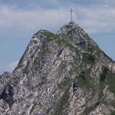
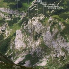
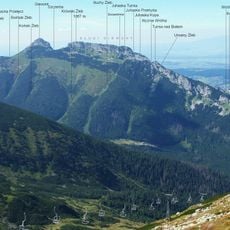
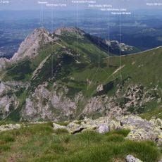
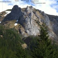
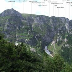
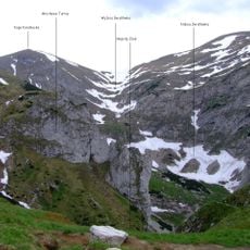
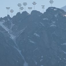
Giewont is a mountain in the Western Tatra range near Zakopane, rising to 1895 meters above sea level. Its northern face drops sharply in vertical cliffs, while three separate rocky summits form the peak zone and give the mountain its characteristic triangular shape.

The first recorded ascent took place in 1832 when Franz Herbich, a geologist from Vienna, reached the top. Mariusz Zaruski made the first winter climb in 1904, opening a new chapter in Polish alpine mountaineering.

The name comes from an old Polish word meaning peak or summit, fitting the sharp profile visible from the valley below. Locals often see the outline of a sleeping knight in the mountain's silhouette when viewed from certain angles.

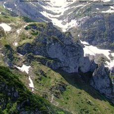
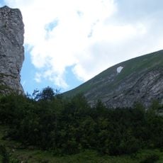
Several marked paths begin at Kuznice and pass through Hala Kondratowa, taking about four to five hours to reach the top. The trail can become crowded during peak summer months, so setting off early in the morning helps avoid the busiest hours.

A steel cross measuring 15 meters in height has stood at the summit since 1901, drawing pilgrims from across Poland. Mountain guides carried the cross to the top in sections, and today it serves as one of the highest religious symbols in the Tatra range.

The community of curious travelers

AroundUs brings together thousands of curated places, local tips, and hidden gems, enriched daily by 60,000 contributors worldwide.

Start exploring
Location
Elevation above the sea
1,895 m
GPS coordinates
49.25056,19.93389
Latest update
December 12, 2025 22:13
Little Poland and the Carpathians: medieval castles, salt mines and historic towns

The south of Poland stretches between Krakow and the Carpathians. There are medieval castles on cliffs, salt mines that became real underground towns since the 13th century, and wooden churches protected by UNESCO. The national parks have trails through gorges and beech forests. The thermal baths...

« Giewont - Mountain peak in Tatra County, Poland » is provided by Around Us (aroundus.com). Images and texts are derived from Wikimedia project under a Creative Commons license. You are allowed to copy, distribute, and modify copies of this page, under the conditions set by the license, as long as this note is clearly visible.

Discover hidden gems everywhere you go!

From secret cafés to breathtaking viewpoints, skip the crowded tourist spots and find places that match your style. Our app makes it easy with voice search, smart filtering, route optimization, and insider tips from travelers worldwide. Download now for the complete mobile experience.

Around Us App Screenshot

A unique approach to discovering new places

Le Figaro

All the places worth exploring

France Info

A tailor-made excursion in just a few clicks

20 Minutes

Around Us
Travel Guide & Maps
Download

Send to your phone

QR Code
1

Open the camera app on your mobile.

2

Point at the QR code with your camera. A notification will appear.

3

Tap the notification to open the link.