Chest opened
+${chestReward.xp} XP
Explorer
NOUVEAU ×${chestReward.collectible.quantity}
tapez pour fermer
Chest locked

Open chests in the app

Around Us is built for your phone — chests unlock when you walk, explore and capture nearby places.

Enable Location

We need your location to show you interesting places around you

Discover nearby places

Find interesting locations and hidden gems around you

Precise directions

Get accurate directions and distances to places

Your location is never shared with other users. It's only used when you tap the location button.

Kunów

Log in to your account

Start exploring — it's free

Trusted by 72,878 travelers worldwide

Continue with Google
Continue with Apple
or

We will send you a code to connect

By continuing, you accept our Terms and Conditions and our Privacy Policy

Check your inbox

We've sent a pincode in your inbox. Please enter the code below.

Kunów
Discussion Reviews 1 Photos
7.7k Popularity

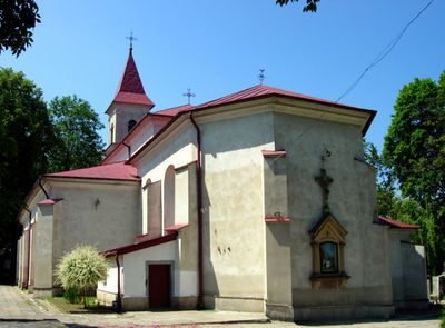
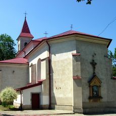
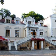
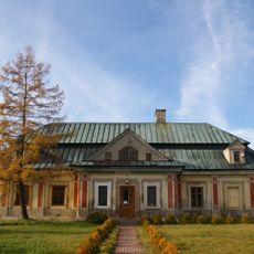
Kunów, Municipality in Świętokrzyskie Voivodeship, Poland.

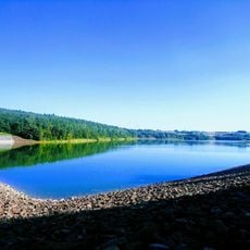
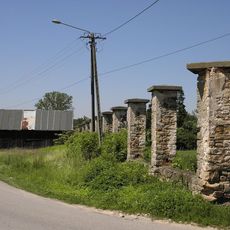
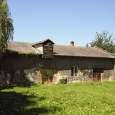
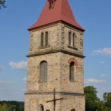
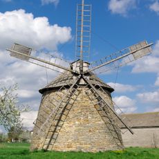
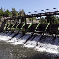
Kunów is a town in the Świętokrzyskie region that sits along the Kamienna River. The surrounding area features rolling landscapes with farmland and natural features typical of central Poland.

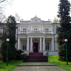
The town was granted Magdeburg rights in 1365 by King Kazimierz Wielki, which gave it legal status as an important administrative center. This charter shaped its early governance and community structure.

The town maintains its traditional governmental structure with a directly elected mayor and hosts regular municipal gatherings that strengthen community bonds.

The town is situated about 8 kilometers northwest of Ostrowiec Świętokrzyski and can be reached via European route E371. The Kamienna River and local roads provide natural and practical navigation markers throughout the region.

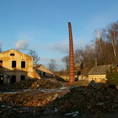
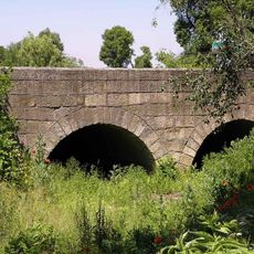
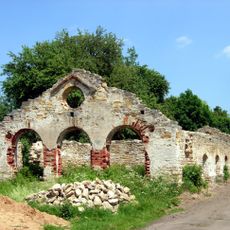
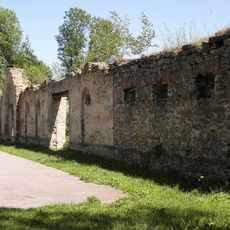
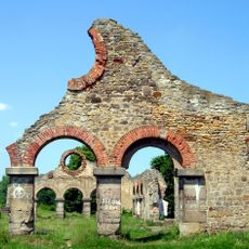
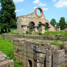
In early modern times, this town was known for its marble quarries that extracted white and red stone. The material supplied building projects across the region and shaped the town's economic importance.

The community of curious travelers

AroundUs brings together thousands of curated places, local tips, and hidden gems, enriched daily by 60,000 contributors worldwide.

Start exploring
Location
Website
GPS coordinates
50.95861,21.28306
Latest update
December 10, 2025 15:46
Around this place
Pomnik lotniczy MiG-17PF w Ostrowcu Świętokrzyskim
Poland

Pomnik lotniczy MiG-17PF w Ostrowcu Świętokrzyskim

7.1 km
Our Lady of La Salette church in Ostrowiec Świętokrzyski
Poland

Our Lady of La Salette church in Ostrowiec Świętokrzyski

6 km
Church of Saint Ladislaus in Kunów
Poland

Church of Saint Ladislaus in Kunów

562 m
Jewish Cemetery in Ostrowiec Świętokrzyski
Poland

Jewish Cemetery in Ostrowiec Świętokrzyski

7.4 km
Zapora Wodna "Wióry"
Poland

Zapora Wodna "Wióry"

6.2 km
Post-industrial area in Doły Biskupie
Poland

Post-industrial area in Doły Biskupie

4.3 km
Cemetery in Kunów
Poland

Cemetery in Kunów

668 m
Most na kanale roboczym, lata 1834-1845
Poland

Most na kanale roboczym, lata 1834-1845

2.9 km
Pozostałości ogrodzenia, lata 1834-1845
Poland

Pozostałości ogrodzenia, lata 1834-1845

2.9 km
Saint Barbara church in Mychów
Poland

Saint Barbara church in Mychów

5.2 km
Częstocice Palace
Poland

Częstocice Palace

6.7 km
Most na Kanale rz. Kamiennej, lata 1834-1845
Poland

Most na Kanale rz. Kamiennej, lata 1834-1845

3.4 km
Pałacyk myśliwski Wielopolskich, obecnie hotel
Poland

Pałacyk myśliwski Wielopolskich, obecnie hotel

6.3 km
Zespół pałacyku myśliwskiego Wielopolskich
Poland

Zespół pałacyku myśliwskiego Wielopolskich

6.3 km
Ruina suszarni, lata 1834-1845
Poland

Ruina suszarni, lata 1834-1845

3 km
Ruina magazynu, lata 1834-1845
Poland

Ruina magazynu, lata 1834-1845

2.9 km
Budynek administracyjny dyrekcji (zarządu), lata 1834-1845
Poland

Budynek administracyjny dyrekcji (zarządu), lata 1834-1845

3 km
Budynek wagi, lata 1834-1845
Poland

Budynek wagi, lata 1834-1845

3 km
Bell tower of Saint Ladislaus church in Kunów
Poland

Bell tower of Saint Ladislaus church in Kunów

532 m
Zespół pałacowy, lata 1880-1885
Poland

Zespół pałacowy, lata 1880-1885

6.6 km
Windmill in Szwarszowice
Poland

Windmill in Szwarszowice

7.3 km
Rectory in Szewna
Poland

Rectory in Szewna

7.4 km
Ruina walcowni, lata 1834-1845
Poland

Ruina walcowni, lata 1834-1845

3 km
Zakład przemysłowy (dawna fabryka tektury „Witulin”)
Poland

Zakład przemysłowy (dawna fabryka tektury „Witulin”)

4.4 km
Muzeum Historyczno-Archeologiczne w Ostrowcu Świętokrzyskim
Poland

Muzeum Historyczno-Archeologiczne w Ostrowcu Świętokrzyskim

6.7 km
Zespół urbanistyczno-przemysłowy w Nietulisku Dużym, lata 1834-1845
Poland

Zespół urbanistyczno-przemysłowy w Nietulisku Dużym, lata 1834-1845

3 km
Budynek wartowni, lata 1834-1845
Poland

Budynek wartowni, lata 1834-1845

3 km
Układ wodny (kanał roboczy i jaz na rz. Świślinie)
Poland

Układ wodny (kanał roboczy i jaz na rz. Świślinie)

4.4 km
Show the full map
Reviews
Share your experience

No review yet

Discussions
Start a discussion...

No discussion yet

« Kunów - Municipality in Świętokrzyskie Voivodeship, Poland » is provided by Around Us (aroundus.com). Images and texts are derived from Wikimedia project under a Creative Commons license. You are allowed to copy, distribute, and modify copies of this page, under the conditions set by the license, as long as this note is clearly visible.

Discover hidden gems everywhere you go!

From secret cafés to breathtaking viewpoints, skip the crowded tourist spots and find places that match your style. Our app makes it easy with voice search, smart filtering, route optimization, and insider tips from travelers worldwide. Download now for the complete mobile experience.

Around Us App Screenshot

A unique approach to discovering new places

Le Figaro

All the places worth exploring

France Info

A tailor-made excursion in just a few clicks

20 Minutes

Around Us
Travel Guide & Maps
Download

Send to your phone

QR Code
1

Open the camera app on your mobile.

2

Point at the QR code with your camera. A notification will appear.

3

Tap the notification to open the link.