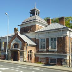
Lemkivshchyna, Ukrainian historical region in southeastern Poland
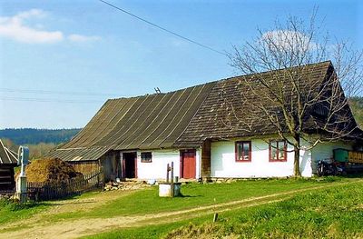
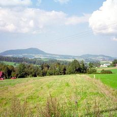
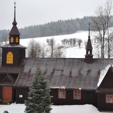
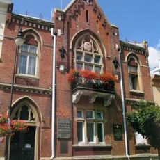
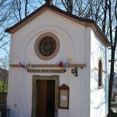
Lemkivshchyna is a historical region spanning the eastern Carpathians across southeastern Poland and Slovakia. The landscape features dense forests, rolling hills, and scattered traditional wooden buildings that define the character of its villages.
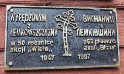
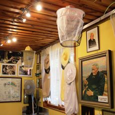
The region emerged as a settlement area for the Lemko people, who developed their own language and culture in the Carpathians. After World War II, the population changed dramatically when Operation Vistula forcibly removed thousands of Lemko residents from their ancestral lands.
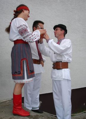
The Lemko people maintain their identity through traditional music with distinctive vocal styles and regional instruments like the trembita, a wooden horn. These musical practices still shape village life today and appear at local celebrations.
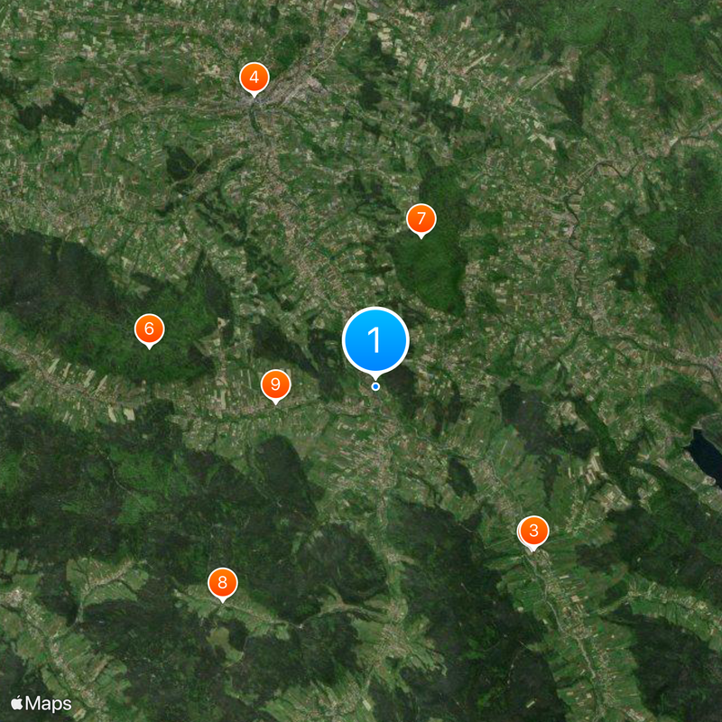
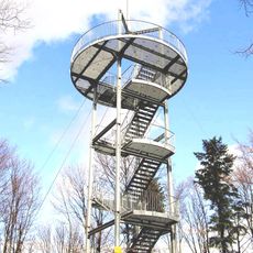
The region can be explored on marked hiking trails connecting traditional villages like Krynica-Zdrój and Uście Gorlickie. Local festivals happen throughout the year, offering insight into regional traditions.
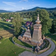
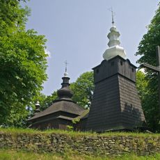
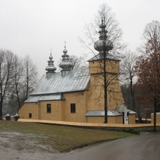
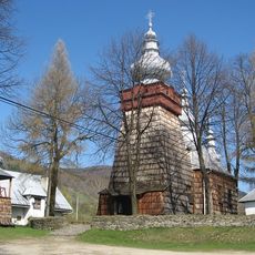
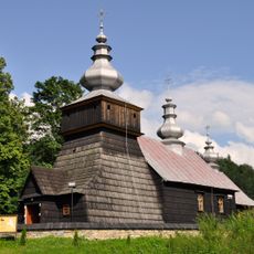
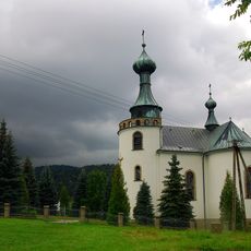
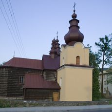
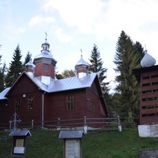
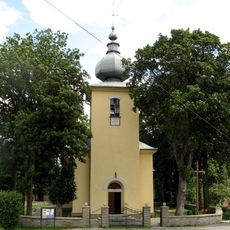
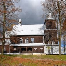
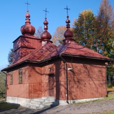
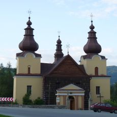
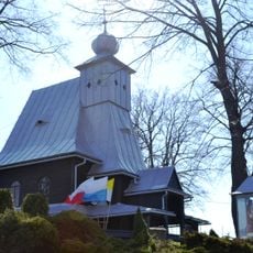
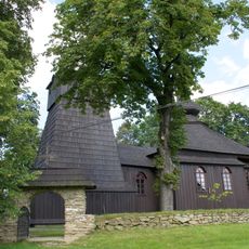
The region contains numerous wooden churches with distinctive domes that display architectural techniques different from neighboring Carpathian communities. These construction methods reflect the Lemko people's own craft tradition and remain rare in their form.
Part of: Wooded Carpathians
GPS coordinates: 49.56670,20.98330
Latest update: December 20, 2025 13:31
Wooden tserkvas of Carpathian region in Poland and Ukraine
5.1 km
St. Michael Archangel's Church, Brunary
5.1 km
Saint Catherine church in Grybów
7.1 km
Jaworze
5.2 km
Jaworze
5.2 km
Chełm
3.5 km
Muzeum Pszczelarstwa w Kamiannej
5.9 km
Saint Demetrius church in Binczarowa
2.3 km
Saint Demetrius church in Bogusza
6.9 km
Church of St.Michael the Archangel in Polany
5.3 km
Synagoge
7.2 km
Church of the Dormition in Klimkówka
6.6 km
Kościół św. Michała Archanioła w Ropie
5.8 km
Saints Peter and Paul chapel in Grybów
5.1 km
Nativity of the Virgin Mary church in Kamianna
5.8 km
Sacred Heart church in Florynka
1.1 km
Church of Saint Adalbert in Kąclowa
1.4 km
Muzeum Parafialne w Grybowie
7.1 km
Church of the Pokrov in Wawrzka
1.7 km
Church of Saint Demetrius of Thessaloniki in Bogusza
7.1 km
Old rectory in Grybów
7.1 km
Town hall in Grybów
7.1 km
Kaplica Męki Pańskiej w Grybowie
7.1 km
Kościół pomocniczy św. Michała Archanioła
5.8 km
Sacred heart chapel Grybów Podchełmie
4.5 km
Synagoga, ob. opuszczona
7.2 km
Budynek Towarzystwa Gimnastycznego Sokół w zakresie zewnętrznej architektury wraz z dolną częścią klatki schodowej
6.8 km
Ogrodzenie z bramkami
5.1 kmVisited this place? Tap the stars to rate it and share your experience / photos with the community! Try now! You can cancel it anytime.
Discover hidden gems everywhere you go!
From secret cafés to breathtaking viewpoints, skip the crowded tourist spots and find places that match your style. Our app makes it easy with voice search, smart filtering, route optimization, and insider tips from travelers worldwide. Download now for the complete mobile experience.
A unique approach to discovering new places❞
— Le Figaro
All the places worth exploring❞
— France Info
A tailor-made excursion in just a few clicks❞
— 20 Minutes