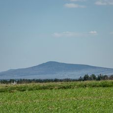
Bukowa Góra, Mountain summit in Świętokrzyskie Mountains, Poland
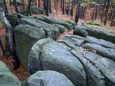
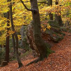
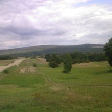
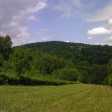
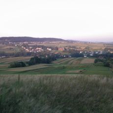
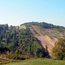
Bukowa Góra is a mountain summit in the Świętokrzyskie range, characterized by quartzite rock formations and thick forests covering its slopes. The peak sits among other summits in this ancient mountain chain, offering views across forested valleys and ridges.
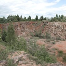
This mountain formed part of one of Europe's oldest ranges during the Caledonian orogeny, approximately 440 million years ago. The region was once underwater, which explains the marine fossils found within the rock layers.
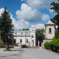
Local residents maintain traditional hiking ceremonies during specific dates, marking seasonal changes with gatherings at designated points along the mountain paths.
Multiple marked trails lead to the summit, with the main route beginning from the eastern parking area near the forest entrance. Wear sturdy footwear as the quartzite rocks can become slippery, especially when wet.
The mountain slopes preserve fossils of prehistoric sea creatures from when this region formed part of an ancient seabed. Visitors hiking the trails may spot traces of these ancient marine life forms within the rock layers.
GPS coordinates: 50.95802,20.83313
Latest update: December 12, 2025 16:42
Łysica
8.6 km
Park Rozrywki i Miniatur - Sabat Krajno
7.1 km
Bodzentyn Castle
8.5 km
Mausoleum in Michniów
5.4 km
Saint Stanislaus church in Bodzentyn
8.6 km
Centrum Edukacyjne Szklany Dom w Ciekotach
5.6 km
Nature reserve Kamień Michniowski
5.3 km
Holy Spirit church in Bodzentyn
9.1 km
Jewish Cemetery in Bodzentyn
8 km
Zachełmie quarry
10.1 km
Jaskinia Ponurego
5.2 km
Nature reserve Góra Sieradowska
10.2 km
Saint Andrew church in Suchedniów
10.3 km
Barcza (Góry Świętokrzyskie)
5.8 km
Dąbrówka (Pasmo Masłowskie)
6.9 km
World War I cemetery in Bodzentyn
8.2 km
Kościół Wniebowzięcia NMP we Wzdół-Koloni
4.1 km
Kościół św. Katarzyny
7.1 km
Parish Cemetery in Bodzentyn
9.4 km
Klonówka (góra)
7.9 km
Zespół klasztorny bernardynek
7.1 km
Klasztor
7.1 km
3 Berezów Street in Suchedniów
8.8 km
30 Bodzentyńska Street in Suchedniów
9.3 km
54 Kielecka Street in Suchedniów
9.6 km
Góra Radostowa (strefa ochrony konserwatorskiej, teren góry w granicach gminy Masłów i gminy Górno)
7 km
Pozostałości murów miejskich, przed 1380 r.
8.6 km
Miasto (układ w granicach d. murów obronnych), poł. XIV w.
8.7 kmVisited this place? Tap the stars to rate it and share your experience / photos with the community! Try now! You can cancel it anytime.
Discover hidden gems everywhere you go!
From secret cafés to breathtaking viewpoints, skip the crowded tourist spots and find places that match your style. Our app makes it easy with voice search, smart filtering, route optimization, and insider tips from travelers worldwide. Download now for the complete mobile experience.
A unique approach to discovering new places❞
— Le Figaro
All the places worth exploring❞
— France Info
A tailor-made excursion in just a few clicks❞
— 20 Minutes