Enable Location

We need your location to show you interesting places around you

Discover nearby places

Find interesting locations and hidden gems around you

Precise directions

Get accurate directions and distances to places

Your location is never shared with other users. It's only used when you tap the location button.

Fort Reditowy 12 "Luneta Warszawska"

Log in to your account

Start exploring — it's free

Trusted by 61,351 travelers worldwide

Continue with Google
Continue with Apple
or

We will send you a code to connect

By continuing, you accept our Terms and Conditions and our Privacy Policy

Check your inbox

We've sent a pincode in your inbox. Please enter the code below.

Fort Reditowy 12 "Luneta Warszawska"

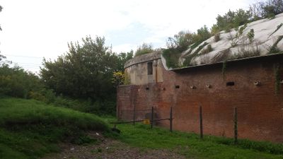
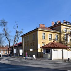
Fort Reditowy 12 "Luneta Warszawska", Military fort and heritage site near Kamienna Street, Kraków, Poland.

Description

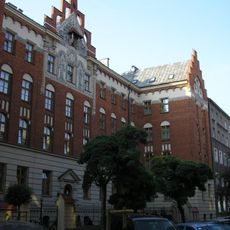
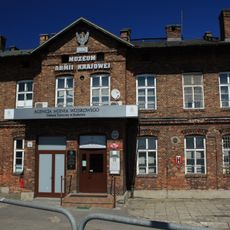
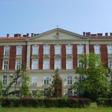
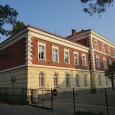
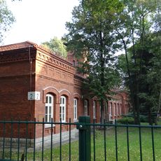
Fort Reditowy 12 is a fortification in Kraków located at a major street intersection and showcasing neo-Gothic features combined with multiple defensive caponiers built into its layout. The complex contains original defensive structures that date from its construction period in the 19th century.

History

Built between 1850 and 1856, the fort originally protected a key strategic route through the region as part of a larger defensive system. During World War II, occupying forces converted it into a prison facility, completely changing its purpose.

Culture

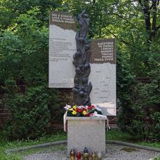
The fort's walls hold inscriptions left by prisoners during its years as a detention center in World War II. These carved marks tell stories of people held within and their attempts to leave a trace of their presence.

Practical

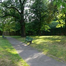
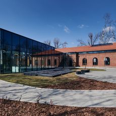
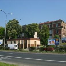
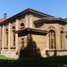
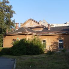
The site is currently used for commercial purposes in parts of its space and can be viewed from the exterior, though some sections may have limited access. The best way to appreciate its architecture is to walk around the perimeter and observe the defensive features from different angles.

Did you know?

This fort is one of the few preserved remains of the Austrian fortress system that once ringed Kraków and retains its original polygonal design from the 1850s. The mix of military construction with later commercial use shows how war-era buildings have been adapted for peacetime purposes over generations.

Location
Inception
1856
Address
Kamienna 16
GPS coordinates
50.07796,19.94684
Latest update
December 12, 2025 17:42

AroundUs brings together thousands of curated places, local tips, and hidden gems, enriched daily by 60,000 contributors worldwide. Discover all places nearby (Kraków).

« Fort Reditowy 12 "Luneta Warszawska" - Military fort and heritage site near Kamienna Street, Kraków, Poland » is provided by Around Us (aroundus.com). Images and texts are derived from Wikimedia project under a Creative Commons license. You are allowed to copy, distribute, and modify copies of this page, under the conditions set by the license, as long as this note is clearly visible.

Discover hidden gems everywhere you go!

From secret cafés to breathtaking viewpoints, skip the crowded tourist spots and find places that match your style. Our app makes it easy with voice search, smart filtering, route optimization, and insider tips from travelers worldwide. Download now for the complete mobile experience.

Around Us App Screenshot

A unique approach to discovering new places

Le Figaro

All the places worth exploring

France Info

A tailor-made excursion in just a few clicks

20 Minutes

Around Us
Travel Guide & Maps
Download

Send to your phone

QR Code
1

Open the camera app on your mobile.

2

Point at the QR code with your camera. A notification will appear.

3

Tap the notification to open the link.