Klimont, Mountain summit in Lesser Poland, Poland.
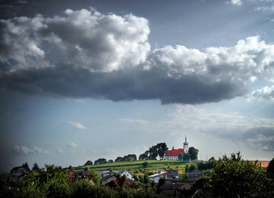
Klimont is a mountain summit in the southern part of Poland, marked by sloping terrain and exposed rock formations along its higher reaches. The landscape transitions from wooded slopes to more open areas that offer views across the valleys below.
The summit has long served as a natural landmark for local communities navigating the landscape. Its visible peak has guided travelers and helped shape the way people understand and move through this region.
The mountain serves as a gathering place for hikers and outdoor enthusiasts during warmer months, when local people and visitors walk the slopes together. This tradition has made it a focal point for spending time outdoors and enjoying the landscape.
Marked trails lead to the summit from several starting points, with most routes taking one to two hours of walking. Along the way, information signs and rest spots are available for hikers who need to take breaks.
The exposed summit experiences strong winds that limit plant growth and create a windswept, more open landscape near the peak. This creates a distinct environment at the top that differs noticeably from the sheltered forested slopes below.
GPS coordinates: 50.12101,19.10227
Latest update: December 14, 2025 11:03
FM- and TV-mast Kosztowy
7.5 km
Saint Francis of Assisi church in Tychy
7.4 km
Sanctuary of St. Valentine in Bieruń
3.5 km
Stadion Zimowy Tychy
7.3 km
Church of Our Lady of the Scapular in Imielin
6.6 km
Church of Saint Clemens in Lędziny
62 m
Church of Saint Bartholomew in Bieruń
3.2 km
Płone Bagno
5.4 km
Jewish cemetery in Bieruń
3.9 km
Church of Sacred Heart of Jesus in Bieruń
7.7 km
Holy Trinity church in Chełm Śląski
7 km
Evangelical church of the Holy Trinity in Lędziny-Hołdunów
3.7 km
Saint Joseph church in Mysłowice
7.6 km
Body and Blood of Christ church in Mysłowice
5.7 km
Morgue in Bieruń Stary
3.5 km
Miasto w ramach historycznego założenia
3.2 km
Library in Lędziny
954 m
St. Valentine church in Bieruń
3.6 km
Kostnica na cmentarzu
3.8 km
Budynek domu gminy protestanckiej, obecnie siedziba fundacji „Fastryga”
4 km
Gawlik family tomb in Bieruń
3.6 km
Spichrz, poł. XIX w.
7.8 km
Stodoła, poł. XIX w.
7.8 km
Dworek, poł. XIX w.
7.9 km
Muzeum Miejskie w Bieruniu
3.2 km
Former grain mill in Tychy
7.9 km
Zespół dworski, poł. XIX w.
7.9 km
Zespół domu
6.9 kmVisited this place? Tap the stars to rate it and share your experience / photos with the community! Try now! You can cancel it anytime.
Discover hidden gems everywhere you go!
From secret cafés to breathtaking viewpoints, skip the crowded tourist spots and find places that match your style. Our app makes it easy with voice search, smart filtering, route optimization, and insider tips from travelers worldwide. Download now for the complete mobile experience.
A unique approach to discovering new places❞
— Le Figaro
All the places worth exploring❞
— France Info
A tailor-made excursion in just a few clicks❞
— 20 Minutes