Mirandela, Municipality and city in Trás-os-Montes region, Portugal
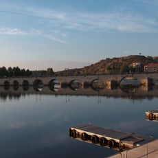
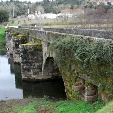
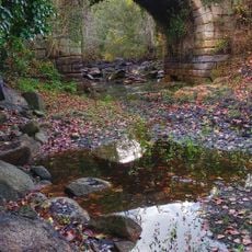
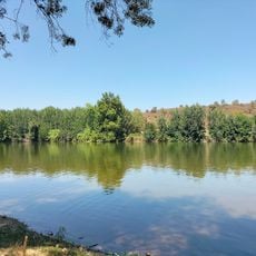
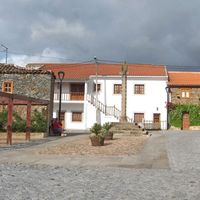
Mirandela is a city in northeastern Portugal situated along the Tua River, surrounded by olive groves and farmland within hilly terrain. The settlement extends along the river banks, shaped by the surrounding agricultural landscape.
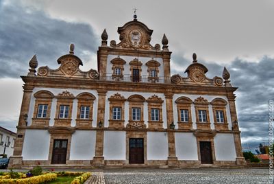
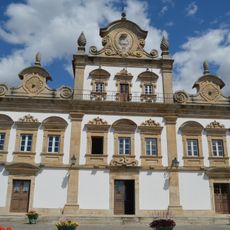
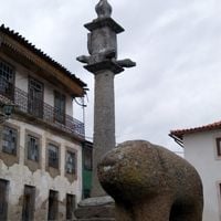
In 1250, King Afonso III granted the settlement a municipal charter, spurring the development of a fortified community. This early royal recognition shaped its strategic importance in the region.
The town center is home to the Museu Municipal Armindo Teixeira Lopes, displaying extensive Portuguese art spanning the 19th to 21st centuries. This collection reflects the artistic development of the region and offers insight into its cultural heritage.
The weekly market runs on Thursdays and offers regional products, fresh produce, and traditional crafts from the area. The selection changes with the seasons and reflects the agricultural character of the region.
The Tua River hosts the European Jetski Championship during summer months, transforming its normally calm waters into a competitive racing venue. This sporting event brings a different kind of energy to the otherwise rural setting.
Location: Bragança
Location: Terras de Trás-os-Montes
Inception: January 1, 1250
Shares border with: Carrazeda de Ansiães, Murça, Valpaços, Vinhais, Macedo de Cavaleiros, Alfândega da Fé, Vila Flor
Phone: +351278200200
Email: geral@cm-mirandela.pt
Website: https://cm-mirandela.pt
GPS coordinates: 41.48333,-7.18333
Latest update: December 14, 2025 18:23
Paço dos Távoras
833 m
Ponte Velha sobre o rio Tua
295 m
Castle of Mirandela
252 m
Ponte de Torre de Dona Chama
20.5 km
Pontão de Possacos
16.6 kmAbrigos rupestres do Regato das Bouças
8.1 km
Praia Fluvial de Mirandela
625 m
Igreja de Guide
17.5 km
Pelourinho de Torre de Dona Chama
19.4 km
Pelourinho de Lamas de Orelhão
10.1 km
Igreja de São Tomé de Abambres
7.9 km
Pelourinho de Mirandela
804 m
Igreja de Nossa Senhora dos Reis, matriz de Lamalonga, incluindo o adro
23.3 km
Pelourinho de Frechas
8.1 km
Church of São Pedro
16.8 km
Pelourinho de Abreiro
17.4 km
Pillory of Vilas Boas
15.3 km
Pelourinho de Vale de Prados
14 km
Pillory of Nozelos
20.2 km
Pillory of Ervedosa
26.8 km
Pelourinho de Águas Revés
16.1 km
Pillory of Santa Comba da Vilariça
16.8 km
Igreja Paroquial de Frechas
8.1 km
Igreja Paroquial de Veiga do Lila
12.5 km
Ponte dos Jogos
1 km
Igreja Paroquial de Vilarandelo
23.5 km
Igreja Paroquial de Valpaços
17.4 km
Igreja Paroquial de Ervedosa
26.8 kmVisited this place? Tap the stars to rate it and share your experience / photos with the community! Try now! You can cancel it anytime.
Avidagos, Navalho e Pereira
Avantos e Romeu
Freixeda e Vila Verde
Barcel, Marmelos e Valverde da Gestosa
Franco e Vila Boa
Abambres
Abreiro
Aguieiras
Alvites
Cabanelas
Cobro
Bouça
Mirandela
São Salvador
Suçães
Vale de Telhas
Carvalhais
Vale de Asnes
Fradizela
Múrias
Cedães
Lamas de Orelhão
Vale de Salgueiro
Mascarenhas
Caravelas
Passos
Frechas
São Pedro Velho
Torre de Dona Chama
Vale de Gouvinhas
Discover hidden gems everywhere you go!
From secret cafés to breathtaking viewpoints, skip the crowded tourist spots and find places that match your style. Our app makes it easy with voice search, smart filtering, route optimization, and insider tips from travelers worldwide. Download now for the complete mobile experience.
A unique approach to discovering new places❞
— Le Figaro
All the places worth exploring❞
— France Info
A tailor-made excursion in just a few clicks❞
— 20 Minutes