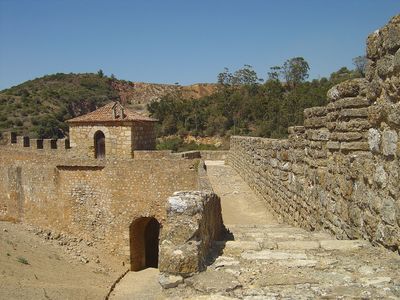
Castle of Alenquer, Medieval castle in Alenquer, Portugal
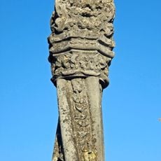
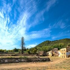
The Castle of Alenquer is a medieval fortress with stone walls and reinforced towers rising from a hillside, shaped to follow the natural terrain. The ruins still display the layout of the fortification with its defensive structures and inner spaces.
The fortress was founded in 714 as a Muslim stronghold and later fell to Christian forces when King Afonso Henriques seized it following a military siege. This capture marked a shift in regional power and control.
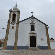
The chapel dedicated to Nossa Senhora da Conceição sits within the fortress walls, showing how religious spaces were woven into military structures. This blend of faith and defense shaped how people used the castle daily.
Visitors can reach the castle via marked trails from Alenquer town center, with informational signs along the way describing the historical structures. Sturdy footwear is advisable as the terrain is uneven and slopes in places.
The Knights Templar took control of this strategic fortress in 1216 to settle territorial disputes between Portuguese noble families. This role as a neutral power broker in local conflicts made it an important center of influence during that period.
GPS coordinates: 39.05746,-9.00725
Latest update: December 9, 2025 12:27
Lezíria Bridge
8 km
Convento de São Francisco
633 m
Túmulo de Damião de Góis
431 m
Fábrica Nova da Romeira
803 m
Pillory of Aldeia Galega da Merceana
9.5 km
Igreja da Misericórdia de Alenquer
349 m
Igreja de Nossa Senhora da Piedade (Merceana)
9.9 km
Real Fábrica de Atanados da Vila de Povos
10.1 km
Igreja de Nossa Senhora dos Prazeres de Aldeia Galega da Merceana
9.5 km
Câmara Municipal de Alenquer
307 m
Convento de Nossa Senhora da Encarnação
6.7 km
Tribunal Judicial de Alenquer
777 m
Igreja Paroquial de Vila Nova da Rainha
6.7 km
Monumento a Damião de Góis
767 m
Auditório Damião de Góis
472 m
Fonte de São Pedro
426 m
Monte do Senhor da Boa Morte
9.8 km
Monumento do Centenário da Aviação Militar
6.9 km
Capela da Igreja de São Pedro (e recheio)
456 m
Padrão da Ponte do Espírito Santo
788 m
Mercado Municipal de Alenquer
719 m
Quinta da Abrigada
9.8 km
Fábrica de Lanifícios da Chemina
793 m
Capela de São Roque (Abrigada)
9.8 km
Um marco de Légua na EN 12-1 (actual EN 10), ao km. 29,270
6.7 km
Ermida de Nossa Senhora do Monte (Arruda dos Vinhos)
8.6 km
Portal manuelino do Convento de São Francisco
636 m
Antiga Câmara Municipal de Arruda dos Vinhos
10.1 kmVisited this place? Tap the stars to rate it and share your experience / photos with the community! Try now! You can cancel it anytime.
Discover hidden gems everywhere you go!
From secret cafés to breathtaking viewpoints, skip the crowded tourist spots and find places that match your style. Our app makes it easy with voice search, smart filtering, route optimization, and insider tips from travelers worldwide. Download now for the complete mobile experience.
A unique approach to discovering new places❞
— Le Figaro
All the places worth exploring❞
— France Info
A tailor-made excursion in just a few clicks❞
— 20 Minutes