Enable Location

We need your location to show you interesting places around you

Discover nearby places

Find interesting locations and hidden gems around you

Precise directions

Get accurate directions and distances to places

Your location is never shared with other users. It's only used when you tap the location button.

Serra d'Aboboreira

Log in to your account

Start exploring — it's free

Trusted by 62,096 travelers worldwide

Continue with Google
Continue with Apple
or

We will send you a code to connect

By continuing, you accept our Terms and Conditions and our Privacy Policy

Check your inbox

We've sent a pincode in your inbox. Please enter the code below.

Serra d'Aboboreira

Serra d'Aboboreira, Mountain chain and archaeological site in Amarante region, Portugal

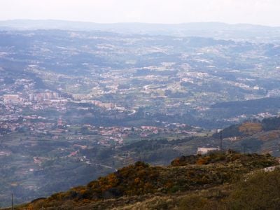
Serra d'Aboboreira is a granite mountain range in the Amarante region extending across three municipalities with elevations reaching about 1000 meters. The plateau holds some forty prehistoric burial mounds arranged across its flat sections and connected by walking routes.

The megalithic complex developed during the Neolithic period roughly 4500 years ago when early communities used this plateau as a burial ground. Archaeological excavations beginning in 1978 revealed the structure of this ancient necropolis and showed how burial rituals continued across many generations.

The grouped burial mounds scattered across the plateau reveal how prehistoric communities gathered to honor their dead and reinforce their bonds. These monuments were gathering places for rituals that connected the living to their ancestors.

The plateau is reachable via a road connecting Baião to Mesão Frio, with marked pathways leading to individual monuments from there. Visit during warmer months as mountain weather can change quickly at these higher elevations.

The flat areas across the mountain are called 'chãs' by locals and mark where ancient communities deliberately grouped their burial mounds together. These high plateaus reveal a deliberate system of land use by prehistoric settlers.

The community of curious travelers

AroundUs brings together thousands of curated places, local tips, and hidden gems, enriched daily by 60,000 contributors worldwide.

Start exploring
GPS coordinates
41.19028,-8.02694
Latest update
December 12, 2025 12:07
« Serra d'Aboboreira - Mountain chain and archaeological site in Amarante region, Portugal » is provided by Around Us (aroundus.com). Images and texts are derived from Wikimedia project under a Creative Commons license. You are allowed to copy, distribute, and modify copies of this page, under the conditions set by the license, as long as this note is clearly visible.

Discover hidden gems everywhere you go!

From secret cafés to breathtaking viewpoints, skip the crowded tourist spots and find places that match your style. Our app makes it easy with voice search, smart filtering, route optimization, and insider tips from travelers worldwide. Download now for the complete mobile experience.

Around Us App Screenshot

A unique approach to discovering new places

Le Figaro

All the places worth exploring

France Info

A tailor-made excursion in just a few clicks

20 Minutes

Around Us
Travel Guide & Maps
Download

Send to your phone

QR Code
1

Open the camera app on your mobile.

2

Point at the QR code with your camera. A notification will appear.

3

Tap the notification to open the link.