Serra de Arga, Mountain chain and nature reserve in Viana do Castelo, Portugal
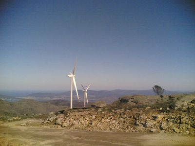
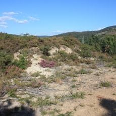
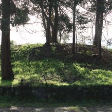
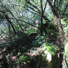
Serra de Arga is a mountain chain in the Norte Region featuring rocky granite formations and slopes covered with Mediterranean plants. The landscape shifts from more open areas at lower elevations to increasingly dense vegetation as you climb higher up the slopes.
The area became a protected site through the Natura 2000 network in 2000, marking its official recognition as a conservation area of European importance. This designation established safeguards for the mountain chain and its natural ecosystems.
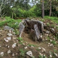
The Serra de Arga has long served as grazing land where shepherds managed their flocks across the slopes, shaping the landscape through centuries of pastoral use. You can still see signs of this tradition in how the vegetation grows and how people move through the terrain.
The mountain reserve is accessible year-round with marked hiking trails that wind through different elevations and terrain types. Spring and autumn offer the most comfortable weather for exploring, while summer can be warm and dry.
Wild Garrano horses, an ancient Portuguese breed, roam the slopes freely and have grazed these mountains for generations. These animals are an integral part of the landscape, their grazing habits helping to maintain the vegetation patterns.
Location: Norte Region
Elevation above the sea: 664 m
Operator: Instituto da Conservação da Natureza e das Florestas
Opening Hours: 24/7
Website: https://natura2000.eea.europa.eu/Natura2000/SDF.aspx?site=PTCON0039
GPS coordinates: 41.80608,-8.71369
Latest update: December 10, 2025 16:21
Sereia da Gelfa
12.4 km
Santuário de São João de Arga
3.9 km
Anta da Barrosa
11.4 km
Forte de Âncora
12.8 km
Ponte medieval de Vilar de Mouros
11 km
Cividade de Âncora
11.9 km
Convento de São João de Cabanas
11.6 km
Chafariz da Praça Municipal
12.9 km
Casa dos Pitas
12.9 km
Igreja de São Cláudio (Viana do Castelo)
8.5 km
Mamoa de Aspra
10.4 km
Igreja de Santa Clara
12.9 km
Complexo mineiro da época romana do Couço do Monte Furado
8.3 km
Capela de Santa Luzia (Marinhas)
11.1 km
Capela de São Pedro de Varais
9.8 km
Dólmen de Vile
10.6 km
Estação arqueológica do Alto do Coto da Pena
12.1 km
Vilarelho church
12.5 km
Casa de Esteiró, jardins e mata anexa
12.9 km
Árvore isolada em Venda Velha - R. 5 de Outubro
12.5 km
Casa em Vila Praia de Âncora, jardim e quintal
12.5 km
Árvore isolada em Convento das Cabanas
11.6 km
Convento de Santo António
12.7 km
Cruzeiro de Venade
10.2 km
Árvore isolada em Casa de Esteiró
13 km
Árvore isolada em Casa de Esteiró
13 km
Capela da Senhora da Peneda
11 km
Mamoa de Eireira
12.8 kmVisited this place? Tap the stars to rate it and share your experience / photos with the community! Try now! You can cancel it anytime.
Discover hidden gems everywhere you go!
From secret cafés to breathtaking viewpoints, skip the crowded tourist spots and find places that match your style. Our app makes it easy with voice search, smart filtering, route optimization, and insider tips from travelers worldwide. Download now for the complete mobile experience.
A unique approach to discovering new places❞
— Le Figaro
All the places worth exploring❞
— France Info
A tailor-made excursion in just a few clicks❞
— 20 Minutes