Logor, Berggipfel in Serbien
Location: Serbia
Elevation above the sea: 443 m
GPS coordinates: 44.44750,19.42194
Latest update: November 15, 2025 10:15
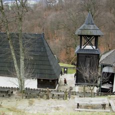
Church in Dobri Potok
9.2 km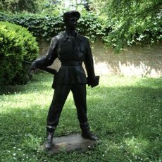
Stolice
8.9 km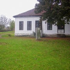
Ensemble mémoriel de Bela Crkva
7.5 km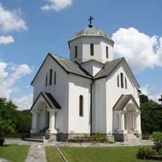
Crkva Sv. Georgija (Mojković)
5.9 km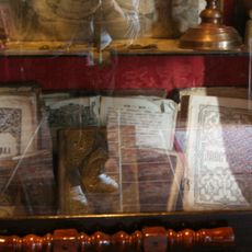
Library „Sv. Petka Paraskeva“ Krupanj
9.2 km
Novačevica Pećina
7 km
Prtolis
3.6 km
Kik
1.8 km
Cerovačka Glava
5.7 km
Matića Brdo
3.1 km
Culište
4.7 km
Razbojište
2.6 km
Miškovac
1 km
Majdan
3.3 km
Visoka Glavica
7.2 km
Visibaba
4.5 km
Rudine
5.6 km
Stolice
9 km
Miškovac
1.7 km
Golovo
6.4 km
Račevića Brdo
4 km
Kovačevića pećina
6.3 km
Споменик природе Стабло липе Бела црква
7.7 km
Меморијални природни споменик Драгинац
6.4 km
Чеда Милосављевић
7.5 km
Миша Пантић
7.5 km
Жикица Јовановић Шпанац
7.5 km
Симболика у камену
7.5 kmReviews
Visited this place? Tap the stars to rate it and share your experience / photos with the community! Try now! You can cancel it anytime.
Discover hidden gems everywhere you go!
From secret cafés to breathtaking viewpoints, skip the crowded tourist spots and find places that match your style. Our app makes it easy with voice search, smart filtering, route optimization, and insider tips from travelers worldwide. Download now for the complete mobile experience.

A unique approach to discovering new places❞
— Le Figaro
All the places worth exploring❞
— France Info
A tailor-made excursion in just a few clicks❞
— 20 Minutes