Chest opened
+${chestReward.xp} XP
Explorer
NOUVEAU ×${chestReward.collectible.quantity}
tapez pour fermer

See the monuments around you in AR Open chests in the app

Around Us is built for your phone — point your camera at the streets and discover the monuments and places around you in augmented reality. Around Us is built for your phone — chests unlock when you walk, explore and capture nearby places.

Enable Location

We need your location to show you interesting places around you

Discover nearby places

Find interesting locations and hidden gems around you

Precise directions

Get accurate directions and distances to places

Your location is never shared with other users. It's only used when you tap the location button.

Pik Aborigen

Log in to your account

Start exploring — it's free

Trusted by 81,053 travelers worldwide

Continue with Google
Continue with Apple
or

We will send you a code to connect

By continuing, you accept our Terms and Conditions and our Privacy Policy

Check your inbox

We've sent a pincode in your inbox. Please enter the code below.

Discussion Reviews 1 Photos
1.6k Popularity

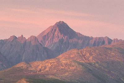
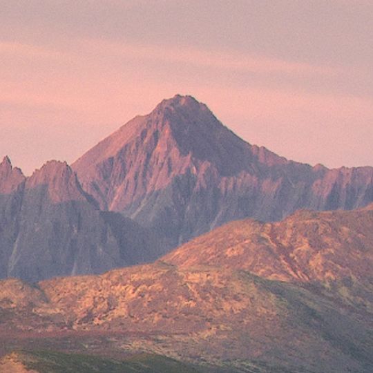
Pik Aborigen, Protected mountain summit in Magadan Oblast, Russia.

Pik Aborigen is a 2286-meter peak and the highest summit in the Anngatchak Mountains, which form part of the Chersky Range. The mountain sits roughly 50 kilometers south of Yagodnoye settlement in one of Russia's remote regions.

This mountain became part of Magadan Oblast when the region was established as a federal subject in 1953. The territory was then administered as part of the wider Soviet Far East development.

The mountain area has deep roots in the lives of indigenous Even, Koryak, and Chukchi peoples who have traveled and hunted these lands for generations. These groups continue to have cultural ties to the region and its landscape.

The remote location far from settlements means visitors need specialized equipment and proper permits to access this peak. Travelers should be prepared for conditions in harsh, untracked mountain terrain with little support infrastructure.

The slopes support roughly 65 species of vascular plants and provide habitat for bighorn sheep and wolf populations. These animal communities make this peak a significant location for observing subarctic wildlife.

The community of curious travelers

AroundUs brings together thousands of curated places, local tips, and hidden gems, enriched daily by 60,000 contributors worldwide.

Start exploring
Location
Elevation above the sea
2,286 m
GPS coordinates
61.98371,149.33088
Latest update
July 24, 2026 14:55
Around this place
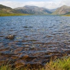
Jack London Lake
Russian Federation

Jack London Lake

14.9 km
Kolyma Reservoir
Russian Federation

Kolyma Reservoir

38.3 km
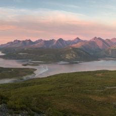
Angachak Range
Russian Federation

Angachak Range

1.8 km
Russian Federation

Мемориал "Серпантинная"

87.6 km
Russian Federation

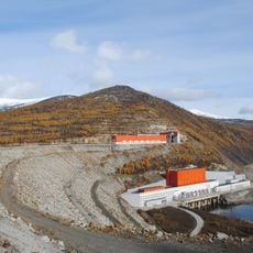
Синегорье колымская ГЭС

62.8 km
Russian Federation

Кости жертв Гулага

92 km
Russian Federation

Расстрельная зона "Свистопляс" - 1937

91.1 km
Russian Federation

Лагерь Сопка

73.8 km
Russian Federation

Нос Ил-18

107.6 km
Russian Federation

ИТЛ "Бутугычаг"

74 km
Russian Federation

Tatra-111

107.2 km
Russian Federation

Вид на Пилу

9.1 km
Russian Federation

Scenic viewpoint

15.3 km
Russian Federation

Scenic viewpoint

17.7 km
Russian Federation

Прииск имени Водопьянова

88.8 km
Russian Federation

Первостроителям Синегорья

63.6 km
Russian Federation

Бывший концлагерь ГУЛАГ "Туманный" по добыче золота

98.3 km
Russian Federation

В. В. Маяковскому

63.5 km
Russian Federation

Мемориал "Серпантинка"

87.8 km
Russian Federation

В. И. Ленину

62.2 km
Russian Federation

Мемориал Славы

62.3 km
Russian Federation

Геологам-первопроходцам

61.7 km
Russian Federation

Memorial

85 km
Russian Federation

Memorial

96 km
Russian Federation

Водопад Анманнычан

64.7 km
Russian Federation

Waterfall

92.1 km
Russian Federation

Waterfall

94.8 km
Russian Federation

Waterfall

96.1 km
Show the full map
Reviews
Share your experience

No review yet

Discussions
Start a discussion...

No discussion yet

« Pik Aborigen - Protected mountain summit in Magadan Oblast, Russia » is provided by Around Us (aroundus.com). Images and texts are derived from Wikimedia project under a Creative Commons license. You are allowed to copy, distribute, and modify copies of this page, under the conditions set by the license, as long as this note is clearly visible.

Discover hidden gems everywhere you go!

From secret cafés to breathtaking viewpoints, skip the crowded tourist spots and find places that match your style. Our app makes it easy with voice search, smart filtering, route optimization, and insider tips from travelers worldwide. Download now for the complete mobile experience.

Around Us App Screenshot

A unique approach to discovering new places

Le Figaro

All the places worth exploring

France Info

A tailor-made excursion in just a few clicks

20 Minutes

Around Us
Travel Guide & Maps
Download

Send to your phone

QR Code
1

Open the camera app on your mobile.

2

Point at the QR code with your camera. A notification will appear.

3

Tap the notification to open the link.