Chest opened
+${chestReward.xp} XP
Explorer
NOUVEAU ×${chestReward.collectible.quantity}
tapez pour fermer
Chest locked

Open chests in the app

Around Us is built for your phone — chests unlock when you walk, explore and capture nearby places.

Enable Location

We need your location to show you interesting places around you

Discover nearby places

Find interesting locations and hidden gems around you

Precise directions

Get accurate directions and distances to places

Your location is never shared with other users. It's only used when you tap the location button.

Log in to your account

Start exploring — it's free

Trusted by 72,891 travelers worldwide

Continue with Google
Continue with Apple
or

We will send you a code to connect

By continuing, you accept our Terms and Conditions and our Privacy Policy

Check your inbox

We've sent a pincode in your inbox. Please enter the code below.

Ob Plateau
Discussion Reviews Photo
3.7k Popularity

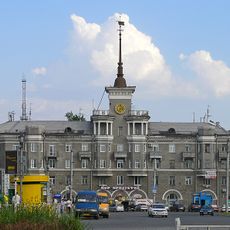
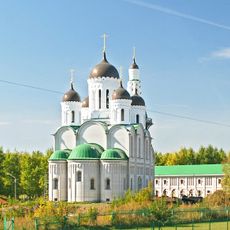
Ob Plateau, Plateau near Altai Mountains in Siberian Federal District, Russia.

The Ob Plateau is a vast elevated plain in the West Siberian Plain marked by deep glacial valleys running across it. Several major rivers including the Aley, Barnaulka, and Irtysch flow through the terrain, carving paths through the relatively flat landscape.

The area gained agricultural importance during the Soviet period when the Kulunda Canal was constructed to enable irrigation. This transformation increased grain production and shaped the region's development into modern times.

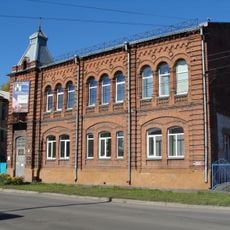
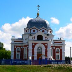
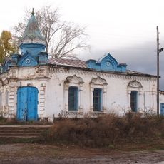
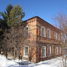
Indigenous Siberian peoples and later Slavic settlers both adapted to life here, each leaving marks on how the land is used and experienced today. You can sense these different layers when observing how communities relate to the rivers, forests, and open spaces.

The terrain is relatively easy to traverse, though the valleys and steep banks require some attention. Summer and early autumn are the best times to visit when paths are drier and temperatures more comfortable.

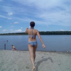
Salt lakes form within the glacial trenches, surrounded by birch forests and remnants of coniferous forest. These distinctive water bodies create a striking contrast to the otherwise open landscape and support specialized ecosystems.

The community of curious travelers

AroundUs brings together thousands of curated places, local tips, and hidden gems, enriched daily by 60,000 contributors worldwide.

Start exploring
GPS coordinates
53.50000,81.00000
Latest update
December 11, 2025 18:09
Around this place
House Under the Spire
Russian Federation

House Under the Spire

184.5 km
Barnaul Zoo
Russian Federation

Barnaul Zoo

178.7 km
Лава
Russian Federation

Лава

174 km
Altai Youth Theatre
Russian Federation

Altai Youth Theatre

184.5 km
Соборная мечеть (Барнаул)
Russian Federation

Соборная мечеть (Барнаул)

182.2 km
State Art Museum of Altai Krai
Russian Federation

State Art Museum of Altai Krai

184.3 km
Intercession Church, Zavyalovo
Russian Federation

Intercession Church, Zavyalovo

146.2 km
House of Culture of the Barnaul Melange Combine
Russian Federation

House of Culture of the Barnaul Melange Combine

184.5 km
Аквапарк
Russian Federation

Аквапарк

178.8 km
Іскра (залізничний роз'їзд, Черепановський район)
Russian Federation

Іскра (залізничний роз'їзд, Черепановський район)

175.1 km
Old Believers' Church of the Intercession
Russian Federation

Old Believers' Church of the Intercession

180.7 km
Kilty, Altai Krai
Russian Federation

Kilty, Altai Krai

159.7 km
Russian Federation

Родина

52.7 km
Novosovkhozny
Russian Federation

Novosovkhozny

171.7 km
Новоосиновский
Russian Federation

Новоосиновский

108.3 km
Merchantess Smirnova shop
Russian Federation

Merchantess Smirnova shop

114.7 km
Рямы
Russian Federation

Рямы

123.5 km
Здание представительства компании «Зингер» (Краснозёрское)
Russian Federation

Здание представительства компании «Зингер» (Краснозёрское)

127.3 km
Зимарі (селище)
Russian Federation

Зимарі (селище)

168 km
Mirny, Burlinsky District, Altai Krai
Russian Federation

Mirny, Burlinsky District, Altai Krai

183.8 km
Шиловський (Калманський район)
Russian Federation

Шиловський (Калманський район)

165.8 km
Дальній (Ребріхинський район)
Russian Federation

Дальній (Ребріхинський район)

111.1 km
Центральный
Russian Federation

Центральный

104.8 km
Паново (селище, Ребріхинський район)
Russian Federation

Паново (селище, Ребріхинський район)

93.1 km
Водная горка
Russian Federation

Водная горка

40.4 km
Podstepnovsky
Russian Federation

Podstepnovsky

82.9 km
Гоноховський
Russian Federation

Гоноховський

65.8 km
War memorial, Lushnikovo
Russian Federation

War memorial, Lushnikovo

174.9 km
Show the full map
Reviews
Share your experience

No review yet

Discussions
Start a discussion...

No discussion yet

« Ob Plateau - Plateau near Altai Mountains in Siberian Federal District, Russia » is provided by Around Us (aroundus.com). Images and texts are derived from Wikimedia project under a Creative Commons license. You are allowed to copy, distribute, and modify copies of this page, under the conditions set by the license, as long as this note is clearly visible.

Discover hidden gems everywhere you go!

From secret cafés to breathtaking viewpoints, skip the crowded tourist spots and find places that match your style. Our app makes it easy with voice search, smart filtering, route optimization, and insider tips from travelers worldwide. Download now for the complete mobile experience.

Around Us App Screenshot

A unique approach to discovering new places

Le Figaro

All the places worth exploring

France Info

A tailor-made excursion in just a few clicks

20 Minutes

Around Us
Travel Guide & Maps
Download

Send to your phone

QR Code
1

Open the camera app on your mobile.

2

Point at the QR code with your camera. A notification will appear.

3

Tap the notification to open the link.