
Golléré, commune of Senegal
Location: Podor Department
Elevation above the sea: 18 m
GPS coordinates: 16.25583,-14.10167
Latest update: March 15, 2025 10:40

Great Mosque of Touba
244.4 km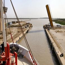
Diama Dam
247.3 km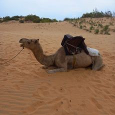
Lompoul desert
290.7 km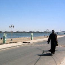
Faidherbe Bridge
257.8 km
Djoudj National Bird Sanctuary
230 km
Stade Olympique
287.2 km
Langue de Barbarie National Park
262.5 km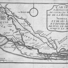
Biffeche
244 km
River Gambia National Park
305.6 km
Mosque Saudique
285.5 km
National Museum of Mauritania
284.9 km
Guembeul Natural Reserve
255.8 km
National Library of Mauritania
285 km
Island of Saint-Louis
256.7 km
Cercles de pierres de Wassu
296.3 km
Usine des eaux de Mbakhana
243 km
Mosque Marocaine
284.7 km
Deer Island (Gambia)
301 km
Ibn Abbas Mosque
285.1 km
Bird Island
296.9 km
Eisenbahnbrücke von Kidira
285.2 km
Cercles de pierres de Kerbatch
298.9 km
Straßenbrücke von Kidira
285.7 km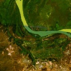
Isla Pangon
308.6 km
Isla Pasari
284.2 km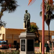
Statue of Louis Faidherbe in Saint-Louis
258.3 km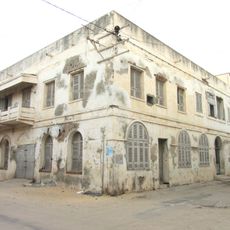
Ancien orphelinat des Sœurs de Saint-Joseph de Cluny, Saint-Louis
258.3 km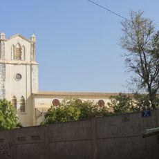
Eglise Notre-Dame-de-Lourdes, Saint-Louis
256.8 kmReviews
Visited this place? Tap the stars to rate it and share your experience / photos with the community! Try now! You can cancel it anytime.
Discover hidden gems everywhere you go!
From secret cafés to breathtaking viewpoints, skip the crowded tourist spots and find places that match your style. Our app makes it easy with voice search, smart filtering, route optimization, and insider tips from travelers worldwide. Download now for the complete mobile experience.

A unique approach to discovering new places❞
— Le Figaro
All the places worth exploring❞
— France Info
A tailor-made excursion in just a few clicks❞
— 20 Minutes