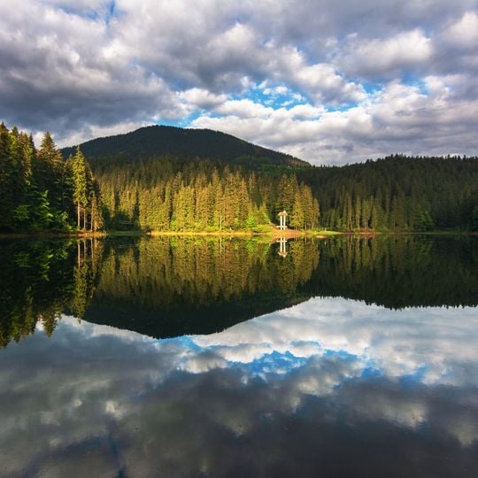
Synevyr, Mountain lake in Zakarpattia Oblast, Ukraine
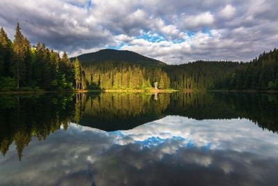
Synevyr is a landslide-dammed mountain lake in the Inner Gorgany massif of the Ukrainian Carpathians, Zakarpattia Oblast, at 989 m above sea level. Its water surface is 4.5–7.5 hectares, average depth 8–12 m and maximum 18–24 m. A tiny island a few metres across lies in the centre, giving the lake its popular name, Sea Eye. Steep slopes of 140–160-year-old spruce descend directly to the water.
The body of water formed around 10,000 years ago when an earthquake triggered tectonic shifts and altered the Carpathian terrain. The movements shaped a natural basin that filled with water over time and developed into today's lake landscape.
The name connects the tragic love story of a count's daughter called Syn with her beloved Vir, whose fate is reflected in the waters. Hikers encounter this narrative at several spots around the shore, where wooden sculptures and plaques remember the two.
The lake level is not stable: it rises during heavy rain and snowmelt and falls in winter and dry spells, varying by 4 to 4.5 metres. The surface area shifts between 4.5 and 7.5 hectares, and the maximum depth between 18 and 23.5 metres. Water drains through the porous natural dam and resurfaces 350 metres west of the lake, 60 metres below its average level.
The islet in the middle is only a few metres across, and it is this pupil-like speck that gave the lake its folk name, Sea Eye of the Carpathians. The lake's surface area shifts between roughly 4.5 and 7.5 hectares as the water level rises and falls by 4 to 4.5 metres.
The community of curious travelers
AroundUs brings together thousands of curated places, local tips, and hidden gems, enriched daily by 93,407 contributors worldwide.