Saint-Lunaire, Coastal commune in Ille-et-Vilaine, France
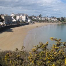
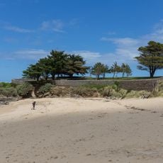
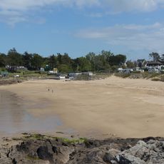
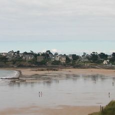
Saint-Lunaire is a coastal commune along France's northwestern shoreline featuring several beaches, with the Grand Plage being the most central one. The land rises gently to about 21 meters above sea level, creating a varied landscape within the settlement.
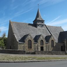
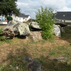
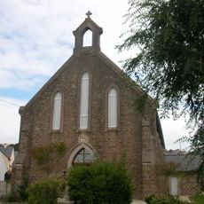
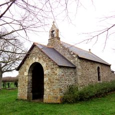
The settlement began as a Christian outpost when Saint Lunarius, son of King Hoël I, founded a chapel at the site of today's Old Church. This religious foundation shaped the area's development for centuries to come.
The Old Church shows layers of Romanesque and Gothic architecture built over time by different generations. Walking inside, you can see how the building grew and changed as the community's needs evolved.
The commune has multiple sports facilities, including a yacht club from 1948 offering regular sailing lessons during warmer months. Visitors can easily reach the various beaches and explore the coastline from these central locations.
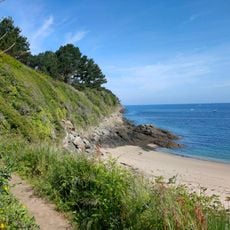
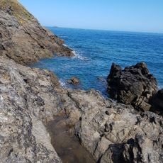
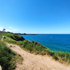
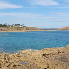
The Decolle peninsula nearby has many walking paths that link different viewpoints overlooking the Atlantic Ocean and nearby settlements. These routes reveal changing perspectives on the coastal landscape as you move along them.
Location: arrondissement of Saint-Malo
Location: Ille-et-Vilaine
Location: Communauté de communes Côte d’Émeraude
Elevation above the sea: 38 m
Shares border with: Dinard, Pleurtuit, Saint-Briac-sur-Mer
Address: Boulevard Flusson, 35800 Saint-Lunaire
Phone: +33299463051
Email: mairie@saint-lunaire.fr
Website: http://saint-lunaire.fr
GPS coordinates: 48.63444,-2.10889
Latest update: December 20, 2025 13:00
St-Lunaire
88 m
Grotte des Hirondelles
915 m
Calvaire de Saint-Lunaire
99 m
Allée couverte de Plate-Roche
624 m
Plage de la Fosse aux Vaults
1.1 km
Plage de la Roche Pelée
2.4 km
Grande plage de Saint-Lunaire
392 m
Plage du Nick
782 m
Église protestante évangélique de Saint-Lunaire
642 m
Plage de la Fourberie
1.7 km
Nouvelle église de Saint-Lunaire
91 m
Plage du Port-Blanc
2 km
Plage de Longchamp
948 m
Rochegoude tide mill
3.5 km
Chapelle de l'Épine
4.3 km
Chemin des Douaniers, La Rance - Erquy, tracé principal
1.5 kmPointe du Décollé
1.2 kmRocher Napoléon
992 mPlage des Hirondelles
936 mPlage naturiste
1.4 kmWayside cross
1.2 kmWayside cross
963 mWayside cross
1.5 kmWayside cross
615 mEsplanade Alphonse Ollivier
577 mCatholic church building, wayside cross, Christianity
1.9 kmChristianity, Catholic church building, wayside cross
4.6 kmChristianity, Catholic church building, wayside cross
3.5 kmVisited this place? Tap the stars to rate it and share your experience / photos with the community! Try now! You can cancel it anytime.
Discover hidden gems everywhere you go!
From secret cafés to breathtaking viewpoints, skip the crowded tourist spots and find places that match your style. Our app makes it easy with voice search, smart filtering, route optimization, and insider tips from travelers worldwide. Download now for the complete mobile experience.
A unique approach to discovering new places❞
— Le Figaro
All the places worth exploring❞
— France Info
A tailor-made excursion in just a few clicks❞
— 20 Minutes