Antonine Wall

Log in to your account

AroundUs is a community-driven map of interesting places, built by curious explorers like you. It grows with every review, story, and photo you share.
Connect to save your favorite spots, contribute locations, and create personalized routes.
Continue with Google
Continue with Apple
Continue with X
Continue with Facebook
Continue with email
By continuing, you accept our Terms and Conditions and our Privacy Policy
Create an account
Add to collection
Map
Suggest a change
Share

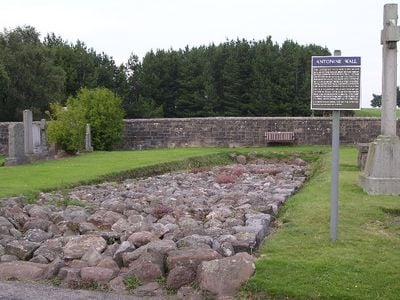
Antonine Wall, Roman defensive wall in Central Scotland.

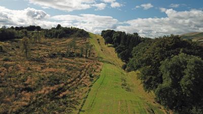
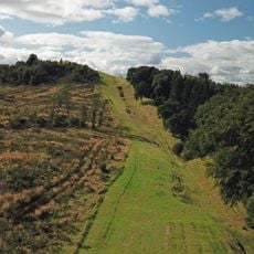
The Antonine Wall is a Roman defensive line between the estuaries of the Clyde and Forth rivers in central Scotland, running roughly 39 miles. The fortification consists of a turf rampart built on stone foundations, with forts and watchtowers placed at regular intervals.

Between 142 and 144, the fortification was built under Emperor Antoninus Pius by three Roman legions to push the northern frontier further into Caledonian territory. However, the Romans abandoned it after about twenty years and withdrew to Hadrian's Wall.

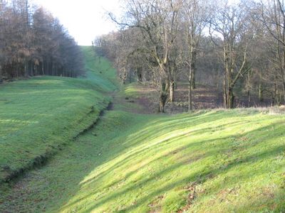
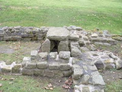
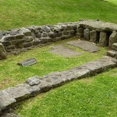
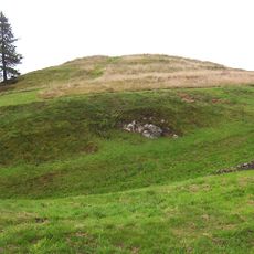
Soldiers from across the Roman Empire built forts and watchtowers along this fortified boundary, each unit bringing its own building methods and inscriptions. Today, foundations and earthworks at several sites show how the troops lived and used the terrain for their military purposes.

Well-preserved sections are found at Bar Hill Fort and Rough Castle, where remains of buildings and fortifications can be seen. The best time to visit is during dry weather, as the terrain can be muddy and slippery in some places.

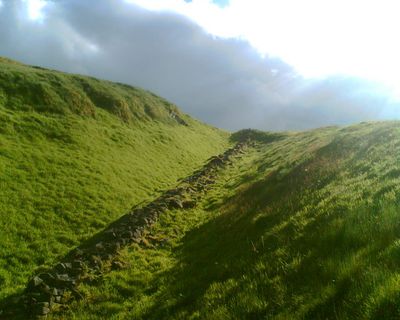
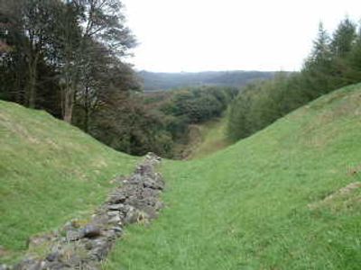
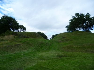
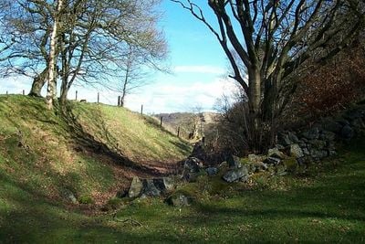
North of the turf rampart, legionaries dug a ditch about 40 feet wide and 12 feet deep, piling the excavated soil into a mound. This arrangement strengthened the defensive effect and made any approach more difficult.

Location: Scotland

Inception: 142

Part of: borders of the Roman Empire, Limes Britannicus

GPS coordinates: 55.96700,-4.06700

Latest update: December 12, 2025 20:20

Photos
Around this place
Bar Hill Roman fort
United Kingdom

Bar Hill Roman fort

957 m
Market Chambers, Kilsyth
United Kingdom

Market Chambers, Kilsyth

1.3 km
Kilsyth, Howe Street, Burial-ground
United Kingdom

Kilsyth, Howe Street, Burial-ground

712 m
48–50 Market Street, Kilsyth
United Kingdom

48–50 Market Street, Kilsyth

1.3 km
United Kingdom

Kilsyth, 30 Low Craigends, St Patrick's Roman Catholic Church

1.3 km
Kilsyth Parish Church
United Kingdom

Kilsyth Parish Church

1.1 km
Pump, Market Square, Kilsyth
United Kingdom

Pump, Market Square, Kilsyth

1.3 km
Garrel Mill
United Kingdom

Garrel Mill

1.8 km
Kilsyth, Garrel Mill House
United Kingdom

Kilsyth, Garrel Mill House

1.8 km
Bar Hill, Roman temporary camp SW of
United Kingdom

Bar Hill, Roman temporary camp SW of

1.1 km
United Kingdom

Kilsyth, 8 - 9 Market Square

1.3 km
Antonine Wall, Bar Hill, rampart, ditch, fort and Military Way
United Kingdom

Antonine Wall, Bar Hill, rampart, ditch, fort and Military Way

916 m
Castle Hill
United Kingdom

Castle Hill

738 m
United Kingdom

Kilsyth, 55-63 Main Street

1.3 km
United Kingdom

Kilsyth, 6 - 7 Market Square

1.3 km
United Kingdom

Antonine Wall, B802 to N of Cuilmuir View, Croy

1.4 km
United Kingdom

Antonine Wall, Girnal Hill to B802 road, Croy

1.2 km
United Kingdom

Antonine Wall, Twechar Main Street to Bar Hill

1.1 km
United Kingdom

Antonine Wall, E edge of Strone Plantation to Girnal Hill

841 m
United Kingdom

55–63 Main Street, Kilsyth

1.3 km
United Kingdom

Balcastle Farm, motte 250m SSW of

1.7 km
United Kingdom

Bar Hill (Samian Ware Discovery Site)

931 m
United Kingdom

Croy Hill (Samian Ware Discovery Site)

1.5 km
United Kingdom

Kilsyth, Burngreen Park, Bandstand

1.4 km
United Kingdom

Brownville, Balmalloch Road, Kilsyth

1.2 km
United Kingdom

36–42 Main Street, Kilsyth

1.3 km
United Kingdom

Scenic viewpoint

1.1 km
United Kingdom

Scenic viewpoint

734 m
Show the full map
Reviews

Visited this place? Tap the stars to rate it and share your experience / photos with the community! Try now! You can cancel it anytime.

« Antonine Wall - Roman defensive wall in Central Scotland » is provided by Around Us (aroundus.com). Images and texts are derived from Wikimedia project under a Creative Commons license. You are allowed to copy, distribute, and modify copies of this page, under the conditions set by the license, as long as this note is clearly visible.

Discover hidden gems everywhere you go!

From secret cafés to breathtaking viewpoints, skip the crowded tourist spots and find places that match your style. Our app makes it easy with voice search, smart filtering, route optimization, and insider tips from travelers worldwide. Download now for the complete mobile experience.

Around Us App Screenshot

A unique approach to discovering new places

Le Figaro

All the places worth exploring

France Info

A tailor-made excursion in just a few clicks

20 Minutes