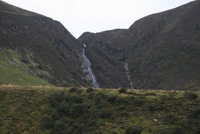
Pistyll y Llyn, Waterfall in Ceredigion and Powys, United Kingdom
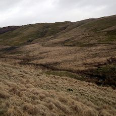
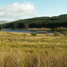
Pistyll y Llyn is a waterfall straddling the border between Ceredigion and Powys, fed by water from Llyn Penrhaeadr that pours into a steep-sided valley. The water tumbles in a series of cascades down a densely vegetated ravine before joining the River Llyfnant below.
In medieval times, this waterfall marked the boundary between the Welsh counties of Montgomeryshire and Cardiganshire. The natural water formation served as a territorial dividing line between these historic administrative regions.
The name joins Welsh words "pistyll" (waterfall) and "llyn" (lake), showing how the Welsh language shapes the geography here. Local walkers have long used this spot as a waypoint on their routes through the valley.
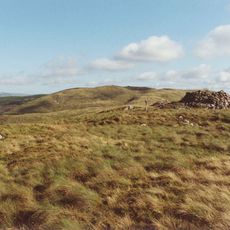
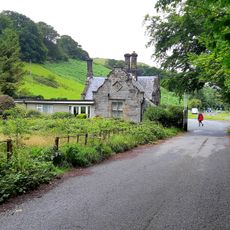
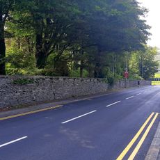
You can reach the waterfall by walking a permissive path from Cwm Rhaeadr down to its base. A separate trail leads upward to the top, giving you options depending on how much time and energy you have.
A weir at the water source controls the flow, meaning the spectacle changes with the seasons. You might see a roaring torrent one visit and a gentle trickle another, depending on when you arrive.
Location: Ysgubor-y-coed
Location: Cadfarch
GPS coordinates: 52.53137,-3.83842
Latest update: December 10, 2025 20:05
Plas Machynlleth
6.4 km
Glandyfi Castle
6.5 km
Mwyngloddfa Brynyrafr
6.4 km
Mwyngloddfa Nant-y-cagl
5.3 km
Llyn Conach
1.7 km
Commins Pant-glas
4.3 km
Drosgol
6.4 km
Cefn yr Esgair
5.5 km
Esgair Foel-ddu
4.9 km
Pennal Independent Chapel
3.8 km
Aberhosan Independent Chapel
6.4 km
Former Smithy to Plas Machynlleth, Heol Pentrehedyn
6.5 km
Pemprys
3.8 km
Machynlleth Community
6.6 km
No.19 Heol Pentrehedyn
6.6 km
Pedestal and Bust of Marchioness of Londonderry In The Gardens of Plas Machynlleth,Plas Drive
6.4 km
Gates and Gatepiers at The Sw Entry to Plas Machynlleth Park
6.3 km
Norbury Lodge,Plas Drive
6.5 km
Fountain In The Gardens of Plas Machynlleth Plas Drive
6.4 km
Former Coach House and Stables to Plas Machynlleth (Plas Kennels) Heol Pentrehedyn
6.4 km
Deildy (Also Known as West Lodge) Heol Pentrehedyn, A476 (E Side)
6.3 km
Two Sections of Boundary Wall to Plas Machynlleth from The Former Coach House and Stables Down to Th
6.4 km
Section of Rubble Wall Bordering The Outer Entrance Courtyard Between The Former Coach House and Sta
6.4 km
Section of Boundary Wall at Plas Machynlleth from & Including The Main Entrance Up to The Former Coa
6.4 km
No.17 Heol Pentrehedyn (Eaton House)
6.6 km
No.15 Heol Pentrehedyn
6.6 km
Soar Welsh Independent Chapel
3 km
Llyn Plas-y-mynydd
2.2 kmVisited this place? Tap the stars to rate it and share your experience / photos with the community! Try now! You can cancel it anytime.
Discover hidden gems everywhere you go!
From secret cafés to breathtaking viewpoints, skip the crowded tourist spots and find places that match your style. Our app makes it easy with voice search, smart filtering, route optimization, and insider tips from travelers worldwide. Download now for the complete mobile experience.
A unique approach to discovering new places❞
— Le Figaro
All the places worth exploring❞
— France Info
A tailor-made excursion in just a few clicks❞
— 20 Minutes