Enable Location

We need your location to show you interesting places around you

Discover nearby places

Find interesting locations and hidden gems around you

Precise directions

Get accurate directions and distances to places

Your location is never shared with other users. It's only used when you tap the location button.

Stane Street

Log in to your account

Start exploring — it's free

Trusted by 62,182 travelers worldwide

Continue with Google
Continue with Apple
or

We will send you a code to connect

By continuing, you accept our Terms and Conditions and our Privacy Policy

Check your inbox

We've sent a pincode in your inbox. Please enter the code below.

Stane Street, Roman road in Mole Valley, England

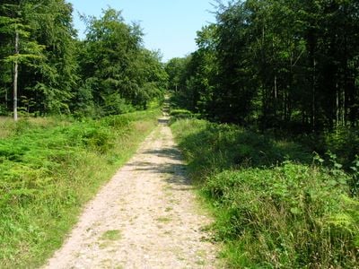
Stane Street is a Roman road in Mole Valley, England, running from the bridge in London to Chichester on the southern coast. The route follows the contours of the land to avoid climbing sharply through the hills between the two settlements.

The route was built around the year 70, when Roman forces occupied Britain and needed better connections between settlements. Construction linked the capital with coastal areas to the south, supporting both military operations and commerce.

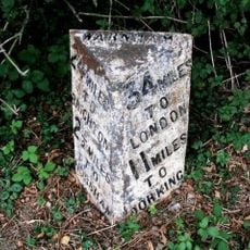
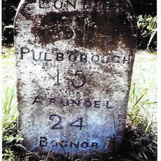
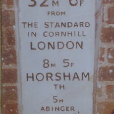
The name Stane Street first appeared in medieval documents from 1270, derived from the Old English word 'stan' meaning stone, distinguishing it from unpaved paths.

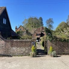
Several sections remain visible today and are protected by law, while others have been absorbed into modern roads. Some stretches can be walked on foot, while others are only noticeable from a car as you drive along the modern route.

Stations at Alfoldean and Hardham provided rest and fresh horses for travelers moving between the two ends of the route. These stops offered shelter and food for messengers and traders crossing the distance in stages rather than all at once.

The community of curious travelers

AroundUs brings together thousands of curated places, local tips, and hidden gems, enriched daily by 60,000 contributors worldwide.

Start exploring
Location
Location
GPS coordinates
51.11360,-0.38538
Latest update
December 5, 2025 22:30
« Stane Street - Roman road in Mole Valley, England » is provided by Around Us (aroundus.com). Images and texts are derived from Wikimedia project under a Creative Commons license. You are allowed to copy, distribute, and modify copies of this page, under the conditions set by the license, as long as this note is clearly visible.

Discover hidden gems everywhere you go!

From secret cafés to breathtaking viewpoints, skip the crowded tourist spots and find places that match your style. Our app makes it easy with voice search, smart filtering, route optimization, and insider tips from travelers worldwide. Download now for the complete mobile experience.

Around Us App Screenshot

A unique approach to discovering new places

Le Figaro

All the places worth exploring

France Info

A tailor-made excursion in just a few clicks

20 Minutes

Around Us
Travel Guide & Maps
Download

Send to your phone

QR Code
1

Open the camera app on your mobile.

2

Point at the QR code with your camera. A notification will appear.

3

Tap the notification to open the link.