Chest opened
+${chestReward.xp} XP
Explorer
NOUVEAU ×${chestReward.collectible.quantity}
tapez pour fermer
Chest locked

Open chests in the app

Around Us is built for your phone — chests unlock when you walk, explore and capture nearby places.

Enable Location

We need your location to show you interesting places around you

Discover nearby places

Find interesting locations and hidden gems around you

Precise directions

Get accurate directions and distances to places

Your location is never shared with other users. It's only used when you tap the location button.

M27 motorway

Log in to your account

Start exploring — it's free

Trusted by 72,933 travelers worldwide

Continue with Google
Continue with Apple
or

We will send you a code to connect

By continuing, you accept our Terms and Conditions and our Privacy Policy

Check your inbox

We've sent a pincode in your inbox. Please enter the code below.

M27 motorway
Discussion Reviews 2 Photos
23.6k Popularity

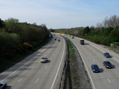
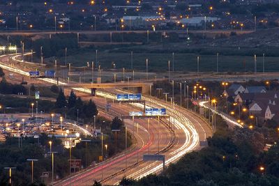
M27 motorway, motorway in Hampshire, England

The M27 is a motorway in Hampshire connecting Southampton and Portsmouth. The route spans approximately 27 miles (43 kilometers) and serves as a vital north-south link in the region with multiple junctions providing access to local roads and surrounding areas.

The M27 opened in the 1970s to handle growing traffic demand between the two major ports on the south coast. It has since become the primary route for commercial and commuter traffic between Southampton and Portsmouth.

The motorway is equipped with modern traffic management systems and delays can occur during peak hours, particularly at junctions serving the ports. Drivers should be aware of frequently changing traffic patterns and allow extra time for journeys when needed.

The community of curious travelers

AroundUs brings together thousands of curated places, local tips, and hidden gems, enriched daily by 60,000 contributors worldwide.

Start exploring
Location
Inception
1972
GPS coordinates
50.91820,-1.59300
Latest update
December 20, 2025 14:04
Around this place
Paultons Park
United Kingdom

Paultons Park

4.5 km
Rufus Stone
United Kingdom

Rufus Stone

1.8 km
Christ Church
United Kingdom

Christ Church

4.9 km
Minstead Lodge
United Kingdom

Minstead Lodge

2 km
Peppa Pig's House
United Kingdom

Peppa Pig's House

4.7 km
Church of St Matthew
United Kingdom

Church of St Matthew

4.5 km
Church of All Saints
United Kingdom

Church of All Saints

2.5 km
Sir John Barleycorn Inn
United Kingdom

Sir John Barleycorn Inn

534 m
Church of St Mary
United Kingdom

Church of St Mary

2.4 km
Church of Our Lady and St Edward
United Kingdom

Church of Our Lady and St Edward

5.1 km
Church of St Peter
United Kingdom

Church of St Peter

4 km
Green Dragon Inn
United Kingdom

Green Dragon Inn

1.6 km
The Swan Inn
United Kingdom

The Swan Inn

5.2 km
Malwood Castle hillfort
United Kingdom

Malwood Castle hillfort

1.5 km
Morrisons
United Kingdom

Morrisons

5 km
Netley Marsh War Memorial
United Kingdom

Netley Marsh War Memorial

4.5 km
Milestone 250 Metres North Of The Kennels, On Opposite Side Of Road
United Kingdom

Milestone 250 Metres North Of The Kennels, On Opposite Side Of Road

3 km
Bowl barrow 645m north of Longcross Pond forming part of Black Bush Plain round barrow cemetery
United Kingdom

Bowl barrow 645m north of Longcross Pond forming part of Black Bush Plain round barrow cemetery

4.7 km
Milestone, Bartley, by 'Brentor' , Southampton Road
United Kingdom

Milestone, Bartley, by 'Brentor' , Southampton Road

2.1 km
Milestone, Whitemoor Road
United Kingdom

Milestone, Whitemoor Road

4.4 km
Milestone, Parsonage Farm, St Peters Branshaw; 75 metres S of the church.
United Kingdom

Milestone, Parsonage Farm, St Peters Branshaw; 75 metres S of the church.

4 km
Milestone, Bunker's Hill
United Kingdom

Milestone, Bunker's Hill

2.8 km
Milestone, Court Farm
United Kingdom

Milestone, Court Farm

2.5 km
Milestone, Lodgehill Cottage; 100m NE of cattle grid on S of road and Lodgehill cottage on N of road
United Kingdom

Milestone, Lodgehill Cottage; 100m NE of cattle grid on S of road and Lodgehill cottage on N of road

5.1 km
Milestone, Salisbury Road; Ower; opp. bungalow "Oaklands"
United Kingdom

Milestone, Salisbury Road; Ower; opp. bungalow "Oaklands"

4.8 km
Milestone, Birchenwood Farm
United Kingdom

Milestone, Birchenwood Farm

1.3 km
Milestone, Stoney Cross; 50m W of junction of A31 with New Town Road
United Kingdom

Milestone, Stoney Cross; 50m W of junction of A31 with New Town Road

3.5 km
Milestone, Malwood; 50m W access road on to A31
United Kingdom

Milestone, Malwood; 50m W access road on to A31

2 km
Show the full map
Reviews
Share your experience

No review yet

Discussions
Start a discussion...

No discussion yet

« M27 motorway - motorway in Hampshire, England » is provided by Around Us (aroundus.com). Images and texts are derived from Wikimedia project under a Creative Commons license. You are allowed to copy, distribute, and modify copies of this page, under the conditions set by the license, as long as this note is clearly visible.

Discover hidden gems everywhere you go!

From secret cafés to breathtaking viewpoints, skip the crowded tourist spots and find places that match your style. Our app makes it easy with voice search, smart filtering, route optimization, and insider tips from travelers worldwide. Download now for the complete mobile experience.

Around Us App Screenshot

A unique approach to discovering new places

Le Figaro

All the places worth exploring

France Info

A tailor-made excursion in just a few clicks

20 Minutes

Around Us
Travel Guide & Maps
Download

Send to your phone

QR Code
1

Open the camera app on your mobile.

2

Point at the QR code with your camera. A notification will appear.

3

Tap the notification to open the link.