Enable Location

We need your location to show you interesting places around you

Discover nearby places

Find interesting locations and hidden gems around you

Precise directions

Get accurate directions and distances to places

Your location is never shared with other users. It's only used when you tap the location button.

Westhoughton

Log in to your account

Start exploring — it's free

Trusted by 62,892 travelers worldwide

Continue with Google
Continue with Apple
or

We will send you a code to connect

By continuing, you accept our Terms and Conditions and our Privacy Policy

Check your inbox

We've sent a pincode in your inbox. Please enter the code below.

Discussion Reviews 1 Photos
28.1k Popularity

Westhoughton, Civil parish and town in Bolton, England

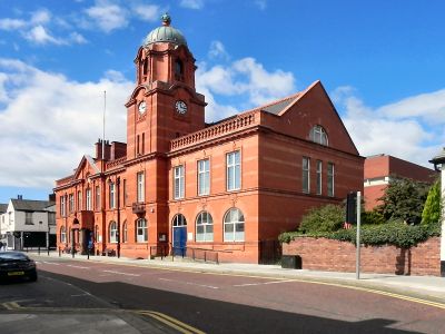
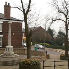
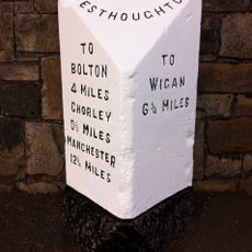
Westhoughton is a town and civil parish in Bolton that grew from several former villages including Wingates, White Horse, Over Hulton, Four Gates, Chequerbent, and Hunger Hill. The area sits between Manchester and Wigan, and you can still see how these separate settlements shaped the way the place is organized.

In 1910, the Pretoria Pit disaster killed 344 miners in a single event that shook British mining history. A century earlier, in 1812, Luddite workers burned down a mill in response to factory conditions, leading to executions and deportations.

The name comes from Old English, referring to the western location of an older settlement in the area. People who live here today can still see the separate village character in different neighborhoods and local landmarks.

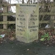
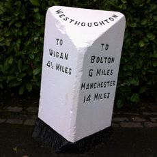
The town connects to major routes through the M61 motorway at junctions 5 and 6, making road travel straightforward. Train services from Westhoughton station link you to Manchester and Wigan Wallgate on a regular basis.

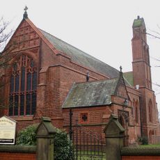
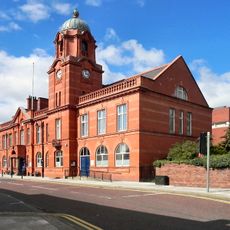
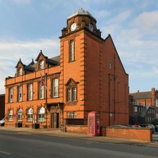
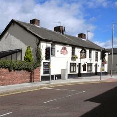
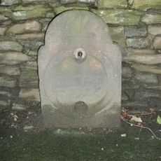
Westhoughton was a hub for textile and coal production during the Industrial Revolution, with factories and mining operations shaping the look and rhythm of the place. You can still see traces of this industrial past in the landscape and in place names that recall this working history.

The community of curious travelers

AroundUs brings together thousands of curated places, local tips, and hidden gems, enriched daily by 60,000 contributors worldwide.

Start exploring
Location
Shares border with
Horwich
GPS coordinates
53.54800,-2.52900
Latest update
December 20, 2025 12:56
Around this place
St John the Baptist's Church, Atherton
United Kingdom

St John the Baptist's Church, Atherton

3.7 km
United Kingdom

Rumworth Lodge Reservoir

3.5 km
St James' Church, Daisy Hill
United Kingdom

St James' Church, Daisy Hill

1.7 km
Westhoughton Town Hall
United Kingdom

Westhoughton Town Hall

569 m
United Kingdom

Gidlow Hall

2.8 km
Atherton Town Hall
United Kingdom

Atherton Town Hall

3.7 km
Church of St. John the Evangelist
United Kingdom

Church of St. John the Evangelist

1.5 km
Tower of Church of St Bartholomew
United Kingdom

Tower of Church of St Bartholomew

230 m
Westhoughton War Memorial Including Steps And Rear Wall.
United Kingdom

Westhoughton War Memorial Including Steps And Rear Wall.

237 m
White Lion Public House
United Kingdom

White Lion Public House

605 m
United Kingdom

Hindley House

3.2 km
United Kingdom

Southworth House

3.1 km
Milestone, Chequerbent
United Kingdom

Milestone, Chequerbent

2.3 km
United Kingdom

Barn To North West Of Higher Barn Farmhouse

2.5 km
United Kingdom

Higher Barn Farmhouse

2.5 km
Milestone, Dobb Brow, opp No. 273
United Kingdom

Milestone, Dobb Brow, opp No. 273

626 m
Milestone, Chorley New Road, 70m E jnct with Whinslee Drive
United Kingdom

Milestone, Chorley New Road, 70m E jnct with Whinslee Drive

4.1 km
Milestone, Bolton Road, opp. No. 234 , 140m from the jct with the A6 Manchester Road
United Kingdom

Milestone, Bolton Road, opp. No. 234 , 140m from the jct with the A6 Manchester Road

1.3 km
United Kingdom

Obelisk Adjacent To South-East Corner Of Church Of St. John The Baptist

3.7 km
United Kingdom

Georgian House Hotel

3.8 km
United Kingdom

Sundial Approx 17M To South Of Church Of St Bartholomew

217 m
United Kingdom

Collier Brook Farmhouse

3.1 km
United Kingdom

Collier Brook Bolt House

3.2 km
United Kingdom

Barn To South West Of Gidlow Hall

2.9 km
United Kingdom

Gidlow Hall

2.8 km
United Kingdom

Westhoughton Golf Club

775 m
United Kingdom

Regent Park Golf Course

3.3 km
United Kingdom

Hart Common Golf Club

1.7 km
Show the full map
« Westhoughton - Civil parish and town in Bolton, England » is provided by Around Us (aroundus.com). Images and texts are derived from Wikimedia project under a Creative Commons license. You are allowed to copy, distribute, and modify copies of this page, under the conditions set by the license, as long as this note is clearly visible.

Discover hidden gems everywhere you go!

From secret cafés to breathtaking viewpoints, skip the crowded tourist spots and find places that match your style. Our app makes it easy with voice search, smart filtering, route optimization, and insider tips from travelers worldwide. Download now for the complete mobile experience.

Around Us App Screenshot

A unique approach to discovering new places

Le Figaro

All the places worth exploring

France Info

A tailor-made excursion in just a few clicks

20 Minutes

Around Us
Travel Guide & Maps
Download

Send to your phone

QR Code
1

Open the camera app on your mobile.

2

Point at the QR code with your camera. A notification will appear.

3

Tap the notification to open the link.