Enable Location

We need your location to show you interesting places around you

Discover nearby places

Find interesting locations and hidden gems around you

Precise directions

Get accurate directions and distances to places

Your location is never shared with other users. It's only used when you tap the location button.

Fairford

Log in to your account

Start exploring — it's free

Trusted by 68,113 travelers worldwide

Continue with Google
Continue with Apple
or

We will send you a code to connect

By continuing, you accept our Terms and Conditions and our Privacy Policy

Check your inbox

We've sent a pincode in your inbox. Please enter the code below.

Discussion Reviews 1 Photos
17.8k Popularity

Fairford, Administrative town in Cotswold District, England

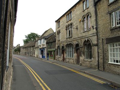
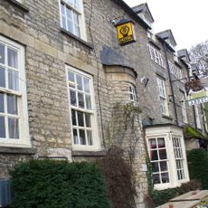
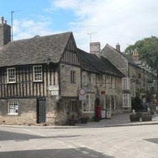
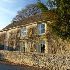
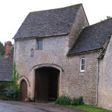
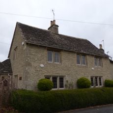
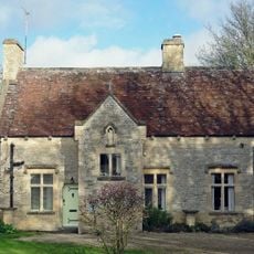
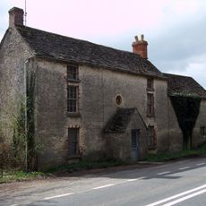
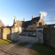
Fairford is a town in the Cotswold District that spreads along the River Coln, made up of stone buildings from the 17th and 18th centuries. These structures line the main street and shape how this Gloucestershire settlement looks today.

In the 12th century, the town received a royal market charter and became a major coaching stop between London and Gloucester. This position made it an important crossroads during medieval times.

St Mary's Church holds England's only complete set of 28 medieval stained glass windows, each showing detailed biblical stories in colored glass. These windows are the centerpiece of the place and draw visitors who want to see religious art from the Middle Ages.

The town center has a weekly market every Wednesday, where locals and visitors find local products and fresh goods. It is a good day to see the active market and experience how the community gathers here.

RAF Fairford is home to the Royal International Air Tattoo in July, the world's largest military aviation display. This yearly event brings aircraft fans and spectators from around the globe.

The community of curious travelers

AroundUs brings together thousands of curated places, local tips, and hidden gems, enriched daily by 60,000 contributors worldwide.

Start exploring
GPS coordinates
51.71077,-1.78200
Latest update
December 7, 2025 19:23
Around this place
St Mary's Church
United Kingdom

St Mary's Church

186 m
Fairford Park
United Kingdom

Fairford Park

232 m
Church of St Anne
United Kingdom

Church of St Anne

3 km
Church of St Swithin
United Kingdom

Church of St Swithin

2.6 km
Roman Catholic Church of St Thomas of Canterbury
United Kingdom

Roman Catholic Church of St Thomas of Canterbury

867 m
The Bull Hotel
United Kingdom

The Bull Hotel

323 m
Stone stile and attached wall about 5 1/2 metres long, adjoining on east of wall of Quenington House
United Kingdom

Stone stile and attached wall about 5 1/2 metres long, adjoining on east of wall of Quenington House

2.9 km
The Old Rectory
United Kingdom

The Old Rectory

2.6 km
The Chanting House
United Kingdom

The Chanting House

348 m
King and Randall Monuments, about 6 metres south west of south door in churchyard of Church of St Swithin
United Kingdom

King and Randall Monuments, about 6 metres south west of south door in churchyard of Church of St Swithin

2.6 km
Barn at Court Farm
United Kingdom

Barn at Court Farm

2.6 km
The Little House
United Kingdom

The Little House

2.7 km
Quenington House
United Kingdom

Quenington House

2.9 km
Barn at Mawley House Cottage
United Kingdom

Barn at Mawley House Cottage

2.8 km
Mawley Farm House
United Kingdom

Mawley Farm House

2.7 km
Knights Hospitallers Gateway at Knights Gate
United Kingdom

Knights Hospitallers Gateway at Knights Gate

2.6 km
8, The Green
United Kingdom

8, The Green

3 km
Bee Furlong Barn and shelter sheds
United Kingdom

Bee Furlong Barn and shelter sheds

3.3 km
Presbytery Of Church Of St Thomas Of Canterbury
United Kingdom

Presbytery Of Church Of St Thomas Of Canterbury

870 m
Three Magpies
United Kingdom

Three Magpies

2.7 km
The Long House
United Kingdom

The Long House

2.7 km
Milestone, near rt-angle bend in hedge 187 yds W of turning to Marston Hill.
United Kingdom

Milestone, near rt-angle bend in hedge 187 yds W of turning to Marston Hill.

2.2 km
Milestone, Village Green
United Kingdom

Milestone, Village Green

3 km
Milestone, Netherton
United Kingdom

Milestone, Netherton

3 km
Milestone, Fowler's Hill, by cemetery
United Kingdom

Milestone, Fowler's Hill, by cemetery

3.3 km
Milestone, NE Donkeywell Buildings
United Kingdom

Milestone, NE Donkeywell Buildings

3.2 km
Milestone, E of garage, E of Whelford turning.
United Kingdom

Milestone, E of garage, E of Whelford turning.

2.4 km
Milestone, E of entrance to football ground.
United Kingdom

Milestone, E of entrance to football ground.

882 m
Show the full map
Reviews
Share your experience

No review yet

Discussions
Start a discussion...

No discussion yet

« Fairford - Administrative town in Cotswold District, England » is provided by Around Us (aroundus.com). Images and texts are derived from Wikimedia project under a Creative Commons license. You are allowed to copy, distribute, and modify copies of this page, under the conditions set by the license, as long as this note is clearly visible.

Discover hidden gems everywhere you go!

From secret cafés to breathtaking viewpoints, skip the crowded tourist spots and find places that match your style. Our app makes it easy with voice search, smart filtering, route optimization, and insider tips from travelers worldwide. Download now for the complete mobile experience.

Around Us App Screenshot

A unique approach to discovering new places

Le Figaro

All the places worth exploring

France Info

A tailor-made excursion in just a few clicks

20 Minutes

Around Us
Travel Guide & Maps
Download

Send to your phone

QR Code
1

Open the camera app on your mobile.

2

Point at the QR code with your camera. A notification will appear.

3

Tap the notification to open the link.