Wake Island, Coral atoll in Pacific Ocean, United States
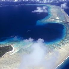
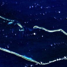
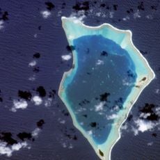
Wake Island is an atoll formed by three connected islets that surround a central lagoon in the North Pacific. The narrow strips of land rise only a few meters above sea level and form a horseshoe shape with sandy shores and sparse vegetation consisting of shrubs and grasses.
A Spanish explorer documented the existence of this atoll in the 16th century, before British sailors gave it a new name two centuries later. During World War II the territory became the site of fierce fighting between American and Japanese forces in the Pacific theater.
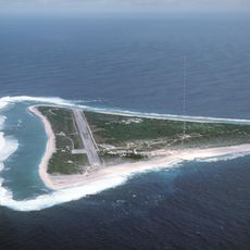
The territory functions solely as a military installation with no permanent civilian population, so traditional community life is absent. The small number of stationed personnel live in a functional environment centered on airfield operations and maintenance work, with no public gatherings or local customs visible to visitors.
Access to the atoll is strictly limited to authorized military and contract personnel, as it operates as an active Air Force facility. Visitors need official clearance in advance and can only enter the installation during approved missions or emergency landings.
The atoll sits west of the International Date Line, so a new calendar day begins here while the previous day still exists on the American mainland. This time shift means personnel stationed here technically experience New Year or other holidays before their families back in the United States.
The community of curious travelers
AroundUs brings together thousands of curated places, local tips, and hidden gems, enriched daily by 60,000 contributors worldwide.