Enable Location

We need your location to show you interesting places around you

Discover nearby places

Find interesting locations and hidden gems around you

Precise directions

Get accurate directions and distances to places

Your location is never shared with other users. It's only used when you tap the location button.

Cumberland County

Log in to your account

Start exploring — it's free

Trusted by 62,994 travelers worldwide

Continue with Google
Continue with Apple
or

We will send you a code to connect

By continuing, you accept our Terms and Conditions and our Privacy Policy

Check your inbox

We've sent a pincode in your inbox. Please enter the code below.

Discussion Reviews 1 Photos
12.4k Popularity

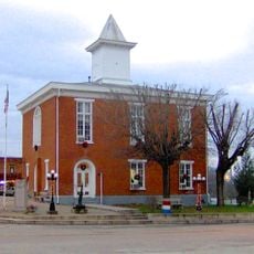
Cumberland County, Administrative division in North Carolina, United States.

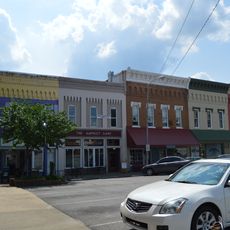
Cumberland County is an administrative division in North Carolina shaped by the Cape Fear River, with Fayetteville as its county seat and commercial hub. The area is home to several colleges, including Fayetteville State University, Methodist University, and Fayetteville Technical Community College, which support education and workforce development.

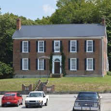
The county was established in 1754, carved from Bladen County, and named after Prince William Augustus, Duke of Cumberland, a British military figure of the era. This naming reflected the colonial ties and political influences of the time.

The Cumberland County Public Library and its eight branches serve as gathering places where residents connect with local history and their family roots. These spaces reflect how the community values remembering and sharing stories from the past.

Getting around this county is best done by car, as attractions and towns are spread across the landscape with distances between them. Plan to spend several days exploring different areas, since there is much to see across the region.

The arts and cultural sector generates significant economic activity that often goes unnoticed compared to larger employers in the region. This creative community supports both artists and the broader local economy in ways many visitors overlook.

The community of curious travelers

AroundUs brings together thousands of curated places, local tips, and hidden gems, enriched daily by 60,000 contributors worldwide.

Start exploring
GPS coordinates
36.79346,-85.37951
Latest update
December 7, 2025 20:45
Around this place
Dale Hollow Reservoir
United States of America

Dale Hollow Reservoir

29.3 km
Standing Stone State Park
United States of America

Standing Stone State Park

36 km
Lake Cumberland State Resort Park
United States of America

Lake Cumberland State Resort Park

31 km
Creelsboro Natural Bridge
United States of America

Creelsboro Natural Bridge

16.3 km
Cordell Hull Birthplace State Park
United States of America

Cordell Hull Birthplace State Park

29.4 km
Old Mulkey Meetinghouse State Historic Site
United States of America

Old Mulkey Meetinghouse State Historic Site

32 km
Pickett County Courthouse
United States of America

Pickett County Courthouse

33.5 km
Metcalfe County Jail
United States of America

Metcalfe County Jail

29.3 km
Judge Killis Huddleston House
United States of America

Judge Killis Huddleston House

22.6 km
Adair County Courthouse
United States of America

Adair County Courthouse

35 km
Mount Vernon AME Church
United States of America

Mount Vernon AME Church

39.7 km
Dr. Nathan Gaither House
United States of America

Dr. Nathan Gaither House

35.2 km
Bell House
United States of America

Bell House

25.8 km
Marrowbone Historic District
United States of America

Marrowbone Historic District

11.7 km
Jesse Noland House
United States of America

Jesse Noland House

29.9 km
Daniel Trabue House
United States of America

Daniel Trabue House

34.9 km
United States of America

Stockton-Ray House

33.1 km
Clay County Courthouse
United States of America

Clay County Courthouse

29.3 km
James Baker House
United States of America

James Baker House

7.3 km
Metcalfe County Kentucky Courthouse
United States of America

Metcalfe County Kentucky Courthouse

29.2 km
Columbia Commercial Historic District
United States of America

Columbia Commercial Historic District

35.1 km
John Field House
United States of America

John Field House

34.9 km
Coe House
United States of America

Coe House

1.2 km
Zion Meetinghouse and School
United States of America

Zion Meetinghouse and School

30.5 km
Old Mulkey Meetinghouse
United States of America

Old Mulkey Meetinghouse

32 km
Standing Stone Rustic Park Historic District
United States of America

Standing Stone Rustic Park Historic District

36.1 km
Cumberland County Courthouse
United States of America

Cumberland County Courthouse

877 m
Lake Cumberland
United States of America

Lake Cumberland

31.2 km
Show the full map
Reviews
Share your experience

No review yet

Discussions
Start a discussion...

No discussion yet

« Cumberland County - Administrative division in North Carolina, United States » is provided by Around Us (aroundus.com). Images and texts are derived from Wikimedia project under a Creative Commons license. You are allowed to copy, distribute, and modify copies of this page, under the conditions set by the license, as long as this note is clearly visible.

Discover hidden gems everywhere you go!

From secret cafés to breathtaking viewpoints, skip the crowded tourist spots and find places that match your style. Our app makes it easy with voice search, smart filtering, route optimization, and insider tips from travelers worldwide. Download now for the complete mobile experience.

Around Us App Screenshot

A unique approach to discovering new places

Le Figaro

All the places worth exploring

France Info

A tailor-made excursion in just a few clicks

20 Minutes

Around Us
Travel Guide & Maps
Download

Send to your phone

QR Code
1

Open the camera app on your mobile.

2

Point at the QR code with your camera. A notification will appear.

3

Tap the notification to open the link.