Enable Location

We need your location to show you interesting places around you

Discover nearby places

Find interesting locations and hidden gems around you

Precise directions

Get accurate directions and distances to places

Your location is never shared with other users. It's only used when you tap the location button.

Adair County

Log in to your account

Start exploring — it's free

Trusted by 61,692 travelers worldwide

Continue with Google
Continue with Apple
or

We will send you a code to connect

By continuing, you accept our Terms and Conditions and our Privacy Policy

Check your inbox

We've sent a pincode in your inbox. Please enter the code below.

Adair County, Administrative division in northeastern Missouri, United States

Description

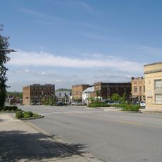
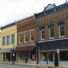
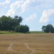
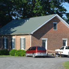
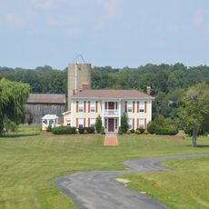
Adair County is an administrative division in northeastern Missouri spanning rural and urban communities connected by an extensive network of roads. The area encompasses multiple municipalities, with Kirksville serving as a significant hub for commerce and services.

History

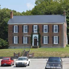
The county was established on January 29, 1841, and named for John Adair, who served as Kentucky's eighth governor from 1820 to 1824. This founding date marks the beginning of organized governance and settlement patterns in the region.

Culture

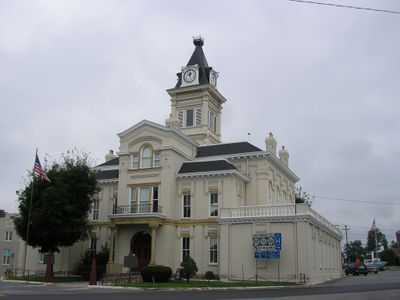
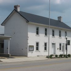
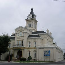
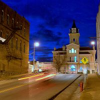
The 1899 courthouse anchors downtown Kirksville with its three-story Romanesque design and prominent position. This building reflects the architectural choices of the era and remains a focal point where residents gather for civic purposes.

Practical

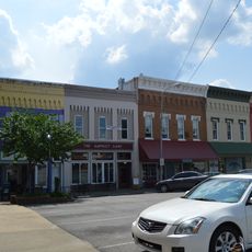
Visitors should plan to spend time in downtown Kirksville, where most services and facilities are concentrated. The area is accessible by car, and exploring during spring or fall offers pleasant conditions for touring.

Did you know?

Two major universities, A.T. Still University and Truman State University, operate within the county, bringing diverse student populations. The presence of these institutions shapes the local character and economy of the area.

Location
Inception
December 11, 1801
Capital city
Columbia
Shares border with
Green County, Taylor County, Casey County, Russell County, Cumberland County, Metcalfe County
GPS coordinates
37.11000,-85.28000
Latest update
December 7, 2025 10:07

AroundUs brings together thousands of curated places, local tips, and hidden gems, enriched daily by 60,000 contributors worldwide. Discover all places nearby (Kentucky).

Around this place
Lake Cumberland State Resort Park
United States of America

Lake Cumberland State Resort Park

29.3 km
Green River Lake State Park
United States of America

Green River Lake State Park

19.1 km
Creelsboro Natural Bridge
United States of America

Creelsboro Natural Bridge

25.3 km
Downtown Greensburg Historic District
United States of America

Downtown Greensburg Historic District

25.8 km
Battle of Tebb's Bend Monument
United States of America

Battle of Tebb's Bend Monument

14.7 km
Federal House
United States of America

Federal House

25.8 km
Metcalfe County Jail
United States of America

Metcalfe County Jail

32.8 km
Sulphur Well Historic District
United States of America

Sulphur Well Historic District

31.5 km
Mt. Gilead Baptist Church
United States of America

Mt. Gilead Baptist Church

11.3 km
Campbellsville Historic Commercial District
United States of America

Campbellsville Historic Commercial District

26.3 km
Adair County Courthouse
United States of America

Adair County Courthouse

2.5 km
Dr. Nathan Gaither House
United States of America

Dr. Nathan Gaither House

2.6 km
Greensburg Cumberland Presbyterian Church
United States of America

Greensburg Cumberland Presbyterian Church

26 km
Bell House
United States of America

Bell House

24.4 km
Daniel Trabue House
United States of America

Daniel Trabue House

2.3 km
James Baker House
United States of America

James Baker House

29.2 km
Metcalfe County Kentucky Courthouse
United States of America

Metcalfe County Kentucky Courthouse

32.8 km
Russell Lodge No. 284
United States of America

Russell Lodge No. 284

23.8 km
Anderson House
United States of America

Anderson House

13.2 km
Columbia Commercial Historic District
United States of America

Columbia Commercial Historic District

2.4 km
Green County Court Clerk's Office
United States of America

Green County Court Clerk's Office

25.8 km
John Field House
United States of America

John Field House

2.5 km
Zion Meetinghouse and School
United States of America

Zion Meetinghouse and School

6.8 km
James Caldwell House
United States of America

James Caldwell House

18.9 km
United States of America

Keltner House

12.8 km
Star Theater
United States of America

Star Theater

18.4 km
Goose Creek Foot Bridge
United States of America

Goose Creek Foot Bridge

25.7 km
Lake Cumberland
United States of America

Lake Cumberland

32 km
Show the full map
Administrative divisions
« Adair County - Administrative division in northeastern Missouri, United States » is provided by Around Us (aroundus.com). Images and texts are derived from Wikimedia project under a Creative Commons license. You are allowed to copy, distribute, and modify copies of this page, under the conditions set by the license, as long as this note is clearly visible.

Discover hidden gems everywhere you go!

From secret cafés to breathtaking viewpoints, skip the crowded tourist spots and find places that match your style. Our app makes it easy with voice search, smart filtering, route optimization, and insider tips from travelers worldwide. Download now for the complete mobile experience.

Around Us App Screenshot

A unique approach to discovering new places

Le Figaro

All the places worth exploring

France Info

A tailor-made excursion in just a few clicks

20 Minutes

Around Us
Travel Guide & Maps
Download

Send to your phone

QR Code
1

Open the camera app on your mobile.

2

Point at the QR code with your camera. A notification will appear.

3

Tap the notification to open the link.