Enable Location

We need your location to show you interesting places around you

Discover nearby places

Find interesting locations and hidden gems around you

Precise directions

Get accurate directions and distances to places

Your location is never shared with other users. It's only used when you tap the location button.

Log in to your account

Start exploring — it's free

Trusted by 63,014 travelers worldwide

Continue with Google
Continue with Apple
or

We will send you a code to connect

By continuing, you accept our Terms and Conditions and our Privacy Policy

Check your inbox

We've sent a pincode in your inbox. Please enter the code below.

Beacon Hill
Discussion Reviews Photo
1.7k Popularity

Beacon Hill, Summit in Connecticut, United States.

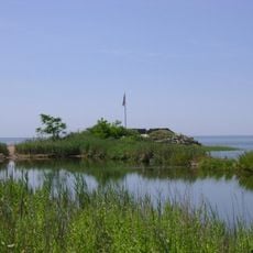
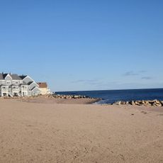
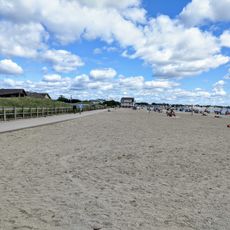
Beacon Hill is a basalt outcrop in Connecticut that rises above the surrounding salt marshes with steep edges. The solidified lava formations create a distinct elevation in the otherwise flat coastal landscape.

The formation dates to the Triassic Period when lava flows hardened as North America separated from Africa and solidified into rock layers. These geological events shaped the basalt rock visible in the landscape today.

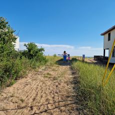
The trails connecting Beacon Hill integrate with the 28-mile Branford Trail system, offering numerous outdoor recreation opportunities for local residents.

The hill is accessible through a parking area at the end of Dominican Road, located just south of U.S. Route 1. Visitors should note this location in relation to the nearby highway when planning their visit.

A former stone quarry called Johnson's Quarry sits at the eastern base of the hill, marking industrial use at this site until 1942. This extraction activity shows how people took advantage of the natural basalt resources.

The community of curious travelers

AroundUs brings together thousands of curated places, local tips, and hidden gems, enriched daily by 60,000 contributors worldwide.

Start exploring
Location
Elevation above the sea
40 m
Made from material
igneous rock
Part of
Metacomet Ridge
GPS coordinates
41.27176,-72.85816
Latest update
December 14, 2025 12:22
Around this place
Pearl Harbor Memorial Bridge
United States of America

Pearl Harbor Memorial Bridge

4.9 km
Shore Line Trolley Museum
United States of America

Shore Line Trolley Museum

481 m
Fort Nathan Hale
United States of America

Fort Nathan Hale

3.9 km
Five Mile Point Light
United States of America

Five Mile Point Light

4.6 km
Lighthouse Point Park
United States of America

Lighthouse Point Park

4.4 km
Farm River State Park
United States of America

Farm River State Park

1.9 km
Quinnipiac River Historic District
United States of America

Quinnipiac River Historic District

4.7 km
Raynham
United States of America

Raynham

3.1 km
Branford Town Hall
United States of America

Branford Town Hall

4.1 km
Morris House
United States of America

Morris House

3.3 km
Morris Cove Historic District
United States of America

Morris Cove Historic District

3.2 km
Swain-Harrison House
United States of America

Swain-Harrison House

2.8 km
Dr. Mary B. Moody House
United States of America

Dr. Mary B. Moody House

4.4 km
Branford Point Historic District
United States of America

Branford Point Historic District

3.1 km
Thomas Harrison House
United States of America

Thomas Harrison House

3 km
East Haven Green Historic District
United States of America

East Haven Green Historic District

837 m
Old East Haven High School
United States of America

Old East Haven High School

1.6 km
Isaac Palmer House
United States of America

Isaac Palmer House

3.7 km
Timothy Bradley House
United States of America

Timothy Bradley House

3.2 km
Samuel Beach House
United States of America

Samuel Beach House

4.6 km
James Blackstone Memorial Library
United States of America

James Blackstone Memorial Library

3.8 km
Sunset Beach
United States of America

Sunset Beach

4.2 km
West Silver Sands Beach
United States of America

West Silver Sands Beach

3.8 km
Momauguin Beach
United States of America

Momauguin Beach

3 km
Lighthouse Point Carousel
United States of America

Lighthouse Point Carousel

4.6 km
Silver Sands Beach
United States of America

Silver Sands Beach

3.4 km
Shell Beach
United States of America

Shell Beach

4.4 km
Branford Center Historic District
United States of America

Branford Center Historic District

3.7 km
Show the full map
Reviews
Share your experience

No review yet

Discussions
Start a discussion...

No discussion yet

« Beacon Hill - Summit in Connecticut, United States » is provided by Around Us (aroundus.com). Images and texts are derived from Wikimedia project under a Creative Commons license. You are allowed to copy, distribute, and modify copies of this page, under the conditions set by the license, as long as this note is clearly visible.

Discover hidden gems everywhere you go!

From secret cafés to breathtaking viewpoints, skip the crowded tourist spots and find places that match your style. Our app makes it easy with voice search, smart filtering, route optimization, and insider tips from travelers worldwide. Download now for the complete mobile experience.

Around Us App Screenshot

A unique approach to discovering new places

Le Figaro

All the places worth exploring

France Info

A tailor-made excursion in just a few clicks

20 Minutes

Around Us
Travel Guide & Maps
Download

Send to your phone

QR Code
1

Open the camera app on your mobile.

2

Point at the QR code with your camera. A notification will appear.

3

Tap the notification to open the link.