Enable Location

We need your location to show you interesting places around you

Discover nearby places

Find interesting locations and hidden gems around you

Precise directions

Get accurate directions and distances to places

Your location is never shared with other users. It's only used when you tap the location button.

Quinnipiac River Historic District

Log in to your account

Start exploring — it's free

Trusted by 61,608 travelers worldwide

Continue with Google
Continue with Apple
or

We will send you a code to connect

By continuing, you accept our Terms and Conditions and our Privacy Policy

Check your inbox

We've sent a pincode in your inbox. Please enter the code below.

Quinnipiac River Historic District, Historic district in Fair Haven and Fair Haven Heights, New Haven, United States.

Description

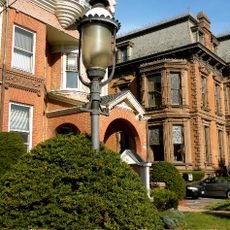
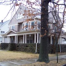
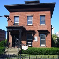
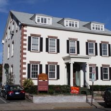
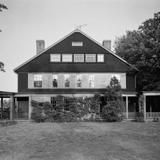
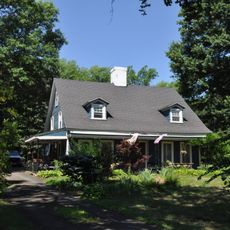
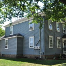
The Quinnipiac River Historic District sits on both sides of the river in New Haven, containing more than 500 buildings with Greek Revival, Italianate, and Victorian designs. The residential homes, storage buildings, and commercial structures show how a river community developed and changed over time.

History

The area began as farmland but transformed after a bridge was built across the river in 1790, attracting maritime business and trade. Over the next decades, the oyster and shipping industries drove growth and shaped how the community was built and organized.

Culture

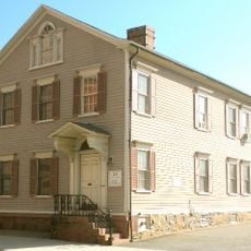
The district preserves homes built by oyster traders and river workers during the 1800s, showing how maritime families lived and organized their daily routines. Walking through, you notice how houses face the water and how streets connect the community to the working waterfront.

Practical

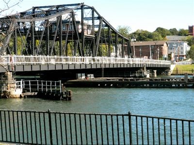
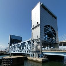
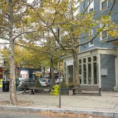
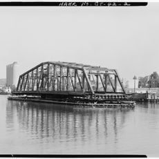
The Grand Avenue Swing Bridge connects both sides of the district and serves as a natural starting point for exploration. Walking on foot is best to notice the building details and how streets are arranged along the water.

Did you know?

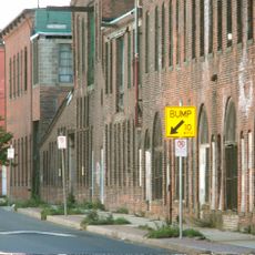
The district still shows oyster wharves from the 1800s where workers processed shells and prepared them for shipment to markets up and down the Atlantic Coast. These waterfront work areas reveal how goods moved directly from the river to distant trading routes.

Location
Architectural style
Greek Revival architecture, Renaissance Revival architecture
Elevation above the sea
13 m
GPS coordinates
41.30972,-72.88306
Latest update
December 14, 2025 12:23

AroundUs brings together thousands of curated places, local tips, and hidden gems, enriched daily by 60,000 contributors worldwide. Discover all places nearby (Connecticut).

Around this place
Pearl Harbor Memorial Bridge
United States of America

Pearl Harbor Memorial Bridge

2.1 km
Hotel Marcel
United States of America

Hotel Marcel

3.3 km
Wooster Square
United States of America

Wooster Square

3 km
East Rock
United States of America

East Rock

2.6 km
East Rock Park
United States of America

East Rock Park

2.8 km
Soldiers and Sailors Monument
United States of America

Soldiers and Sailors Monument

2.7 km
Edward P. Evans Hall
United States of America

Edward P. Evans Hall

3.2 km
Yale University Observatory
United States of America

Yale University Observatory

3.3 km
New Haven Lawn Club
United States of America

New Haven Lawn Club

3.1 km
Strouse, Adler Company Corset Factory
United States of America

Strouse, Adler Company Corset Factory

3.1 km
Statue of Christopher Columbus
United States of America

Statue of Christopher Columbus

3 km
Tomlinson Lift Bridge
United States of America

Tomlinson Lift Bridge

2.3 km
Wooster Square Historic District
United States of America

Wooster Square Historic District

3 km
Orange Street Historic District
United States of America

Orange Street Historic District

2.8 km
Whitney Avenue Historic District
United States of America

Whitney Avenue Historic District

3 km
Upper State Street Historic District
United States of America

Upper State Street Historic District

2.4 km
Lincoln Theatre
United States of America

Lincoln Theatre

3.1 km
River Street Historic District (New Haven, Connecticut)
United States of America

River Street Historic District (New Haven, Connecticut)

1.7 km
Lafayette B. Mendel House
United States of America

Lafayette B. Mendel House

3 km
Dr. Mary B. Moody House
United States of America

Dr. Mary B. Moody House

346 m
John Cook House
United States of America

John Cook House

3.3 km
William Pinto House
United States of America

William Pinto House

3.3 km
Atwater-Ciampolini House
United States of America

Atwater-Ciampolini House

3.2 km
Atwater-Linton House
United States of America

Atwater-Linton House

2.8 km
Caroline Nicoll House
United States of America

Caroline Nicoll House

3.3 km
George Atwater House
United States of America

George Atwater House

2.9 km
Chapel Street Bridge
United States of America

Chapel Street Bridge

2 km
Ferry Street Bridge
United States of America

Ferry Street Bridge

1.6 km
Show the full map
« Quinnipiac River Historic District - Historic district in Fair Haven and Fair Haven Heights, New Haven, United States » is provided by Around Us (aroundus.com). Images and texts are derived from Wikimedia project under a Creative Commons license. You are allowed to copy, distribute, and modify copies of this page, under the conditions set by the license, as long as this note is clearly visible.

Discover hidden gems everywhere you go!

From secret cafés to breathtaking viewpoints, skip the crowded tourist spots and find places that match your style. Our app makes it easy with voice search, smart filtering, route optimization, and insider tips from travelers worldwide. Download now for the complete mobile experience.

Around Us App Screenshot

A unique approach to discovering new places

Le Figaro

All the places worth exploring

France Info

A tailor-made excursion in just a few clicks

20 Minutes

Around Us
Travel Guide & Maps
Download

Send to your phone

QR Code
1

Open the camera app on your mobile.

2

Point at the QR code with your camera. A notification will appear.

3

Tap the notification to open the link.