Enable Location

We need your location to show you interesting places around you

Discover nearby places

Find interesting locations and hidden gems around you

Precise directions

Get accurate directions and distances to places

Your location is never shared with other users. It's only used when you tap the location button.

DeSoto County

Log in to your account

Start exploring — it's free

Trusted by 63,938 travelers worldwide

Continue with Google
Continue with Apple
or

We will send you a code to connect

By continuing, you accept our Terms and Conditions and our Privacy Policy

Check your inbox

We've sent a pincode in your inbox. Please enter the code below.

Discussion Reviews 1 Photos
32.8k Popularity

DeSoto County, County administrative division in northwestern Mississippi, United States.

DeSoto County is an administrative area in northwestern Mississippi bordering the Mississippi River as part of the Memphis metropolitan region. It encompasses multiple communities spread across the landscape with varied terrain and land use.

The area was founded in 1836 and named after Spanish explorer Hernando de Soto, who reached the Mississippi River during his expeditions. Its establishment came during a period of European exploration and settlement in the region.

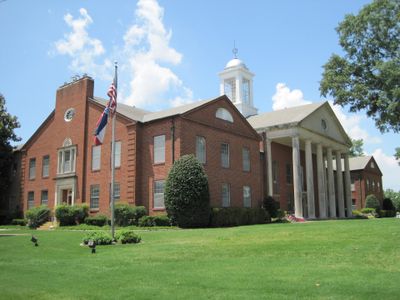
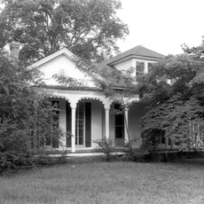
The county museum displays local heritage through exhibits of Native American objects, settlement documents, and records about regional farming. Visitors can learn how communities developed in this area over time.

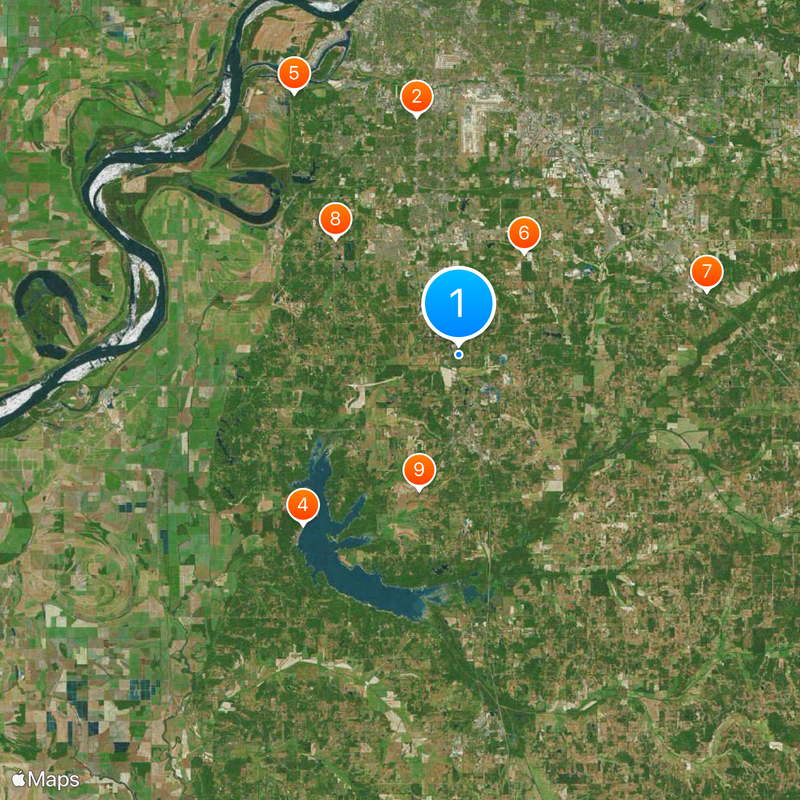
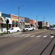
Visitors will find multiple towns and facilities spread across the county connected by local services. A vehicle is helpful for getting around since communities are distributed across wider distances.

The area transformed from pure farmland into a densely settled region within just a few generations. This rapid shift attracted many newcomers and reshaped how people work and live here.

The community of curious travelers

AroundUs brings together thousands of curated places, local tips, and hidden gems, enriched daily by 60,000 contributors worldwide.

Start exploring
Location
Inception
February 9, 1836
Capital city
Hernando
Shares border with
Shelby County, Tate County, Marshall County, Tunica County, Crittenden County
GPS coordinates
34.88000,-89.99000
Latest update
December 20, 2025 00:07
Around this place
Graceland
United States of America

Graceland

18.8 km
Chucalissa Indian Village
United States of America

Chucalissa Indian Village

23.9 km
Arkabutla Lake
United States of America

Arkabutla Lake

17.9 km
T. O. Fuller State Park
United States of America

T. O. Fuller State Park

23.9 km
BankPlus Amphitheater at Snowden Grove
United States of America

BankPlus Amphitheater at Snowden Grove

9.4 km
United States of America

Miller Plantation House

19.9 km
United States of America

Circle G Ranch

13.1 km
United States of America

Robertson-Yates House

10.9 km
Felix LaBauve House
United States of America

Felix LaBauve House

6.7 km
Downtown Senatobia Historic District
United States of America

Downtown Senatobia Historic District

29.2 km
United States of America

College Street Historic District

29.1 km
United States of America

Hernando South Side (Magnolia) Historic District

6.7 km
United States of America

Winchester Court Cinema

22.3 km
United States of America

Southbrook Theatre

16.5 km
United States of America

Village Cinema

21.7 km
United States of America

Hickory Ridge Mall Cinema

22.3 km
United States of America

Bon Theater

6.3 km
United States of America

Maywood Lake

16.3 km
United States of America

The Links at Whitehaven

15.2 km
United States of America

Cherokee Golf Course

15 km
United States of America

Tunica National Golf & Tennis

28.9 km
United States of America

Memphis Athletic Ministries Park Golf Course

22.6 km
United States of America

Wedgewood Golfer's Club

11.7 km
United States of America

Cherokee Valley Golf Course

14.5 km
United States of America

Lisa Marie Jet

18.9 km
United States of America

Hound Dog II Jet

18.9 km
United States of America

Wholesale glass

17.8 km
United States of America

BankPlus Amptheater at Snowden Grove

9.4 km
Show the full map
Reviews
Share your experience

No review yet

Discussions
Start a discussion...

No discussion yet

Administrative divisions
« DeSoto County - County administrative division in northwestern Mississippi, United States » is provided by Around Us (aroundus.com). Images and texts are derived from Wikimedia project under a Creative Commons license. You are allowed to copy, distribute, and modify copies of this page, under the conditions set by the license, as long as this note is clearly visible.

Discover hidden gems everywhere you go!

From secret cafés to breathtaking viewpoints, skip the crowded tourist spots and find places that match your style. Our app makes it easy with voice search, smart filtering, route optimization, and insider tips from travelers worldwide. Download now for the complete mobile experience.

Around Us App Screenshot

A unique approach to discovering new places

Le Figaro

All the places worth exploring

France Info

A tailor-made excursion in just a few clicks

20 Minutes

Around Us
Travel Guide & Maps
Download

Send to your phone

QR Code
1

Open the camera app on your mobile.

2

Point at the QR code with your camera. A notification will appear.

3

Tap the notification to open the link.