Enable Location

We need your location to show you interesting places around you

Discover nearby places

Find interesting locations and hidden gems around you

Precise directions

Get accurate directions and distances to places

Your location is never shared with other users. It's only used when you tap the location button.

Audrain County

Log in to your account

Start exploring — it's free

Trusted by 61,977 travelers worldwide

Continue with Google
Continue with Apple
or

We will send you a code to connect

By continuing, you accept our Terms and Conditions and our Privacy Policy

Check your inbox

We've sent a pincode in your inbox. Please enter the code below.

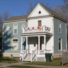
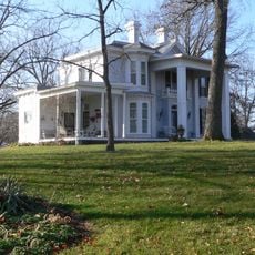
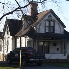
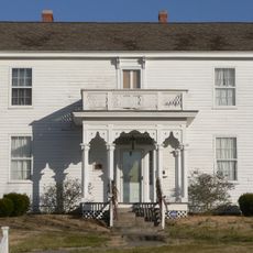
Audrain County, Administrative division in central Missouri, US

Audrain County is an administrative division in central Missouri containing eight municipalities, with Mexico serving as its county seat. The region encompasses farmland, small towns, and rural areas that together form a typical Midwest landscape.

Audrain County was established in 1836 and named after Colonel James Hunter Audrain, a veteran of the War of 1812. The creation of this administrative unit shaped early settlement patterns in central Missouri.

The Missouri Military Academy and Audrain County Historical Society maintain educational and heritage preservation programs for the local community.

Visitors can explore county services and infrastructure by traveling between the different municipalities scattered across the region. Spring and fall offer the best conditions for exploring, as the weather is mild and the landscape reveals its agricultural character.

The region has become a center for biofuel production, hosting major processing plants like Poet Biorefinery Laddonia. These facilities have reshaped the local economy and positioned the area as an important hub for renewable energy manufacturing.

The community of curious travelers

AroundUs brings together thousands of curated places, local tips, and hidden gems, enriched daily by 60,000 contributors worldwide.

Start exploring
Location
Inception
January 12, 1831
Capital city
Mexico
Shares border with
Monroe County, Randolph County, Boone County, Callaway County, Ralls County, Pike County, Montgomery County
GPS coordinates
39.21000,-91.84000
Latest update
December 7, 2025 20:44
Around this place
National Churchill Museum
United States of America

National Churchill Museum

41.3 km
Mark Twain Birthplace State Historic Site
United States of America

Mark Twain Birthplace State Historic Site

31.9 km
Mark Twain State Park
United States of America

Mark Twain State Park

31.5 km
Union Covered Bridge State Historic Site
United States of America

Union Covered Bridge State Historic Site

33.5 km
Albert Bishop Chance House and Gardens
United States of America

Albert Bishop Chance House and Gardens

25.4 km
Chatol
United States of America

Chatol

25.5 km
Westminster College Gymnasium
United States of America

Westminster College Gymnasium

41.5 km
Mount Zion Church and Cemetery
United States of America

Mount Zion Church and Cemetery

33.2 km
George Washington Carver School
United States of America

George Washington Carver School

40.8 km
St. Paul Catholic Church
United States of America

St. Paul Catholic Church

38.4 km
Merritt Violette House
United States of America

Merritt Violette House

31.9 km
Ross House
United States of America

Ross House

6.3 km
Paris Male Academy
United States of America

Paris Male Academy

33.1 km
Arthur Simmons Stables Historic District
United States of America

Arthur Simmons Stables Historic District

6.7 km
Audrain County Courthouse
United States of America

Audrain County Courthouse

5.6 km
White Cloud Presbyterian Church and Cemetery
United States of America

White Cloud Presbyterian Church and Cemetery

42.3 km
Lincoln School
United States of America

Lincoln School

31.8 km
Brandon-Bell-Collier House
United States of America

Brandon-Bell-Collier House

40.6 km
John Augustus Hockaday House
United States of America

John Augustus Hockaday House

42 km
M. Fred Bell Speculative Cottage
United States of America

M. Fred Bell Speculative Cottage

41.4 km
Downtown Fulton Historic District
United States of America

Downtown Fulton Historic District

41.3 km
M. Fred Bell Rental Cottage
United States of America

M. Fred Bell Rental Cottage

41.4 km
Robnett-Payne House
United States of America

Robnett-Payne House

41.4 km
Court Street Historic Residential District
United States of America

Court Street Historic Residential District

40.8 km
Dr. George M. Willing House
United States of America

Dr. George M. Willing House

41.7 km
Mark Twain State Park Picnic Shelter at Buzzard's Roost
United States of America

Mark Twain State Park Picnic Shelter at Buzzard's Roost

29.6 km
Mark Twain Birthplace State Historic Site
United States of America

Mark Twain Birthplace State Historic Site

31.3 km
Mark Twain Lake
United States of America

Mark Twain Lake

34.5 km
Show the full map
Administrative divisions
« Audrain County - Administrative division in central Missouri, US » is provided by Around Us (aroundus.com). Images and texts are derived from Wikimedia project under a Creative Commons license. You are allowed to copy, distribute, and modify copies of this page, under the conditions set by the license, as long as this note is clearly visible.

Discover hidden gems everywhere you go!

From secret cafés to breathtaking viewpoints, skip the crowded tourist spots and find places that match your style. Our app makes it easy with voice search, smart filtering, route optimization, and insider tips from travelers worldwide. Download now for the complete mobile experience.

Around Us App Screenshot

A unique approach to discovering new places

Le Figaro

All the places worth exploring

France Info

A tailor-made excursion in just a few clicks

20 Minutes

Around Us
Travel Guide & Maps
Download

Send to your phone

QR Code
1

Open the camera app on your mobile.

2

Point at the QR code with your camera. A notification will appear.

3

Tap the notification to open the link.