Enable Location

We need your location to show you interesting places around you

Discover nearby places

Find interesting locations and hidden gems around you

Precise directions

Get accurate directions and distances to places

Your location is never shared with other users. It's only used when you tap the location button.

Log in to your account

Start exploring — it's free

Trusted by 61,976 travelers worldwide

Continue with Google
Continue with Apple
or

We will send you a code to connect

By continuing, you accept our Terms and Conditions and our Privacy Policy

Check your inbox

We've sent a pincode in your inbox. Please enter the code below.

Cass County, Administrative county in western Missouri, United States

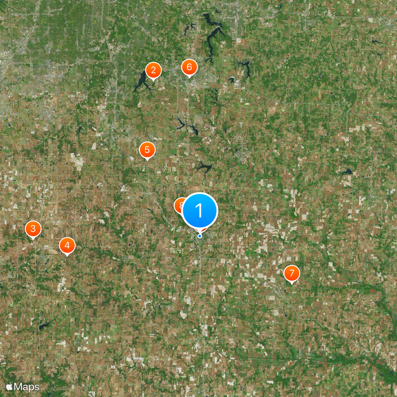
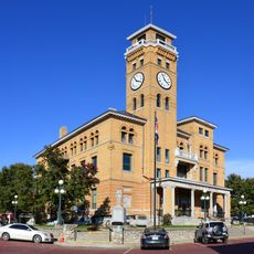
Cass County is an administrative division in western Missouri covering roughly 700 square kilometers of land and water. Harrisonville functions as the county seat and administrative center for the region.

The area was originally established as Van Buren County in 1835 and renamed in 1849 to honor U.S. Senator Lewis Cass. The Civil War brought severe destruction in 1863 when federal forces evacuated the county seat and burned most of its buildings.

Native American groups like the Osage, Quapaw, and Kansa inhabited this region long before European arrival, leaving marks on the land and local names. Visitors can still sense this heritage in the geography and community identity.

The region is served by multiple school districts including Harrisonville R-IX and Raymore-Peculiar R-II that cover different parts of the county. Visitors will find government services, shops, and local facilities centered around Harrisonville and other towns throughout the area.

During the Civil War, federal forces completely evacuated and burned the county seat in 1863, leaving it almost entirely destroyed. This wartime devastation remains a pivotal moment in local memory and regional storytelling.

The community of curious travelers

AroundUs brings together thousands of curated places, local tips, and hidden gems, enriched daily by 60,000 contributors worldwide.

Start exploring
Location
Inception
March 3, 1835
Capital city
Harrisonville
Shares border with
Jackson County, Bates County, Johnson County, Henry County, Miami County
GPS coordinates
38.65000,-94.35000
Latest update
December 20, 2025 13:51
Around this place
Longview Farm
United States of America

Longview Farm

29.7 km
United States of America

Powell Observatory

30.4 km
Cedar Cove Feline Conservatory & Sanctuary
United States of America

Cedar Cove Feline Conservatory & Sanctuary

24.5 km
United States of America

Watkins Family Farm Historic District

16.9 km
Saint Paul's Episcopal Church
United States of America

Saint Paul's Episcopal Church

29.1 km
United States of America

O'Bannon Homestead

18.8 km
United States of America

Robert A. Brown House

5 km
Harrisonville Courthouse Square Historic District
United States of America

Harrisonville Courthouse Square Historic District

509 m
United States of America

Pleasant Hill Downtown Historic District

16.7 km
Pleasant View School
United States of America

Pleasant View School

30 km
United States of America

St. Peter's Episcopal Church

990 m
United States of America

Stumbaugh Post No. 180 GAR Hall

16.9 km
Arcade Alley
United States of America

Arcade Alley

29.2 km
United States of America

Lisle Pond

23.9 km
United States of America

Peculiar City Reservoir

10.7 km
United States of America

Eagles' Landing Golf Course

27.1 km
United States of America

Country Creek Golf Club - The Rock & The Quarry

9.8 km
United States of America

Metcalf Ridge Golf Course

27.8 km
United States of America

Twin Pines Country Club

3.6 km
United States of America

Shamrock Hills Golf Club

23.8 km
United States of America

Creekmoor Golf Club

22.9 km
United States of America

Grand Summit Golf & Country Club

26.5 km
United States of America

Country Club at Loch Lloyd

29.6 km
United States of America

Legacy Park Amphitheatre

30.9 km
United States of America

Grandview Amphitheater

28.7 km
United States of America

Country Creek Golf Club - Hoot's Hollow

9.1 km
United States of America

Work of art, sculpture

31.3 km
United States of America

Scenic viewpoint

24.2 km
Show the full map
Administrative divisions
« Cass County - Administrative county in western Missouri, United States » is provided by Around Us (aroundus.com). Images and texts are derived from Wikimedia project under a Creative Commons license. You are allowed to copy, distribute, and modify copies of this page, under the conditions set by the license, as long as this note is clearly visible.

Discover hidden gems everywhere you go!

From secret cafés to breathtaking viewpoints, skip the crowded tourist spots and find places that match your style. Our app makes it easy with voice search, smart filtering, route optimization, and insider tips from travelers worldwide. Download now for the complete mobile experience.

Around Us App Screenshot

A unique approach to discovering new places

Le Figaro

All the places worth exploring

France Info

A tailor-made excursion in just a few clicks

20 Minutes

Around Us
Travel Guide & Maps
Download

Send to your phone

QR Code
1

Open the camera app on your mobile.

2

Point at the QR code with your camera. A notification will appear.

3

Tap the notification to open the link.