Enable Location

We need your location to show you interesting places around you

Discover nearby places

Find interesting locations and hidden gems around you

Precise directions

Get accurate directions and distances to places

Your location is never shared with other users. It's only used when you tap the location button.

Harrisonville

Log in to your account

Start exploring — it's free

Trusted by 63,938 travelers worldwide

Continue with Google
Continue with Apple
or

We will send you a code to connect

By continuing, you accept our Terms and Conditions and our Privacy Policy

Check your inbox

We've sent a pincode in your inbox. Please enter the code below.

Discussion Reviews 1 Photos
19.1k Popularity

Harrisonville, city in Cass County, Missouri, United States

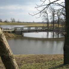
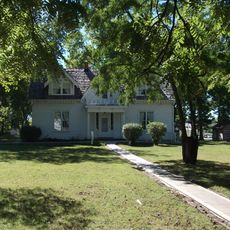
Harrisonville is a city in Cass County, Missouri, located about 40 miles from the center of Kansas City. Its downtown features historic streets lined with buildings from different periods, while newer development extends into surrounding areas.

The first settlers arrived around 1830, and the town was officially formed in 1837. After the Civil War and the destruction from Order No. 11, the railroad in the 1880s helped restore the economy, followed by highways in the early 20th century that spurred growth.

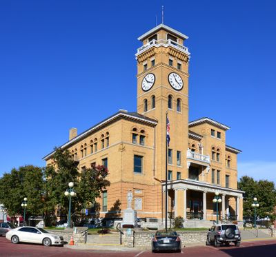
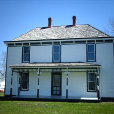
The town's name honors Albert G. Harrison, a Missouri representative from the early days. The historic downtown preserves buildings from the 1800s and reflects how residents continue to value their local roots.

The city is easily reached by car through modern highways that connect to Kansas City. Visitors can walk through the historic downtown streets and should allow time to explore the central areas where most buildings of interest are located.

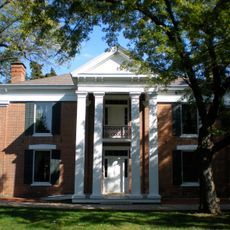
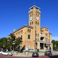
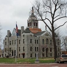
The city was struck by the Panic of 1893 when banks closed, but the courthouse was rebuilt in 1897 as a sign of resilience. This reconstruction after the crisis shows how the community responded to hardship.

The community of curious travelers

AroundUs brings together thousands of curated places, local tips, and hidden gems, enriched daily by 60,000 contributors worldwide.

Start exploring
Location
Inception
1851
Elevation above the sea
290 m
GPS coordinates
38.65361,-94.34694
Latest update
February 16, 2026 23:00
Around this place
Arrowhead Stadium
United States of America

Arrowhead Stadium

45.6 km
Kauffman Stadium
United States of America

Kauffman Stadium

45.8 km
Kansas City Zoo
United States of America

Kansas City Zoo

42.3 km
United Methodist Church of the Resurrection
United States of America

United Methodist Church of the Resurrection

35.9 km
Sprint World Headquarters Campus
United States of America

Sprint World Headquarters Campus

40 km
Blue Valley Northwest High School
United States of America

Blue Valley Northwest High School

40.5 km
Kansas City National Security Campus
United States of America

Kansas City National Security Campus

39 km
Swope Park
United States of America

Swope Park

42.7 km
Fairyland Park
United States of America

Fairyland Park

41.7 km
Bannister Federal Complex
United States of America

Bannister Federal Complex

39 km
Blue Valley West High School
United States of America

Blue Valley West High School

36.2 km
Longview Farm
United States of America

Longview Farm

29.4 km
Powell Gardens
United States of America

Powell Gardens

36 km
United States of America

Overland Park Arboretum and Botanical Gardens

34.1 km
Harry S. Truman Farm Home
United States of America

Harry S. Truman Farm Home

31.9 km
John Wornall House Museum
United States of America

John Wornall House Museum

45.9 km
United States of America

Marine Corps Individual Reserve Support Activity

28.1 km
Andrew Drumm Institute
United States of America

Andrew Drumm Institute

45.7 km
Waldo Water Tower
United States of America

Waldo Water Tower

42.7 km
United States of America

Powell Observatory

30.7 km
Trailside Center
United States of America

Trailside Center

38.6 km
Saint Paul's Episcopal Church
United States of America

Saint Paul's Episcopal Church

28.7 km
Rice-Tremonti House
United States of America

Rice-Tremonti House

40.7 km
Harrisonville Courthouse Square Historic District
United States of America

Harrisonville Courthouse Square Historic District

172 m
Bates County Courthouse
United States of America

Bates County Courthouse

44.1 km
Herman J. and Ella B. Voigts House
United States of America

Herman J. and Ella B. Voigts House

39.9 km
Marjorie Powell Allen Chapel
United States of America

Marjorie Powell Allen Chapel

36.3 km
Deer Creek Golf Course
United States of America

Deer Creek Golf Course

38.2 km
Show the full map
Reviews
Share your experience

No review yet

Discussions
Start a discussion...

No discussion yet

« Harrisonville - city in Cass County, Missouri, United States » is provided by Around Us (aroundus.com). Images and texts are derived from Wikimedia project under a Creative Commons license. You are allowed to copy, distribute, and modify copies of this page, under the conditions set by the license, as long as this note is clearly visible.

Discover hidden gems everywhere you go!

From secret cafés to breathtaking viewpoints, skip the crowded tourist spots and find places that match your style. Our app makes it easy with voice search, smart filtering, route optimization, and insider tips from travelers worldwide. Download now for the complete mobile experience.

Around Us App Screenshot

A unique approach to discovering new places

Le Figaro

All the places worth exploring

France Info

A tailor-made excursion in just a few clicks

20 Minutes

Around Us
Travel Guide & Maps
Download

Send to your phone

QR Code
1

Open the camera app on your mobile.

2

Point at the QR code with your camera. A notification will appear.

3

Tap the notification to open the link.