Enable Location

We need your location to show you interesting places around you

Discover nearby places

Find interesting locations and hidden gems around you

Precise directions

Get accurate directions and distances to places

Your location is never shared with other users. It's only used when you tap the location button.

Morgan County

Log in to your account

Start exploring — it's free

Trusted by 62,504 travelers worldwide

Continue with Google
Continue with Apple
or

We will send you a code to connect

By continuing, you accept our Terms and Conditions and our Privacy Policy

Check your inbox

We've sent a pincode in your inbox. Please enter the code below.

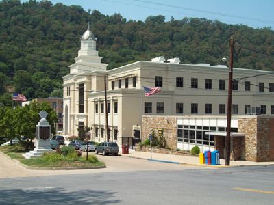
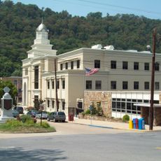
Morgan County, County seat in Eastern Panhandle, West Virginia, US

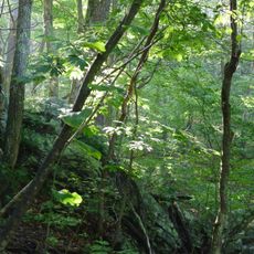
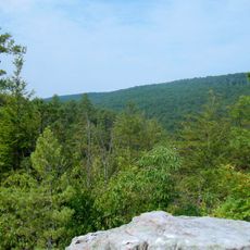
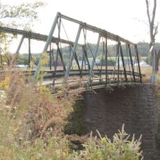
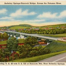
Morgan County spreads across the eastern region of West Virginia with the Potomac River forming its northern boundary. The area contains mineral springs, woodlands, and thermal facilities, particularly around Berkeley Springs.

The county was separated from Berkeley County in 1820 and named after General Daniel Morgan, a commander during the American Revolution. This naming honors his role in the nation's founding period.

The Apple Butter Festival each October brings together craftspeople, food vendors, and residents to celebrate regional traditions and farming heritage. This event shows how important local fruit and preservation traditions remain to the community.

The county offers hiking trails, fishing spots, and thermal facilities accessible throughout the year. Spring and summer months are ideal for outdoor activities as weather is most comfortable.

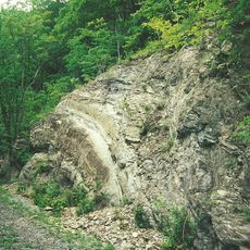
A major silica sand mining operation extracts high-purity material used across various industrial processes and construction products. This mining activity has shaped the county's economy for many decades.

The community of curious travelers

AroundUs brings together thousands of curated places, local tips, and hidden gems, enriched daily by 60,000 contributors worldwide.

Start exploring
Location
Inception
February 9, 1820
Capital city
Berkeley Springs
Shares border with
Allegany County, Washington County, Berkeley County, Frederick County, Hampshire County
GPS coordinates
39.56000,-78.26000
Latest update
December 7, 2025 19:23
Around this place
Samuel Taylor Suit Cottage
United States of America

Samuel Taylor Suit Cottage

7.9 km
Fort Frederick
United States of America

Fort Frederick

21.2 km
Berkeley Springs State Park
United States of America

Berkeley Springs State Park

7.9 km
Green Ridge State Forest
United States of America

Green Ridge State Forest

19.6 km
Cacapon Resort State Park
United States of America

Cacapon Resort State Park

6.9 km
Sleepy Creek Mountain
United States of America

Sleepy Creek Mountain

12.6 km
Roundtop Hill
United States of America

Roundtop Hill

13.3 km
Park's Gap Bridge
United States of America

Park's Gap Bridge

19.9 km
William Wilson House
United States of America

William Wilson House

24.4 km
Baldwin-Grantham House
United States of America

Baldwin-Grantham House

18.3 km
Morgan County Courthouse
United States of America

Morgan County Courthouse

8.2 km
Town of Bath Historic District
United States of America

Town of Bath Historic District

7.9 km
Thomas Brown House
United States of America

Thomas Brown House

25.9 km
Ar-Qua Springs
United States of America

Ar-Qua Springs

23.8 km
Hedgesville Historic District
United States of America

Hedgesville Historic District

22.8 km
T. H. B. Dawson House
United States of America

T. H. B. Dawson House

7.7 km
Victor Cushwa Memorial Bridge
United States of America

Victor Cushwa Memorial Bridge

17.7 km
Campbellton
United States of America

Campbellton

23.6 km
Clarence Hovermale House
United States of America

Clarence Hovermale House

8.1 km
Benjamin H. Snyder House
United States of America

Benjamin H. Snyder House

16.7 km
Sloat-Horn-Rossell House
United States of America

Sloat-Horn-Rossell House

8 km
Redbud Hollow
United States of America

Redbud Hollow

24.3 km
Clary's Mountain Historic District
United States of America

Clary's Mountain Historic District

23.2 km
Cacapon State Park Nature Center
United States of America

Cacapon State Park Nature Center

7.6 km
Star Theatre
United States of America

Star Theatre

8 km
Judge John W. Wright Cottage
United States of America

Judge John W. Wright Cottage

7.7 km
John Herbert Quick House
United States of America

John Herbert Quick House

2.6 km
Hancock Bridge
United States of America

Hancock Bridge

16.3 km
Show the full map
« Morgan County - County seat in Eastern Panhandle, West Virginia, US » is provided by Around Us (aroundus.com). Images and texts are derived from Wikimedia project under a Creative Commons license. You are allowed to copy, distribute, and modify copies of this page, under the conditions set by the license, as long as this note is clearly visible.

Discover hidden gems everywhere you go!

From secret cafés to breathtaking viewpoints, skip the crowded tourist spots and find places that match your style. Our app makes it easy with voice search, smart filtering, route optimization, and insider tips from travelers worldwide. Download now for the complete mobile experience.

Around Us App Screenshot

A unique approach to discovering new places

Le Figaro

All the places worth exploring

France Info

A tailor-made excursion in just a few clicks

20 Minutes

Around Us
Travel Guide & Maps
Download

Send to your phone

QR Code
1

Open the camera app on your mobile.

2

Point at the QR code with your camera. A notification will appear.

3

Tap the notification to open the link.