Enable Location

We need your location to show you interesting places around you

Discover nearby places

Find interesting locations and hidden gems around you

Precise directions

Get accurate directions and distances to places

Your location is never shared with other users. It's only used when you tap the location button.

Sibley County

Log in to your account

Start exploring — it's free

Trusted by 61,901 travelers worldwide

Continue with Google
Continue with Apple
or

We will send you a code to connect

By continuing, you accept our Terms and Conditions and our Privacy Policy

Check your inbox

We've sent a pincode in your inbox. Please enter the code below.

Sibley County, Administrative county in Minnesota, United States

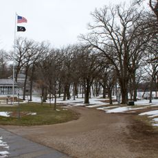
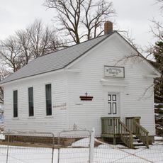
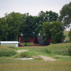
Sibley County is an administrative division in the South Central region of Minnesota with varied terrain and water features throughout. The landscape transitions from flatter areas to gently rolling hills, particularly toward the northwestern sections.

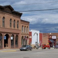
The county was established on March 5, 1853 by Minnesota's territorial government as settlements expanded across the region. This early founding reflects the period of rapid European migration and development that transformed the landscape.

The county takes its name from Henry Hastings Sibley, an early territorial leader whose influence shaped the region's early development. This naming reflects the area's connection to the pioneers and settlers who established communities here.

The county is accessible via U.S. Highway 169 and several state highways that connect different parts of the region. These routes make it easy to navigate between towns and explore various communities within the area.

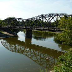
The Minnesota River forms the northeastern boundary and shapes much of the area's natural landscape. This river served as a vital transportation corridor historically and remains a defining feature of the region today.

The community of curious travelers

AroundUs brings together thousands of curated places, local tips, and hidden gems, enriched daily by 60,000 contributors worldwide.

Start exploring
Location
Inception
March 5, 1853
Capital city
Gaylord
Shares border with
McLeod County, Nicollet County, Renville County, Carver County, Scott County, Le Sueur County
GPS coordinates
44.58000,-94.23000
Latest update
December 8, 2025 13:42
Around this place
Hermann Heights Monument
United States of America

Hermann Heights Monument

36 km
Dr. William W. Mayo House
United States of America

Dr. William W. Mayo House

28.2 km
Nicollet County Courthouse and Jail
United States of America

Nicollet County Courthouse and Jail

36 km
Eugene Saint Julien Cox House
United States of America

Eugene Saint Julien Cox House

34.9 km
Young America City Hall
United States of America

Young America City Hall

33.7 km
Merton S. Goodnow House
United States of America

Merton S. Goodnow House

35.9 km
Gibbon Village Hall
United States of America

Gibbon Village Hall

24.1 km
Harry Merrill House
United States of America

Harry Merrill House

36.6 km
Wanda Gág House
United States of America

Wanda Gág House

35 km
New Ulm Oil Company Service Station
United States of America

New Ulm Oil Company Service Station

34.7 km
St. Peter Armory
United States of America

St. Peter Armory

35.9 km
Gaylord City Park
United States of America

Gaylord City Park

2.3 km
Episcopal Church of the Transfiguration
United States of America

Episcopal Church of the Transfiguration

37.3 km
Broadway Bridge
United States of America

Broadway Bridge

35.9 km
Methodist Episcopal Church
United States of America

Methodist Episcopal Church

31.3 km
Union Presbyterian Church
United States of America

Union Presbyterian Church

35.8 km
Emily and Stephen Schumacher House
United States of America

Emily and Stephen Schumacher House

35.5 km
German Evangelical Salem Church
United States of America

German Evangelical Salem Church

36.6 km
August F. Poehler House
United States of America

August F. Poehler House

26 km
Johann Schimmelpfennig Farmstead
United States of America

Johann Schimmelpfennig Farmstead

35.5 km
Henderson Commercial Historic District
United States of America

Henderson Commercial Historic District

26.3 km
Church of the Ascension
United States of America

Church of the Ascension

31.9 km
Norwood Methodist Episcopal Church
United States of America

Norwood Methodist Episcopal Church

31.9 km
Le Sueur Theater
United States of America

Le Sueur Theater

28.2 km
Wheel and Cog
United States of America

Wheel and Cog

35 km
Hooper–Bowler–Hillstrom House
United States of America

Hooper–Bowler–Hillstrom House

37.2 km
Linnaeus Arboretum
United States of America

Linnaeus Arboretum

35.1 km
Old Main
United States of America

Old Main

35.3 km
Show the full map
« Sibley County - Administrative county in Minnesota, United States » is provided by Around Us (aroundus.com). Images and texts are derived from Wikimedia project under a Creative Commons license. You are allowed to copy, distribute, and modify copies of this page, under the conditions set by the license, as long as this note is clearly visible.

Discover hidden gems everywhere you go!

From secret cafés to breathtaking viewpoints, skip the crowded tourist spots and find places that match your style. Our app makes it easy with voice search, smart filtering, route optimization, and insider tips from travelers worldwide. Download now for the complete mobile experience.

Around Us App Screenshot

A unique approach to discovering new places

Le Figaro

All the places worth exploring

France Info

A tailor-made excursion in just a few clicks

20 Minutes

Around Us
Travel Guide & Maps
Download

Send to your phone

QR Code
1

Open the camera app on your mobile.

2

Point at the QR code with your camera. A notification will appear.

3

Tap the notification to open the link.