Enable Location

We need your location to show you interesting places around you

Discover nearby places

Find interesting locations and hidden gems around you

Precise directions

Get accurate directions and distances to places

Your location is never shared with other users. It's only used when you tap the location button.

Noble County

Log in to your account

Start exploring — it's free

Trusted by 62,121 travelers worldwide

Continue with Google
Continue with Apple
or

We will send you a code to connect

By continuing, you accept our Terms and Conditions and our Privacy Policy

Check your inbox

We've sent a pincode in your inbox. Please enter the code below.

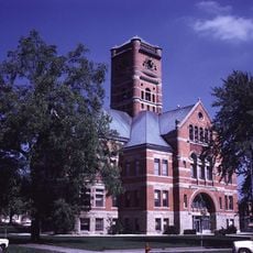
Noble County, County seat in northeast Indiana, United States.

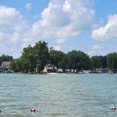
Noble County is located in northeast Indiana and stretches across terrain marked by low rolling hills, numerous lakes, and wetland areas. The landscape features these natural elements throughout the region, creating varied environments across the land.

The county was established in 1835 and named after Noah Noble, Indiana's first governor who served from 1831 to 1837. Its creation reflected the westward expansion into the region during that era.

The initial settlers of Noble County were primarily descendants of English Puritans who moved westward from New England during the early nineteenth century.

The area is best explored by car, as it consists of rural countryside with an extensive road network connecting its communities. Visitors should expect longer distances between destinations when traveling through the region.

Sand Hill rises to an elevation of about 1,070 feet and stands as the second-highest named elevation point in the state. This geographic landmark offers a notable peak within an otherwise more gently sloping landscape.

The community of curious travelers

AroundUs brings together thousands of curated places, local tips, and hidden gems, enriched daily by 60,000 contributors worldwide.

Start exploring
Location
Inception
February 7, 1835
Capital city
Albion
Shares border with
Elkhart County, LaGrange County, DeKalb County, Allen County, Whitley County, Kosciusko County, Steuben County
GPS coordinates
41.40000,-85.42000
Latest update
December 7, 2025 20:21
Around this place
Noble County Sheriff's House and Jail
United States of America

Noble County Sheriff's House and Jail

711 m
Ahavas Shalom Reform Temple
United States of America

Ahavas Shalom Reform Temple

15.7 km
Gump House
United States of America

Gump House

19.6 km
Garrett Historic District
United States of America

Garrett Historic District

24.6 km
Jacob Straus House
United States of America

Jacob Straus House

15.8 km
Ligonier Historic District
United States of America

Ligonier Historic District

15.9 km
Kendallville Downtown Historic District
United States of America

Kendallville Downtown Historic District

13.8 km
Edward Kelham House
United States of America

Edward Kelham House

20 km
Samuel Bevier House
United States of America

Samuel Bevier House

24.6 km
Brethren in Christ Church
United States of America

Brethren in Christ Church

22.4 km
Stone's Trace
United States of America

Stone's Trace

14.2 km
Albion Courthouse Square Historic District
United States of America

Albion Courthouse Square Historic District

525 m
Luckey Hospital
United States of America

Luckey Hospital

9.7 km
Stanley School-District No. 2
United States of America

Stanley School-District No. 2

8.2 km
Dixie
United States of America

Dixie

24.4 km
Garrett Community Mausoleum
United States of America

Garrett Community Mausoleum

23.9 km
J.H. Haag House
United States of America

J.H. Haag House

25.1 km
Cromwell Historic District
United States of America

Cromwell Historic District

16.2 km
Mountz House
United States of America

Mountz House

24.9 km
Maria and Franklin Wiltrout Polygonal Barn
United States of America

Maria and Franklin Wiltrout Polygonal Barn

21.1 km
John Wilderson House
United States of America

John Wilderson House

24.8 km
William Fountain House
United States of America

William Fountain House

20.6 km
Orin Clark House
United States of America

Orin Clark House

21.1 km
Breechbill-Davidson House
United States of America

Breechbill-Davidson House

22.4 km
Noble County Courthouse
United States of America

Noble County Courthouse

595 m
Blue Lake Public Access Site
United States of America

Blue Lake Public Access Site

18.8 km
Ligonier Public Library
United States of America

Ligonier Public Library

15.8 km
Dallas Lake Beach
United States of America

Dallas Lake Beach

16.5 km
Show the full map
Administrative divisions
« Noble County - County seat in northeast Indiana, United States » is provided by Around Us (aroundus.com). Images and texts are derived from Wikimedia project under a Creative Commons license. You are allowed to copy, distribute, and modify copies of this page, under the conditions set by the license, as long as this note is clearly visible.

Discover hidden gems everywhere you go!

From secret cafés to breathtaking viewpoints, skip the crowded tourist spots and find places that match your style. Our app makes it easy with voice search, smart filtering, route optimization, and insider tips from travelers worldwide. Download now for the complete mobile experience.

Around Us App Screenshot

A unique approach to discovering new places

Le Figaro

All the places worth exploring

France Info

A tailor-made excursion in just a few clicks

20 Minutes

Around Us
Travel Guide & Maps
Download

Send to your phone

QR Code
1

Open the camera app on your mobile.

2

Point at the QR code with your camera. A notification will appear.

3

Tap the notification to open the link.