Enable Location

We need your location to show you interesting places around you

Discover nearby places

Find interesting locations and hidden gems around you

Precise directions

Get accurate directions and distances to places

Your location is never shared with other users. It's only used when you tap the location button.

Wayne County

Log in to your account

Start exploring — it's free

Trusted by 62,036 travelers worldwide

Continue with Google
Continue with Apple
or

We will send you a code to connect

By continuing, you accept our Terms and Conditions and our Privacy Policy

Check your inbox

We've sent a pincode in your inbox. Please enter the code below.

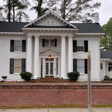
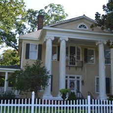
Wayne County, Administrative county in eastern North Carolina, US.

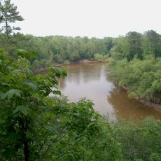
Wayne County is an administrative county in eastern North Carolina with level terrain and broad river valleys. The Neuse River runs through the area and shapes its landscape and settlement patterns.

The county was established in 1779 from the western portion of Dobbs County and named after Revolutionary War General Anthony Wayne. This creation reflected the post-war reorganization of the region's administration.

The county hosts several educational institutions where residents and students from surrounding areas pursue studies and skill development. These schools shape community life and serve as gathering points for local families and young people.

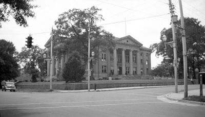
Residents handle governmental matters at the Board of Commissioners in the county seat of Goldsboro. The board meets twice monthly and serves as the primary location for administrative services.

Seymour Johnson Air Force Base operates as a major employer with thousands of military and civilian workers supporting its daily operations. The installation significantly influences the county's economy and employment landscape.

The community of curious travelers

AroundUs brings together thousands of curated places, local tips, and hidden gems, enriched daily by 60,000 contributors worldwide.

Start exploring
Location
Inception
1779
Capital city
Goldsboro
Shares border with
Wilson County, Greene County, Lenoir County, Duplin County, Sampson County, Johnston County
GPS coordinates
35.36000,-78.00000
Latest update
December 20, 2025 14:11
Around this place
Cliffs of the Neuse State Park
United States of America

Cliffs of the Neuse State Park

17.1 km
United States of America

Aycock Birthplace

18 km
United States of America

Everitt P. Stevens House

34.9 km
United States of America

Shiloh Primitive Baptist Church

19.9 km
United States of America

Borden Manufacturing Company

3.8 km
Solomon and Henry Weil Houses
United States of America

Solomon and Henry Weil Houses

2.5 km
Odd Fellows Lodge
United States of America

Odd Fellows Lodge

2.7 km
Southerland-Burnette House
United States of America

Southerland-Burnette House

19.1 km
First Presbyterian Church
United States of America

First Presbyterian Church

2.9 km
United States of America

Richard B. Harrison School

33 km
United States of America

Mount Olive High School

19 km
United States of America

Mount Olive Historic District

19.4 km
United States of America

Nowell-Mayerburg-Oliver House

32.6 km
United States of America

Princeton Graded School

19.6 km
United States of America

Downtown Selma Historic District

32.4 km
United States of America

Bryan Whitfield Herring Farm

24.5 km
United States of America

Herring House

17.9 km
United States of America

Harry Fitzhugh Lee House

2.7 km
United States of America

Dred and Ellen Yelverton House

20.8 km
United States of America

Perry-Cherry House

19.2 km
William E. Smith House
United States of America

William E. Smith House

32.5 km
United States of America

Lovett Lee House

28.7 km
United States of America

Marshall Kornegay House and Cemetery

24.9 km
United States of America

Loftin Farm

23 km
West Selma Historic District
United States of America

West Selma Historic District

32.7 km
Noah Edward Edgerton House
United States of America

Noah Edward Edgerton House

33.3 km
Hastings-McKinnie House
United States of America

Hastings-McKinnie House

18.2 km
United States of America

William E. Faison House

27.3 km
Show the full map
Administrative divisions
« Wayne County - Administrative county in eastern North Carolina, US » is provided by Around Us (aroundus.com). Images and texts are derived from Wikimedia project under a Creative Commons license. You are allowed to copy, distribute, and modify copies of this page, under the conditions set by the license, as long as this note is clearly visible.

Discover hidden gems everywhere you go!

From secret cafés to breathtaking viewpoints, skip the crowded tourist spots and find places that match your style. Our app makes it easy with voice search, smart filtering, route optimization, and insider tips from travelers worldwide. Download now for the complete mobile experience.

Around Us App Screenshot

A unique approach to discovering new places

Le Figaro

All the places worth exploring

France Info

A tailor-made excursion in just a few clicks

20 Minutes

Around Us
Travel Guide & Maps
Download

Send to your phone

QR Code
1

Open the camera app on your mobile.

2

Point at the QR code with your camera. A notification will appear.

3

Tap the notification to open the link.