Chest opened
+${chestReward.xp} XP
Explorer
NOUVEAU ×${chestReward.collectible.quantity}
tapez pour fermer
Chest locked

Open chests in the app

Around Us is built for your phone — chests unlock when you walk, explore and capture nearby places.

Enable Location

We need your location to show you interesting places around you

Discover nearby places

Find interesting locations and hidden gems around you

Precise directions

Get accurate directions and distances to places

Your location is never shared with other users. It's only used when you tap the location button.

Schuylkill River

Log in to your account

Start exploring — it's free

Trusted by 72,892 travelers worldwide

Continue with Google
Continue with Apple
or

We will send you a code to connect

By continuing, you accept our Terms and Conditions and our Privacy Policy

Check your inbox

We've sent a pincode in your inbox. Please enter the code below.

Schuylkill River
Discussion Reviews 3 Photos
91.2k Popularity

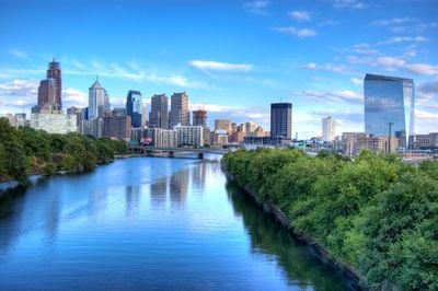
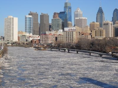
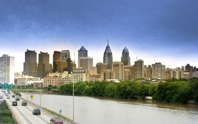
Schuylkill River, River and rowing venue in Pennsylvania, United States.

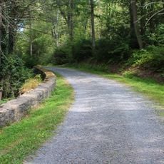
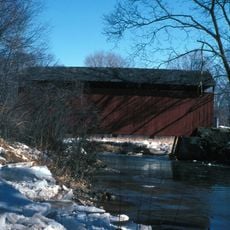
The Schuylkill River is a waterway in southeastern Pennsylvania that extends 209 kilometers (130 miles) from its source near Tuscarora to its confluence with the Delaware River in Philadelphia. The shorelines alternate between wooded sections outside the city and paved quays with green spaces in the urban area.

The Lenape called the waterway Ganshohawanee until Dutch settlers in the 17th century used the name Schuylkill, meaning hidden river. Industries such as coal mining and railroads shaped the riverbanks during the 19th century and influenced the economic development of the region lastingly.

Along the banks stand the illuminated boathouses in neoclassical style, which reflect their facades over the water at night. Rowers train here regularly in eights and fours, while spectators can follow the movements of the teams from the riverside paths.

Multiple access points along both banks allow walks, bicycle rides, and running routes between downtown and the western suburbs. The paved paths are accessible to all visitors and offer different distances depending on the desired route.

The Fairmount Water Works from 1812 was the first municipal water system in Philadelphia and still pumps water directly from this waterway today. The facility originally used water power to supply the city with drinking water and later served as a model for similar systems in other American cities.

The community of curious travelers

AroundUs brings together thousands of curated places, local tips, and hidden gems, enriched daily by 60,000 contributors worldwide.

Start exploring
Location
GPS coordinates
40.63361,-76.18028
Latest update
December 13, 2025 15:41
Around this place
United States of America

Vraj Hindu Temple

9.8 km
United States of America

Muhammad Ali's Training Camp

7.2 km
Weiser State Forest
United States of America

Weiser State Forest

1.1 km
Frank D. Yuengling Mansion
United States of America

Frank D. Yuengling Mansion

5.5 km
John O'Hara House
United States of America

John O'Hara House

5.7 km
United States of America

Cloud Home

5.3 km
Mary Queen of Peace Catholic Church Pottsville, Pennsylvania
United States of America

Mary Queen of Peace Catholic Church Pottsville, Pennsylvania

6.9 km
St. John the Baptist Church
United States of America

St. John the Baptist Church

5.5 km
United States of America

State Game Lands Number 110

12.2 km
Burd Patterson House
United States of America

Burd Patterson House

5.6 km
Pottsville Downtown Historic District
United States of America

Pottsville Downtown Historic District

5.6 km
Schuylkill Gap
United States of America

Schuylkill Gap

14.7 km
Schuylkill County Bridge No. 113
United States of America

Schuylkill County Bridge No. 113

13.9 km
Seyfert Mill
United States of America

Seyfert Mill

14.5 km
United States of America

State Game Lands Number 222

14.4 km
United States of America

State Game Lands Number 286

4 km
United States of America

Minersville Reservoir

15.2 km
United States of America

Majestic Theater

6 km
United States of America

Stairway Lake

6.6 km
United States of America

Fawn Lake

5.6 km
United States of America

Hidden Valley Golf Course

8.2 km
United States of America

Schuylkill Country Club

5 km
United States of America

Majestic Theater

6.1 km
United States of America

Scenic viewpoint

9.6 km
United States of America

Scenic viewpoint

14.2 km
United States of America

Scenic viewpoint

13 km
United States of America

Scenic viewpoint

11.8 km
United States of America

Swatara Falls

15.6 km
Show the full map
Reviews
Share your experience

No review yet

Discussions
Start a discussion...

No discussion yet

« Schuylkill River - River and rowing venue in Pennsylvania, United States » is provided by Around Us (aroundus.com). Images and texts are derived from Wikimedia project under a Creative Commons license. You are allowed to copy, distribute, and modify copies of this page, under the conditions set by the license, as long as this note is clearly visible.

Discover hidden gems everywhere you go!

From secret cafés to breathtaking viewpoints, skip the crowded tourist spots and find places that match your style. Our app makes it easy with voice search, smart filtering, route optimization, and insider tips from travelers worldwide. Download now for the complete mobile experience.

Around Us App Screenshot

A unique approach to discovering new places

Le Figaro

All the places worth exploring

France Info

A tailor-made excursion in just a few clicks

20 Minutes

Around Us
Travel Guide & Maps
Download

Send to your phone

QR Code
1

Open the camera app on your mobile.

2

Point at the QR code with your camera. A notification will appear.

3

Tap the notification to open the link.