Hendersonville

Log in to your account

AroundUs is a community-driven map of interesting places, built by curious explorers like you. It grows with every review, story, and photo you share.
Connect to save your favorite spots, contribute locations, and create personalized routes.
By continuing, you accept our Terms and Conditions and our Privacy Policy
Add to collection
Map
Suggest a change
Share

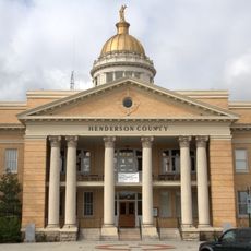
Hendersonville, County seat in Henderson County, North Carolina

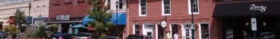
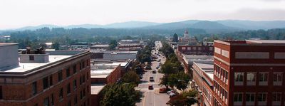
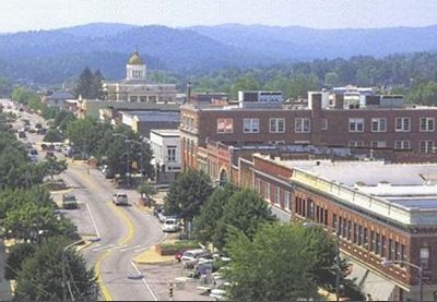
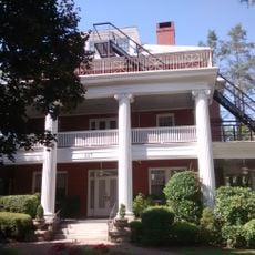
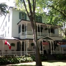
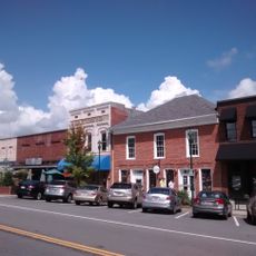
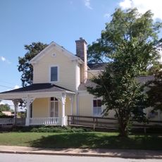
Hendersonville is an administrative seat in Henderson County, western North Carolina, roughly 22 miles (35 kilometers) south of Asheville. The town sits at roughly 2,150 feet (650 meters) elevation between the Blue Ridge Mountains and has a continuous main street with shops and dining.

A judge donated roughly 50 acres in 1847 to establish the settlement, which took the name of an earlier chief justice. The location along transport routes through the mountains favored growth during the 19th and 20th centuries.

The settlement honors Leonard Henderson, a 19th-century chief justice whose legacy remains present in North Carolina's administrative story. Today the restored main thoroughfare with its shops and eateries forms the heart of public life.

Interstate 26 connects the town with larger cities to the north and south, so visitors can arrive and move on comfortably. The main street is easily explored on foot, with parking available along several side streets.

Partnerships with Almuñécar in Spain and Verbania in Italy link the town with coastal regions on the Mediterranean and northern Italian lakes. These international ties promote cultural exchange far beyond the North Carolina mountain region.

Location: Henderson County

Elevation above the sea: 656 m

Website: https://hendersonvillenc.gov

GPS coordinates: 35.32056,-82.46167

Latest update: December 4, 2025 23:40

Around this place
Show the full map
DuPont State Forest
United States of America

DuPont State Forest

18.3 km
Triple Falls
United States of America

Triple Falls

19.6 km
Pearson's Falls
United States of America

Pearson's Falls

16.3 km
Henderson County Courthouse
United States of America

Henderson County Courthouse

692 m
Holmes Educational State Forest
United States of America

Holmes Educational State Forest

13.6 km
Blake House
United States of America

Blake House

17.8 km
Oakdale Cemetery
United States of America

Oakdale Cemetery

1.1 km
Mineral and Lapidary Museum
United States of America

Mineral and Lapidary Museum

428 m
St. John in the Wilderness
United States of America

St. John in the Wilderness

4.6 km
Flat Rock Historic District
United States of America

Flat Rock Historic District

5.4 km
The Meadows
United States of America

The Meadows

13.2 km
Erle Stillwell House
United States of America

Erle Stillwell House

1.6 km
Rugby Grange
United States of America

Rugby Grange

12.4 km
Mills River Chapel
United States of America

Mills River Chapel

12.7 km
Main Street Historic District
United States of America

Main Street Historic District

479 m
Reese House
United States of America

Reese House

865 m
King-Waldrop House
United States of America

King-Waldrop House

656 m
Dillard B. and Georgia Sewell House
United States of America

Dillard B. and Georgia Sewell House

14.6 km
Mary Mills Coxe House
United States of America

Mary Mills Coxe House

2.8 km
Church of the Transfiguration
United States of America

Church of the Transfiguration

14 km
Ryder Hall
United States of America

Ryder Hall

14.2 km
Clarke-Hobbs-Davidson House
United States of America

Clarke-Hobbs-Davidson House

311 m
Charlton Leland
United States of America

Charlton Leland

14 km
Seventh Avenue Depot District
United States of America

Seventh Avenue Depot District

398 m
West Side Historic District
United States of America

West Side Historic District

940 m
Erle Stillwell House II
United States of America

Erle Stillwell House II

1.5 km
Saluda Main Street Historic District
United States of America

Saluda Main Street Historic District

13.9 km
Fox Theatre
United States of America

Fox Theatre

391 m
Show the full map

Reviews

Visited this place? Tap the stars to rate it and share your experience / photos with the community! Try now! You can cancel it anytime.

« Hendersonville - County seat in Henderson County, North Carolina » is provided by Around Us (aroundus.com). Images and texts are derived from Wikimedia project under a Creative Commons license. You are allowed to copy, distribute, and modify copies of this page, under the conditions set by the license, as long as this note is clearly visible.

Discover hidden gems everywhere you go!

From secret cafés to breathtaking viewpoints, skip the crowded tourist spots and find places that match your style. Our app makes it easy with voice search, smart filtering, route optimization, and insider tips from travelers worldwide. Download now for the complete mobile experience.

Around Us App Screenshot

A unique approach to discovering new places

Le Figaro

All the places worth exploring

France Info

A tailor-made excursion in just a few clicks

20 Minutes