Chest opened
+${chestReward.xp} XP
Explorer
NOUVEAU ×${chestReward.collectible.quantity}
tapez pour fermer
Chest locked

Open chests in the app

Around Us is built for your phone — chests unlock when you walk, explore and capture nearby places.

Enable Location

We need your location to show you interesting places around you

Discover nearby places

Find interesting locations and hidden gems around you

Precise directions

Get accurate directions and distances to places

Your location is never shared with other users. It's only used when you tap the location button.

Rising Sun

Log in to your account

Start exploring — it's free

Trusted by 72,876 travelers worldwide

Continue with Google
Continue with Apple
or

We will send you a code to connect

By continuing, you accept our Terms and Conditions and our Privacy Policy

Check your inbox

We've sent a pincode in your inbox. Please enter the code below.

Discussion Reviews 1 Photos
12.4k Popularity

Rising Sun, Administrative division in Cecil County, Maryland, US.

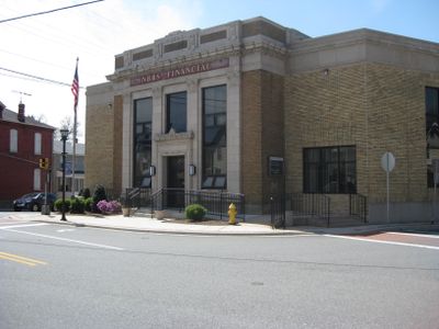
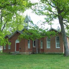
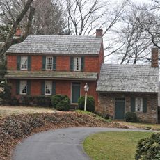
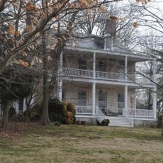
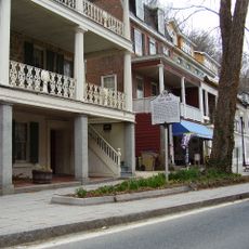
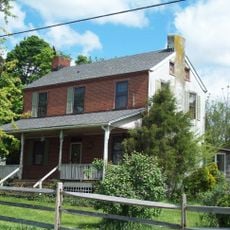
Rising Sun is an unincorporated community located in Cecil County, Maryland, serving as a residential and administrative center for the surrounding area. The community includes residential neighborhoods and local business areas that support everyday life in this rural region.

Rising Sun developed as part of early settlement in Cecil County and was named after a common designation reflecting themes of hope and new beginnings. The community gradually grew into a local administrative center serving the surrounding rural area.

Local government offices in Rising Sun coordinate with community organizations to maintain legal and administrative services for Cecil County residents.

The area can be explored during daytime hours, with most businesses and services available on weekdays. It is helpful to research specific services or locations beforehand, as this is a dispersed rural community.

Rising Sun maintains a network of legal professionals who specialize in administrative law, serving the specific needs of the Cecil County community.

The community of curious travelers

AroundUs brings together thousands of curated places, local tips, and hidden gems, enriched daily by 60,000 contributors worldwide.

Start exploring
GPS coordinates
39.69806,-76.06290
Latest update
December 7, 2025 20:45
Around this place
West Nottingham Academy
United States of America

West Nottingham Academy

3.8 km
Plumpton Park Zoo
United States of America

Plumpton Park Zoo

5.3 km
Gilpin's Falls Covered Bridge
United States of America

Gilpin's Falls Covered Bridge

10.7 km
Pine Grove Covered Bridge
United States of America

Pine Grove Covered Bridge

10.8 km
East Nottingham Friends Meetinghouse
United States of America

East Nottingham Friends Meetinghouse

6.8 km
Colora Meetinghouse
United States of America

Colora Meetinghouse

3.9 km
Jeremiah Brown House and Mill Site
United States of America

Jeremiah Brown House and Mill Site

5.1 km
West Nottingham Meetinghouse
United States of America

West Nottingham Meetinghouse

1.9 km
Isaac England House
United States of America

Isaac England House

7.1 km
Elisha Kirk House
United States of America

Elisha Kirk House

6.7 km
Mercer Brown House
United States of America

Mercer Brown House

5.6 km
Kirks Mills Historic District
United States of America

Kirks Mills Historic District

7.2 km
John Churchman House
United States of America

John Churchman House

7.6 km
Paw Paw Building
United States of America

Paw Paw Building

11.1 km
Thomas Richards House
United States of America

Thomas Richards House

4.2 km
Hopewell Historic District
United States of America

Hopewell Historic District

9.9 km
Nathan and Susannah Harris House
United States of America

Nathan and Susannah Harris House

1.6 km
Edward W. Haviland House
United States of America

Edward W. Haviland House

10.8 km
Chesapeake House
United States of America

Chesapeake House

10.7 km
Octorara Farm
United States of America

Octorara Farm

8.1 km
Port Deposit Historic District
United States of America

Port Deposit Historic District

11 km
United States of America

Octoraro Lake

11.6 km
Joshua Lowe House
United States of America

Joshua Lowe House

8.4 km
United States of America

Conowingo Reservoir

10.3 km
United States of America

West Nottingham Academy Historic District

3.4 km
United States of America

Tome School for Boys Historic District

11.1 km
United States of America

Herrs Potato Chip Factory

6.5 km
United States of America

Waterfall

8.1 km
Show the full map
Reviews
Share your experience

No review yet

Discussions
Start a discussion...

No discussion yet

« Rising Sun - Administrative division in Cecil County, Maryland, US » is provided by Around Us (aroundus.com). Images and texts are derived from Wikimedia project under a Creative Commons license. You are allowed to copy, distribute, and modify copies of this page, under the conditions set by the license, as long as this note is clearly visible.

Discover hidden gems everywhere you go!

From secret cafés to breathtaking viewpoints, skip the crowded tourist spots and find places that match your style. Our app makes it easy with voice search, smart filtering, route optimization, and insider tips from travelers worldwide. Download now for the complete mobile experience.

Around Us App Screenshot

A unique approach to discovering new places

Le Figaro

All the places worth exploring

France Info

A tailor-made excursion in just a few clicks

20 Minutes

Around Us
Travel Guide & Maps
Download

Send to your phone

QR Code
1

Open the camera app on your mobile.

2

Point at the QR code with your camera. A notification will appear.

3

Tap the notification to open the link.